
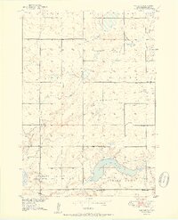
1951 Map of Vayland SW
USGS Topo · Published 1951About this map
Spring Lake dominates the southern landscape of this Hand County prairie, its waters surrounded by the townships of Pearl, Highland, Ohio, and Logan. Published as part of a Department of the Interior program for the development of the Missouri River Basin, this 1951 edition provides a detailed view of the rural educational network serving Pleasant Valley. Numerous small country schools, including Nelson Sch, Horseshoe Bend Sch, and Lake View Sch, are mapped at regular intervals across the section lines, reflecting the decentralized social structure of the mid-century Dakota plains. The community's spiritual and commemorative landmarks are preserved here through the documentation of Pleasant Valley Ch and the T Cem. Windmills are scattered throughout the quadrangle, highlighting the reliance on groundwater for the region's agricultural homesteads during the late 1940s mapping period.
Find a feature on this map
16 named features on this map. Tap any name to fly to it.
Don’t see what you’re looking for? This feature index may not catch every label — zoom into the map to look around manually.
Map Details
Editions of this 1951 Vayland SW Map
2 editions found
Other maps of this area

1949 · Vayland SE
USGS Topo · 1:24,000

1949 · Vayland SW
USGS Topo · 1:24,000

1950 · Vayland
USGS Topo · 1:24,000

1950 · Vayland NW
USGS Topo · 1:24,000

1951 · Vayland SE
USGS Topo · 1:24,000

1953 · Huron
USGS Topo · 1:250,000

1954 · Huron
USGS Topo · 1:250,000

1973 · Ames
USGS Topo · 1:24,000

1973 · Big Bend Dam 4 NE
USGS Topo · 1:24,000

1973 · Cottonwood Lake
USGS Topo · 1:24,000