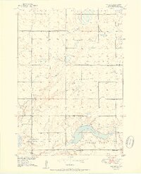
1951 Map of Vayland SW
USGS Topo · Published 1951About this map
Spring Lake anchors the southern reaches of this Hand County landscape, a significant water body in an area defined by the township divisions of Logan, Pearl, Ohio, Holland, and Pleasant Valley. In the early 1950s, this region remained a network of rural school districts and small community hubs. The distribution of one-room schoolhouses, such as Nelson Sch, Horseshoe Bend Sch, Center Sch, McCool Sch, Keck Sch, and Kintigh Sch, illustrates the density of the farm population during this era. Community life is further evidenced by the Pleasant Valley Ch and a nearby Cem, while numerous Windmill labels signify the essential infrastructure of these high plains homesteads. The terrain is characterized by its glacial depressions and gradual rises, providing a clear view of the Missouri River Basin development era's rural geography.
Find a feature on this map
17 named features on this map. Tap any name to fly to it.
Don’t see what you’re looking for? This feature index may not catch every label — zoom into the map to look around manually.
Map Details
Editions of this 1951 Vayland SW Map
2 editions found
Other maps of this area

1949 · Vayland SE
USGS Topo · 1:24,000

1949 · Vayland SW
USGS Topo · 1:24,000

1950 · Vayland
USGS Topo · 1:24,000

1950 · Vayland NW
USGS Topo · 1:24,000

1951 · Vayland SW
USGS Topo · 1:24,000

1951 · Vayland SE
USGS Topo · 1:24,000

1953 · Huron
USGS Topo · 1:250,000

1954 · Huron
USGS Topo · 1:250,000

1973 · Ames
USGS Topo · 1:24,000

1973 · Big Bend Dam 4 NE
USGS Topo · 1:24,000