1970s Maps of Blaine Township, South Dakota
Explore 4 historic maps of Blaine Township from the 1970s. These maps offer a rare glimpse into what life looked like during the 1970s — showing old roads, neighborhoods, homes, and landmarks that have changed or disappeared over time.
Whether you're researching your family's past, planning a metal detecting trip, or studying how Blaine Township's landscape evolved across the 1970s, these high-resolution maps are a powerful tool for exploring the history of this region.
- Focus on a specific era: All maps on this page are from the 1970s, giving you a focused view of this time period.
- See what’s changed: Compare century-old streets, trails, and buildings to today's modern landscape using overlays and satellite layers.
- Research with precision: Use these maps for genealogy, historical research, land use analysis, or educational projects.
- View, download, or print: Maps are fully viewable online in high resolution, and can be downloaded or printed for your own records.
Start exploring Blaine Township's history through authentic maps from the 1970s. This is your window into the past.
Blaine Township, SD maps
(4)- 1973 Map of Woonsocket, 1976 Print
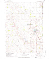 1973 Woonsocket1976 Print · USGSWoonsocket and the surrounding Sanborn County prairie are captured here in the early seventies as a hub of rail transport and rural industry. Researchers can trace family history at St Wilfrid Cem or locate the Lynch Ranch and McCoy Lake hunting grounds.
 - 1973 Map of Lane, 1976 Print
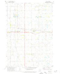 1973 Lane1976 Print · USGSThe town of Lane and the surrounding Jerauld County prairie are captured here in the mid-1970s. Trace the path of the Chicago Milwaukee St Paul and Pacific railroad or locate family sites near Fairview Cem and Firesteel Creek.
 - 1979 Map of Fraser Dam, 1980 Print
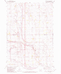 1979 Fraser Dam1980 Print · USGSAgricultural life in Jerauld and Aurora Counties is captured here in the late seventies as local townships managed the prairie landscape. Genealogists can locate family-named landmarks like Piersons Draw and community sites including Solberg Cem and Fraser Dam.
 - 1979 Map of Twin Lakes, 1980 Print
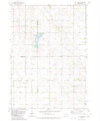 1979 Twin Lakes1980 Print · USGSSanborn County and its neighboring borderlands appear here in the late seventies, centered on the vital prairie waters of the James River Valley region. Researchers can locate rural landmarks like Belford Sch, Elliott Sch, and the Twin Lakes State Recreation Area.
End of results
Showing maps 1-4 of 4
Top cities near Blaine Township
- Wessington Springs historical maps
- Woonsocket historical maps
- Alpena historical maps
- Lane historical maps
Frequently asked questions
- What are the different types of historical maps available for Blaine Township?
- What is the oldest map of Blaine Township?
- Where can I purchase historical maps of Blaine Township for my home or office?
- Where can I download high-res historical maps of Blaine Township?
- Are there historical topographic maps available for Blaine Township?
- Is there historical aerial imagery available for Blaine Township?
- Where are historical maps of Blaine Township sourced from?