Old Maps of Kyle, South Dakota for Hiking & Exploration
Hike through history with 97 historic maps of Kyle. Explore old trails, ghost towns, and forgotten backroads — perfect for outdoor adventurers and local explorers.
- Rediscover forgotten places: Map out old mining camps, roads, and footpaths that no longer exist on modern maps.
- Layer with modern tools: Combine with LiDAR or satellite views to plan hikes through historical terrain.
- Made for exploration: Popular among hikers, overlanders, and local history lovers.
Use these maps to find adventure and explore the hidden past of Kyle.
Kyle, SD maps
(97)- 1950 Map of Conata
 1950 Conata1950 Print · USGSThe Pine Ridge Indian Reservation and the northern prairies meet here in the early fifties. Genealogists and historians can trace the Chicago Milwaukee St Paul and Pacific rail line through Conata and locate an early Oil Well.2 unique versions available
 - 1950 Map of Interior, 1952 Print
 1950 Interior1952 Print · USGSJackson County ranching and rail activity are captured here at mid-century, where the Chicago Milwaukee St Paul and Pacific tracks meet the White River. Trace the era's rural landscape through the location of the Lone Tree Sch. and early Badlands National Monument park features.2 unique versions available
 - 1950 Map of Conata SW, 1952 Print
 1950 Conata SW1952 Print · USGSThe Pine Ridge Indian Reservation landscape is captured here in the mid-century, before significant modern alterations. Researchers can trace the intricate drainage of Redwater Creek and Medicine Root Creek across the Shannon and Washabaugh county lines.2 unique versions available
 - 1950 Map of Potato Creek, 1952 Print
 1950 Potato Creek1952 Print · USGSThe Pine Ridge Indian Reservation in the early fifties shows a landscape of rural schools and winding creek beds. Researchers can trace local history through features like the Bull Cem, Rock Springs Sch, and the small settlement of Potato Creek.2 unique versions available
 - 1950 Map of Imlay, 1952 Print
 1950 Imlay1952 Print · USGSPennington County at the midpoint of the twentieth century shows a landscape divided by federal land designations and the steam-and-diesel era. Trace the path of the Chicago Milwaukee St Paul and Pacific through Imlay or the northern reaches of the Pine Ridge Indian Reservation.3 unique versions available
 - 1950 Map of Imlay SE, 1952 Print
 1950 Imlay SE1952 Print · USGSThe Pine Ridge Indian Reservation is documented here in the early fifties, showing the winding path of the White River. Researchers can trace the location of St Barbaras Ch and various watercourses like Medicine Root Creek and Clifford Creek.2 unique versions available
 - 1950 Map of Bouquet Table, 1972 Print
 1950 Bouquet Table1972 Print · USGSThe South Dakota badlands and the Pine Ridge Indian Reservation meet during the mid-twentieth century on this detailed survey. Genealogists and historians can trace local landmarks like the Cain Creek Sch and the route of the Chicago Milwaukee St Paul and Pacific railroad.
 - 1952 Map of Conata NE
 1952 Conata NE1952 Print · USGSThe South Dakota badlands and the Pine Ridge Indian Reservation meet along the river in the early fifties. Researchers can trace the path of the Chicago Milwaukee St Paul and Pacific rail and locate the Hurley Sch (Abandoned).2 unique versions available
 - 1952 Map of Bouquet Table
 1952 Bouquet Table1952 Print · USGSThe border between the Pine Ridge Indian Reservation and Badlands National Monument is captured here in the early 1950s. Trace local landmarks like the Cain Creek Sch and the Chicago Milwaukee St Paul and Pacific rail line.
 - 1952 Map of Conata SE
 1952 Conata SE1952 Print · USGSThe Pine Ridge Indian Reservation is documented here in the early fifties, showing the intricate drainages of the Missouri River Basin. Family historians can trace the Native American Cem and landmarks like Potato Creek or the local Windmill.2 unique versions available
 - 1952 Map of Conata
 1952 Conata1952 Print · USGSThe northern edge of the Oglala Lakota lands meets the rail-line economy of the early fifties, centered on the Milwaukee Road. Researchers can trace the winding White River through the Pine Ridge Indian Reservation past Conata and Hurley Butte.
 - 1955 Map of Hot Springs, 1958 Print
 1955 Hot Springs1958 Print · USGSThe Black Hills and South Dakota badlands are captured here in the mid-fifties, during a peak of military and industrial activity. Researchers can locate the Black Hills Ordnance Depot, early Uranium Mines, and historic rail stops like Pringle or Oglala.5 unique versions available
 - 1955 Map of Martin, 1968 Print
 1955 Martin1968 Print · USGSTribal lands and rail corridors define the South Dakota plains in the mid-fifties, from the sand hills to the badlands. Genealogists and historians can trace the early layout of Pine Ridge Indian Reservation settlements and find small rail towns like Stamford and Witten.2 unique versions available
 - 1958 Map of Martin
 1958 Martin1958 Print · USGSSouth Dakota's southern plains are documented here in the late fifties, showing the expansive Pine Ridge and Rosebud Indian Reservations. Genealogists and historians can locate early settlements along the Chicago Milwaukee St Paul and Pacific line or find family roots near Martin and the Indian Cemetery.
 - 1967 Map of Wounded Knee, 1970 Print
 1967 Wounded Knee1970 Print · USGSShannon County in the late sixties reveals a landscape shaped by historical routes and secluded missions. Genealogists and historians can trace the paths of the Big Foot Trail and locate family sites at Our Lady of Lourdes Mission or St Julia Cem.
 - 1980 Map of Kadoka
 1980 Kadoka1980 Print · USGSWestern South Dakota's open plains and Badlands are captured here in the early eighties, showcasing a region defined by its railroads and reservations. Researchers can trace the routes of the Chicago and North Western or locate local landmarks like Kadoka Lake and Wanblee.
 - 1981 Map of Wall
 1981 Wall1981 Print · USGSWestern South Dakota in the early eighties reveals a landscape of high tables and deep draws where the prairie meets the Badlands. Researchers can trace the path of the Chicago and North Western rail line and locate rural outposts like Scenic, Conata, and Interior.
 - 1981 Map of Yellow Bear Camp
 1981 Yellow Bear Camp1981 Print · USGSThe Pine Ridge Indian Reservation is documented in the early eighties, showing a landscape defined by deep canyons and traditional community sites. Genealogists and historians can locate Yellow Bear Camp and trace family records at Mediator Cem or Body of Christ Cem.
 - 1981 Map of Kyle
 1981 Kyle1981 Print · USGSThe Pine Ridge Indian Reservation is documented here in the early 1980s, centered on the community of Kyle. Local historians can trace the path of the Big Foot Trail and locate landmarks like the Little Wound Sch and St Barnabas Ch.
 - 1981 Map of Evergreen
 1981 Evergreen1981 Print · USGSShannon County in the early eighties shows a landscape of deep canyons and creek-side settlements within the Pine Ridge region. Genealogists and historians can locate mission churches like St Julia Ch and trace water sources from Iron Cloud Spring to Wounded Knee Creek.
 - 1981 Map of Batesland
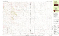 1981 Batesland1981 Print · USGSBatesland and the surrounding plains of the Pine Ridge Indian Reservation are captured here in the early eighties. Genealogists and historians can trace the rural landscape across the Shannon Co Bennett Co line, locating Wimer and the winding American Horse Creek.
 - 1981 Map of Evergreen NE
 1981 Evergreen NE1981 Print · USGSThe Pine Ridge Indian Reservation and the southern edge of the Badlands are captured here in the early eighties. Genealogists and historians can locate the St Luke Cem and trace the path of the Big Foot Trail across the plains.
 - 1981 Map of Hisle
 1981 Hisle1981 Print · USGSThe Pine Ridge Indian Reservation and the rural landscapes of Jackson County are captured in this early 1980s survey. Genealogists can locate St Joseph Cem and trace the small community of Hisle along the banks of Bear-in-the-Lodge Creek.
 - 1983 Map of Martin
 1983 Martin1983 Print · USGSBennett County and the neighboring tribal lands appear here in the early eighties as a network of High Plains settlements and conservation areas. Researchers can trace tribal boundaries and local genealogy through sites like Pine Ridge Indian Reservation, Long Valley, and Arnold Ranch.
 - 1985 Map of Pine Ridge
 1985 Pine Ridge1985 Print · USGSThe Pine Ridge Indian Reservation and the edge of the Badlands are detailed in this mid-eighties survey of the South Dakota-Nebraska border. Researchers can trace the drainages of Wounded Knee Creek and White River to locate landmarks like Red Dog Table and Wounded Knee.2 unique versions available
Showing maps 1-25 of 97
Top cities near Kyle
Top neighborhoods of Kyle
Frequently asked questions
- What are the different types of historical maps available for Kyle?
- What is the oldest map of Kyle?
- Where can I purchase historical maps of Kyle for my home or office?
- Where can I download high-res historical maps of Kyle?
- Are there historical topographic maps available for Kyle?
- Is there historical aerial imagery available for Kyle?
- Where are historical maps of Kyle sourced from?