2020s Maps of Vermillion Township, South Dakota
Explore 4 historic maps of Vermillion Township from the 2020s. These maps offer a rare glimpse into what life looked like during the 2020s — showing old roads, neighborhoods, homes, and landmarks that have changed or disappeared over time.
Whether you're researching your family's past, planning a metal detecting trip, or studying how Vermillion Township's landscape evolved across the 2020s, these high-resolution maps are a powerful tool for exploring the history of this region.
- Focus on a specific era: All maps on this page are from the 2020s, giving you a focused view of this time period.
- See what’s changed: Compare century-old streets, trails, and buildings to today's modern landscape using overlays and satellite layers.
- Research with precision: Use these maps for genealogy, historical research, land use analysis, or educational projects.
- View, download, or print: Maps are fully viewable online in high resolution, and can be downloaded or printed for your own records.
Start exploring Vermillion Township's history through authentic maps from the 2020s. This is your window into the past.
Vermillion Township, SD maps
(4)- 2021 Map of Winfred, 2021 Print
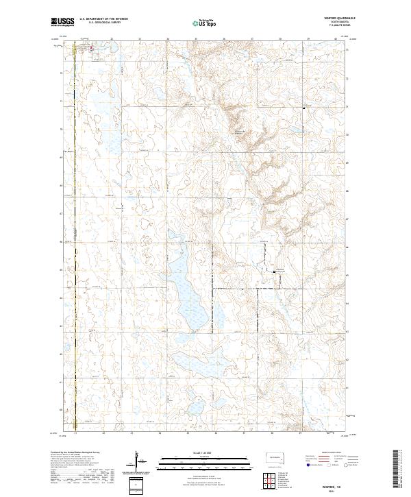 2021 Winfred2021 Print · USGSThe Lake County prairie landscape comes into focus during the early twenty-first century, showcasing the glacial terrain of the Coteau des Prairies. Researchers can trace local landmarks like Winfred, the Gracevale Colony, and family-named sites such as Olson Cem.
 - 2021 Map of Winfred SE, 2021 Print
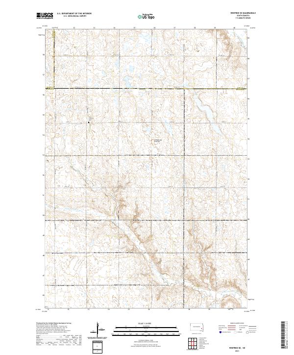 2021 Winfred SE2021 Print · USGSSoutheastern South Dakota’s high prairie plateau is captured here during the early twenty-first century as it spans the borders of Lake, McCook, and Miner counties. Genealogists and local historians can locate the Salem Lutheran Cem and trace the paths of the Little Vermillion River and E Fork Vermillion River.
 - 2021 Map of Unityville, 2021 Print
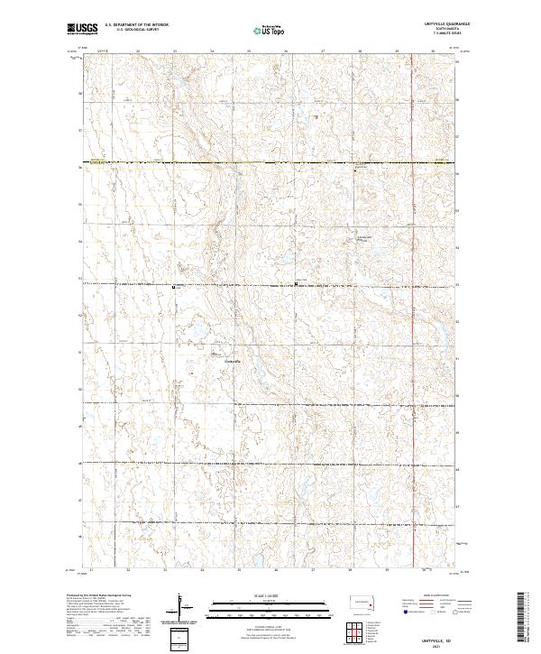 2021 Unityville2021 Print · USGSThe area around Unityville is shown here in the early twenty-first century, spanning the border of McCook and Miner Counties. Genealogists can locate several local burial sites including Sun Prairie Baptist Cem, Olsen Cem, and Unityville Cem.
 - 2021 Map of Canova East, 2021 Print
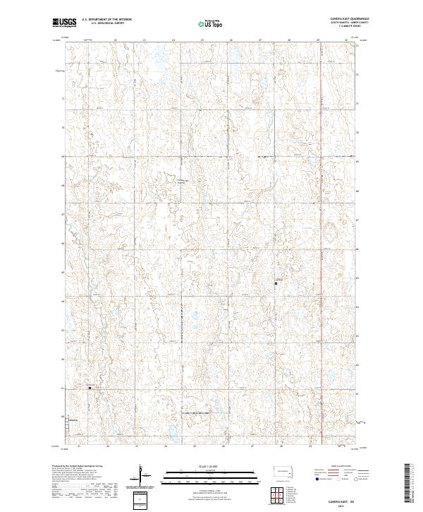 2021 Canova East2021 Print · USGSMiner County farming and the eastern prairie highlands are captured here in the early twenty-first century. Genealogists and local historians can trace the grid of country roads to the Canova townsite or locate the Pleasant Hill Cem and Canova Cem.
End of results
Showing maps 1-4 of 4
Top cities near Vermillion Township
- Salem historical maps
- Howard historical maps
- Winfred historical maps
- Ramona historical maps
- Spencer historical maps
- Canova historical maps
See more
Frequently asked questions
- What are the different types of historical maps available for Vermillion Township?
- What is the oldest map of Vermillion Township?
- Where can I purchase historical maps of Vermillion Township for my home or office?
- Where can I download high-res historical maps of Vermillion Township?
- Are there historical topographic maps available for Vermillion Township?
- Is there historical aerial imagery available for Vermillion Township?
- Where are historical maps of Vermillion Township sourced from?