Old Maps of Box Elder, South Dakota for Metal Detecting
Plan your next treasure hunt with 16 historic maps of Box Elder. Find old homesites, ghost towns, trails, and gathering spots that may be lost to time — perfect for identifying promising metal detecting locations.
- Locate forgotten sites: Uncover places like long-lost settlements, abandoned rail lines, or gathering spots.
- Plan better hunts: Use map overlays combined with LiDAR or satellite views to narrow in on historically rich areas.
- Made for detectorists: Thousands of hobbyists use these maps to discover relics, coins, and hidden history.
Use these historic maps to boost your research and find new opportunities beneath the surface of Box Elder.
Box Elder, SD maps
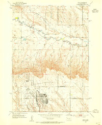
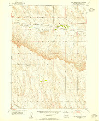
(16)- 1893 Map of Rapid
 1893 Rapid1893 Print · USGSThe Black Hills frontier comes alive in the late nineteenth century as rail lines and military outposts shape the territory. Genealogists and researchers can trace the early layout of Rapid, locate Fort Meade, and find family-named landmarks like Doe Dotie Ranch or Piedmont.2 unique versions available
 - 1898 Map of Rapid
 1898 Rapid1898 Print · USGSThe Black Hills foothills come alive in the 1890s, where early railroads meet military outposts and pioneer settlements. Trace the early streets of Rapid City, the grounds of Fort Meade, and localized landmarks like Crystal Cave.2 unique versions available
 - 1903 Map of Rapid
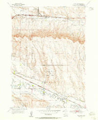
 1903 Rapid1903 Print · USGSThe Black Hills transition from mountains to plains at the turn of the century, centered on the growing rail hub of Rapid. Researchers can trace the early rail corridor of the Fremont Elkhorn and Missouri Valley through Fort Meade and Piedmont.4 unique versions available
 - 1953 Map of Bend, 1954 Print
 1953 Bend1954 Print · USGSMeade and Pennington Counties were undergoing significant change in the early fifties as military infrastructure expanded into the rural landscape. Researchers can trace the development of Ellsworth Air Force Base and locate community landmarks like Bend Sch and Elk Dale Sch.2 unique versions available
 - 1953 Map of Boxelder, 1954 Print
 1953 Boxelder1954 Print · USGSPennington County in the early fifties shows a landscape of expanding military aviation and complex prairie irrigation. Genealogists and local historians can trace rural school districts like White Eagle Sch and Lone Tree Sch alongside the tracks of the Chicago and North Western.4 unique versions available
 - 1953 Map of Rapid City East, 1955 Print
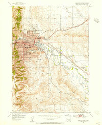 1953 Rapid City East1955 Print · USGSRapid City and the surrounding Pennington County plains are captured here in the early fifties during a period of steady post-war expansion. Researchers can locate vanished landmarks like Halley Airport or trace the early campus of the South Dakota School of Mines.7 unique versions available
 - 1953 Map of Rapid City NW, 1955 Print
 1953 Rapid City NW1955 Print · USGSMeade and Pennington counties appear here in the early fifties, showing a rural landscape of scattered ranching and community schoolhouses. Researchers can locate the Elk Vale Cem, Holy Family Ch, and the site of School No 3 (Abandoned).3 unique versions available
 - 1953 Map of New Underwood SW, 1955 Print
 1953 New Underwood SW1955 Print · USGSPennington County ranching country is captured here during the mid-twentieth century as the rural landscape underwent modern surveying. Researchers can trace the placement of local landmarks like Lone Tree Sch, Engdahl Sch, and the Chicago and North Western line.2 unique versions available
 - 1953 Map of Rapid City, 1964 Print
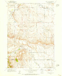
 1953 Rapid City1964 Print · USGSWestern South Dakota's transition from the Black Hills to the open prairie is captured here during the mid-fifties. Researchers can trace the development of Ellsworth Air Force Base alongside historic landmarks like Bear Butte and the Lower Alkali School.3 unique versions available
 - 1957 Map of Rapid City
 1957 Rapid City1957 Print · USGSWestern South Dakota in the mid-fifties reveals a landscape of high-altitude forests and growing military installations. Researchers can trace the development of Ellsworth Air Force Base, locate the Theodore Roosevelt Monument, and find rural landmarks like Lower Alkali School.
 - 1984 Map of New Underwood
 1984 New Underwood1984 Print · USGSPennington and Meade counties in the mid-1980s show a landscape of river-fed agriculture and prairie management. Genealogists and historians can trace rail and road development through New Underwood and Wasta or locate features like Elm Springs and Hubbard Hill.2 unique versions available
 - 2021 Map of Rapid City NW, 2021 Print
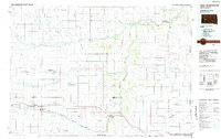
 2021 Rapid City NW2021 Print · USGSThe northern fringes of the Black Hills region come into focus during this era of suburban and rural expansion. Trace the growth of Ashland Heights and Box Elder, or locate the Elk Vale Cem nestled near Elk Creek.
 - 2021 Map of Bend, 2021 Print
 2021 Bend2021 Print · USGSNear the turn of the twenty-first century, this area of Meade County illustrates the proximity between rural ranching life and the sprawl of Ellsworth Air Force Base. Researchers can trace the development of Box Elder and find quiet landmarks like the settlement of Bend and Sweet Gulch.
 - 2021 Map of New Underwood SW, 2021 Print
 2021 New Underwood SW2021 Print · USGSPennington County at the start of the 2020s shows the continued growth of Box Elder against a traditional ranching landscape. Trace family-named landmarks and rural infrastructure including Kauer Private Airport, Mc Cain School Rd, and the Lone Tree Ditch.
 - 2021 Map of Box Elder, 2021 Print
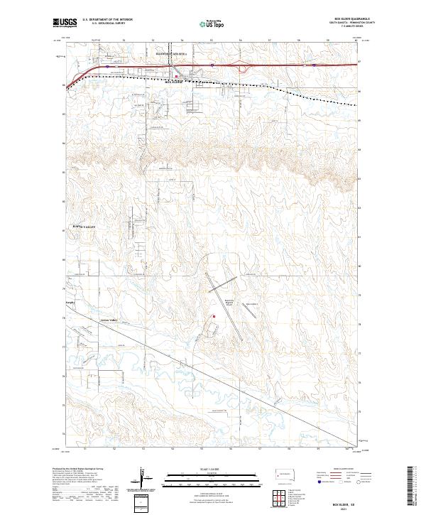 2021 Box Elder2021 Print · USGSPennington County near the turn of the decade shows the growth of aviation and irrigation infrastructure east of the Black Hills. Researchers can trace historic water rights and drainage via Hawthorne Ditch and Lone Tree Ditch near Murphy and Green Valley.
 - 2021 Map of Rapid City East, 2021 Print
 2021 Rapid City East2021 Print · USGSPennington County at the start of the 2020s shows the continued growth of Rapid City and Box Elder. Researchers can trace local development through landmarks like the South Dakota School of Mines and Technology and irrigation networks like Iowa Ditch.
End of results
Showing maps 1-16 of 16
Top cities near Box Elder
Top neighborhoods of Box Elder
Frequently asked questions
- What are the different types of historical maps available for Box Elder?
- What is the oldest map of Box Elder?
- Where can I purchase historical maps of Box Elder for my home or office?
- Where can I download high-res historical maps of Box Elder?
- Are there historical topographic maps available for Box Elder?
- Is there historical aerial imagery available for Box Elder?
- Where are historical maps of Box Elder sourced from?