
1953 Map of Bend
USGS Topo · Published 1954About this map
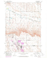
Ellsworth Air Force Base dominates the southern landscape of this mid-century survey, showing the military installation’s footprint straddling the Meade Co / Pennington Co line. North of the base, the terrain transitions into a drainage system defined by Antelope Creek and Elk Creek, where a rural ranching or farming economy is evident through the placement of scattered schoolhouses. Small educational centers like Bend Sch, Elk Dale Sch, and Pleasant Hill Sch serve as the primary landmarks for the dispersed population. The small settlement of Bend sits in the northeast corner, while the topography is marked by several excavations, including a Gravel Pit, and technical infrastructure such as Radio Towers. The contrast between the rigid, gridded layout of the air force base and the meandering watercourses like Sweet Gulch illustrates the region’s dual identity as both a strategic military site and a traditional High Plains landscape.
Find a feature on this map
12 named features on this map. Tap any name to fly to it.
Don’t see what you’re looking for? This feature index may not catch every label — zoom into the map to look around manually.
Map Details
Editions of this 1953 Bend Map
2 editions found
Other maps of this area

1893 · Rapid
USGS Topo · 1:125,000

1898 · Rapid
USGS Topo · 1:125,000

1903 · Rapid
USGS Topo · 1:125,000

1953 · Rapid City 1 SW
USGS Topo · 1:24,000

1953 · Boxelder
USGS Topo · 1:24,000

1953 · Rapid City East
USGS Topo · 1:24,000

1953 · Rapid City NW
USGS Topo · 1:24,000

1953 · New Underwood SW
USGS Topo · 1:24,000

1953 · Hereford SW
USGS Topo · 1:24,000

1953 · Rapid City 1 SE
USGS Topo · 1:24,000