
1953 Map of New Underwood SW
USGS Topo · Published 1955About this map
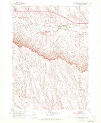
Boxelder Creek winds through the northern portion of this South Dakota landscape, carved into the high plains east of the Black Hills. During the early 1950s, the Chicago and North Western railroad served as the primary transit corridor, running roughly parallel to the creek through the northern tier of the quadrangle. The map reveals a rural community structure organized around local education, with several one-room schoolhouses such as Lone Tree Sch, Engdahl Sch, and Dawkins Sch spaced miles apart to serve the ranching families of the area. A lone Gravel Pit in the northeast corner suggests localized industrial activity amidst the vast, surveyed sections of Pennington County. The detailed contour lines illustrate the complex drainage patterns and breaks in the terrain south of the creek, providing a clear picture of the land as it was managed in the post-war era.
Find a feature on this map
6 named features on this map. Tap any name to fly to it.
Don’t see what you’re looking for? This feature index may not catch every label — zoom into the map to look around manually.
Map Details
Editions of this 1953 New Underwood SW Map
2 editions found
Other maps of this area

1893 · Rapid
USGS Topo · 1:125,000

1894 · Hermosa
USGS Topo · 1:125,000

1898 · Rapid
USGS Topo · 1:125,000

1901 · Hermosa
USGS Topo · 1:125,000

1903 · Rapid
USGS Topo · 1:125,000

1953 · Bend
USGS Topo · 1:24,000

1953 · Viewfield
USGS Topo · 1:24,000

1953 · Boxelder
USGS Topo · 1:24,000

1953 · New Underwood
USGS Topo · 1:24,000

1953 · Caputa
USGS Topo · 1:24,000