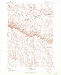
1953 Map of New Underwood SW
USGS Topo · Published 1972About this map
Boxelder Creek winds through the northern plains of Pennington County, defining the drainage patterns of this South Dakota landscape in the early 1950s. The northern reaches are marked by the presence of the Chicago and North Western railroad line, which parallels the creek and provided essential transport for the region's agricultural and industrial outputs. To the south, the terrain rises toward a prominent escarpment, where the landform shifts into more dissected upland territory.
Find a feature on this map
5 named features on this map. Tap any name to fly to it.
Don’t see what you’re looking for? This feature index may not catch every label — zoom into the map to look around manually.
Map Details
Editions of this 1953 New Underwood SW Map
2 editions found
Other maps of this area

1893 · Rapid
USGS Topo · 1:125,000

1894 · Hermosa
USGS Topo · 1:125,000

1898 · Rapid
USGS Topo · 1:125,000

1901 · Hermosa
USGS Topo · 1:125,000

1903 · Rapid
USGS Topo · 1:125,000

1953 · Bend
USGS Topo · 1:24,000

1953 · Viewfield
USGS Topo · 1:24,000

1953 · Boxelder
USGS Topo · 1:24,000

1953 · New Underwood
USGS Topo · 1:24,000

1953 · New Underwood SW
USGS Topo · 1:24,000