2020s Maps of Wall, South Dakota
Explore 4 historic maps of Wall from the 2020s. These maps offer a rare glimpse into what life looked like during the 2020s — showing old roads, neighborhoods, homes, and landmarks that have changed or disappeared over time.
Whether you're researching your family's past, planning a metal detecting trip, or studying how Wall's landscape evolved across the 2020s, these high-resolution maps are a powerful tool for exploring the history of this region.
- Focus on a specific era: All maps on this page are from the 2020s, giving you a focused view of this time period.
- See what’s changed: Compare century-old streets, trails, and buildings to today's modern landscape using overlays and satellite layers.
- Research with precision: Use these maps for genealogy, historical research, land use analysis, or educational projects.
- View, download, or print: Maps are fully viewable online in high resolution, and can be downloaded or printed for your own records.
Start exploring Wall's history through authentic maps from the 2020s. This is your window into the past.
Wall, SD maps
(4)- 2021 Map of Lake Hill, 2021 Print
 2021 Lake Hill2021 Print · USGSPennington County ranch lands and the northern outskirts of Wall are shown here as they appeared in 2021. Genealogists and local historians can trace family land holdings near Lake Hill and along the drainages of Cottonwood Cr and Shearer Lake.
 - 2021 Map of Wasta SE, 2021 Print
 2021 Wasta SE2021 Print · USGSPennington County's high prairie and dissected draws are captured here in the early twenty-first century. Researchers can trace the rural road network and topographic landmarks like Cedar Butte, Cedar Canyon, and the outskirts of Wall.
 - 2021 Map of Wall, 2021 Print
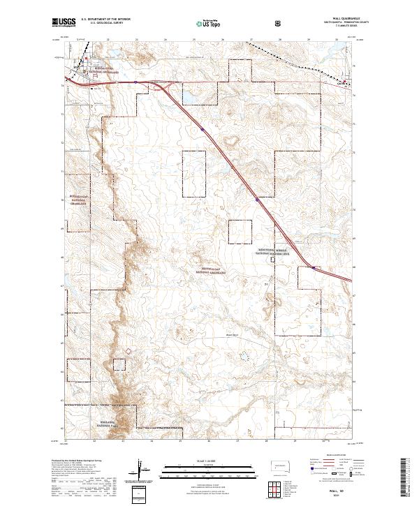 2021 Wall2021 Print · USGSThe northern plains meet the badlands in this recent survey of the area surrounding Wall. Researchers can locate the Wall Cem, the eastern town of Quinn, and the Minuteman Missile National Historic Site among the expansive grasslands.
 - 2021 Map of Quinn Table NE, 2021 Print
 2021 Quinn Table NE2021 Print · USGSPennington County at the edge of the Badlands is captured here in the early twenty-first century, showing a landscape of vast federal grasslands and deep prairie drainages. Researchers can trace the rugged boundaries of Badlands National Park and follow remote routes like Sage Creek Rd and Rim Rd.
End of results
Showing maps 1-4 of 4
Top cities near Wall
Frequently asked questions
- What are the different types of historical maps available for Wall?
- What is the oldest map of Wall?
- Where can I purchase historical maps of Wall for my home or office?
- Where can I download high-res historical maps of Wall?
- Are there historical topographic maps available for Wall?
- Is there historical aerial imagery available for Wall?
- Where are historical maps of Wall sourced from?