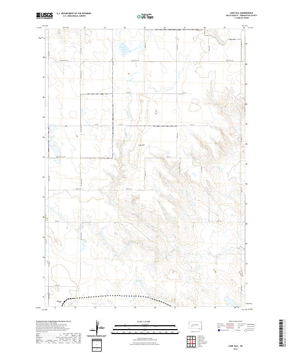
2021 Map of Lake Hill
USGS Topo · Published 2021About this map
Wall marks the southwestern corner of this West River landscape, where the prairie begins its descent into a complex network of drainage basins. The high ground of Lake Hill provides a vantage point over the surrounding plains, which are etched by the meandering paths of Deep Cr, Elm Cr, and the extensive Cottonwood Cr system. This 2021 survey illustrates a sparse ranching and agricultural grid defined by long-established section-line roads such as Creighton Rd and Quinn Rd. The presence of Shearer Lake in the north and the various branches of Lake Cr indicate the critical role of surface water management in this semi-arid region. Researchers can trace the modern township and range boundaries, including t2n r16e, which organize the homesteads and ranch lands that have sustained the local economy for generations.
Find a feature on this map
32 named features on this map. Tap any name to fly to it.
Don’t see what you’re looking for? This feature index may not catch every label — zoom into the map to look around manually.
Map Details
Editions of this 2021 Lake Hill Map
This is the sole edition of this map. No revisions or reprints were ever made.
Other maps of this area

1953 · Rapid City
USGS Topo · 1:250,000

1954 · Wasta NE
USGS Topo · 1:24,000

1954 · Wasta SE
USGS Topo · 1:24,000

1955 · Hot Springs
USGS Topo · 1:250,000

1957 · Rapid City
USGS Topo · 1:250,000

1960 · Quinn Table NE
USGS Topo · 1:24,000

1960 · Wall
USGS Topo · 1:24,000
1961 · Wall NE
USGS Topo · 1:24,000

1981 · Wall
USGS Topo · 1:100,000
1983 · Horse Tooth
USGS Topo · 1:24,000