
1954 Map of Wasta NE
USGS Topo · Published 1956About this map
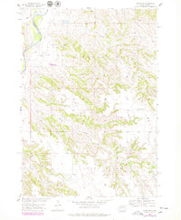
Cheyenne River winds through the northwestern corner of this mid-century survey, defining the boundary between Pennington and Meade counties. The landscape is dominated by the erosive drainages of Elk Creek, Cow Creek, and Calf Creek, which cut through the elevated tablelands of Sunnyside and Cedar Butte. This 1954 field-checked map reveals a sparsely settled ranching or farming region, where social life centered on the Sunnyside Sch and labor was supported by features like the Gravel Pit near Cow Flat. The intricate contouring shows the transition from flat upland pastures to the complex breaks and draws leading down toward the river system, providing a clear record of the Missouri River Basin development era.
Find a feature on this map
11 named features on this map. Tap any name to fly to it.
Don’t see what you’re looking for? This feature index may not catch every label — zoom into the map to look around manually.
Map Details
Editions of this 1954 Wasta NE Map
2 editions found
Other maps of this area

1953 · Rapid City
USGS Topo · 1:250,000

1954 · Dalzell SE
USGS Topo · 1:24,000

1954 · Wasta SE
USGS Topo · 1:24,000

1954 · Dalzell
USGS Topo · 1:24,000

1954 · Wasta
USGS Topo · 1:24,000

1954 · Wasta NW
USGS Topo · 1:24,000

1955 · Creighton
USGS Topo · 1:24,000

1957 · Rapid City
USGS Topo · 1:250,000
1983 · Lake Hill
USGS Topo · 1:24,000
1984 · Pedro 4 NW
USGS Topo · 1:24,000