
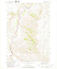
1954 Map of Dalzell SE
USGS Topo · Published 1956About this map
The Cheyenne River winds through this landscape along the border of Meade and Pennington counties, defining a rugged network of drainage systems and high plateaus. This mid-century survey illustrates the rural infrastructure of the South Dakota plains, where cattle ranching and sparse settlement were the primary drivers of land use. A lone Windmill stands near the riverbank, and the Squaw Creek Sch serves as a reminder of the era's local school districts.
Find a feature on this map
15 named features on this map. Tap any name to fly to it.
Don’t see what you’re looking for? This feature index may not catch every label — zoom into the map to look around manually.
Map Details
Editions of this 1954 Dalzell SE Map
2 editions found
Other maps of this area

1953 · Rapid City
USGS Topo · 1:250,000

1954 · Dalzell NW
USGS Topo · 1:24,000

1954 · Wasta NE
USGS Topo · 1:24,000

1954 · Dalzell
USGS Topo · 1:24,000

1954 · Wasta NW
USGS Topo · 1:24,000

1954 · Dalzell NE
USGS Topo · 1:24,000

1955 · Pedro NW
USGS Topo · 1:24,000

1955 · Creighton
USGS Topo · 1:24,000

1957 · Rapid City
USGS Topo · 1:250,000
1984 · Pedro 4 NW
USGS Topo · 1:24,000