
1954 Map of Dalzell NE
USGS Topo · Published 1956About this map
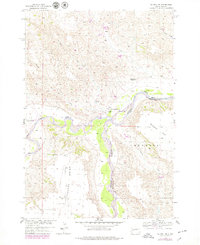
The confluence of the Belle Fourche River and the Cheyenne River anchors this mid-century topographic study of the South Dakota plains. Situated along the boundary of Meade and Pennington counties, the landscape is defined by wide river bottoms and the dramatic elevation of Poverty Point. Agriculture and cattle ranching shape the human presence here, centered on the Two Rivers Ranch and the plateau of Duhamel Flat.
Find a feature on this map
14 named features on this map. Tap any name to fly to it.
Don’t see what you’re looking for? This feature index may not catch every label — zoom into the map to look around manually.
Map Details
Editions of this 1954 Dalzell NE Map
2 editions found
Other maps of this area

1953 · Rapid City
USGS Topo · 1:250,000

1954 · Dalzell SE
USGS Topo · 1:24,000

1954 · Dalzell NW
USGS Topo · 1:24,000

1954 · Dalzell
USGS Topo · 1:24,000

1955 · Pedro NW
USGS Topo · 1:24,000

1955 · Creighton
USGS Topo · 1:24,000

1957 · Rapid City
USGS Topo · 1:250,000

1983 · Plainview
USGS Topo · 1:24,000

1983 · Whiteman Owl
USGS Topo · 1:24,000
1983 · Whiteman Owl SE
USGS Topo · 1:24,000