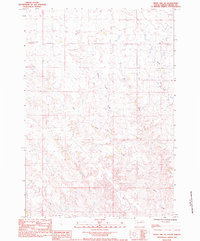
1983 Map of Whiteman Owl SE
USGS Topo · Published 1984About this map
Tepee Creek and its numerous tributaries dominate this landscape in Meade County, revealing a complex drainage system across the high plains. The map illustrates the convergence of West Tepee Creek, Middle Tepee Creek, and East Tepee Creek as they flow through the undulating terrain toward the main channel of Tepee Creek. These watercourses define the geography of the region, creating a network of draws and ridges that have historically dictated land use and movement in this part of South Dakota.
Find a feature on this map
7 named features on this map. Tap any name to fly to it.
Don’t see what you’re looking for? This feature index may not catch every label — zoom into the map to look around manually.
Map Details
Editions of this 1983 Whiteman Owl SE Map
This is the sole edition of this map. No revisions or reprints were ever made.
Other maps of this area

1953 · Rapid City
USGS Topo · 1:250,000

1954 · Dalzell NW
USGS Topo · 1:24,000

1954 · Dalzell NE
USGS Topo · 1:24,000

1955 · Pedro NW
USGS Topo · 1:24,000

1957 · Rapid City
USGS Topo · 1:250,000

1983 · Whiteman Owl NW
USGS Topo · 1:24,000

1983 · Plainview
USGS Topo · 1:24,000

1983 · Whiteman Owl
USGS Topo · 1:24,000

1983 · Marcus
USGS Topo · 1:24,000
1983 · Thompson Lake
USGS Topo · 1:24,000