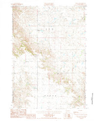
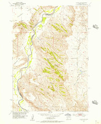
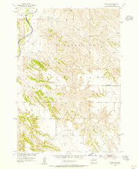
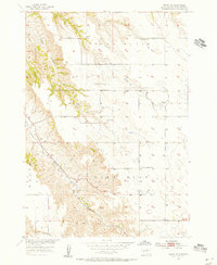
1984 Map of Pedro 4 NW
USGS Topo · Published 1984About this map
Creighton Community Hall stands as a central landmark in this remote western South Dakota landscape, surveyed in the late 1970s and early 1980s. The terrain is defined by the prominent Cedar Butte and a network of drainage systems, including the North Fork Rainy Creek, Deep Creek, and Bull Creek. This map captures a snapshot of rural life and land management during the mid-1980s, where the presence of the Willuweit Ranch suggests the continued importance of ranching in the region. The map also delineates several township or district boundaries, such as Sunnyside, Ash, Huron, and Peno, which provide valuable context for local administrative history and land ownership research.
Find a feature on this map
7 named features on this map. Tap any name to fly to it.
Don’t see what you’re looking for? This feature index may not catch every label — zoom into the map to look around manually.
Map Details
Editions of this 1984 Pedro 4 NW Map
2 editions found

Other maps of this area

1953 · Rapid City
USGS Topo · 1:250,000
1954 · Dalzell SE
USGS Topo · 1:24,000
1954 · Wasta NE
USGS Topo · 1:24,000
1954 · Wasta SE
USGS Topo · 1:24,000

1955 · Creighton
USGS Topo · 1:24,000

1955 · Pedro SE
USGS Topo · 1:24,000

1957 · Rapid City
USGS Topo · 1:250,000

1983 · Horse Tooth
USGS Topo · 1:24,000

1983 · Elm Creek Ranch
USGS Topo · 1:24,000

1983 · Lake Hill
USGS Topo · 1:24,000