
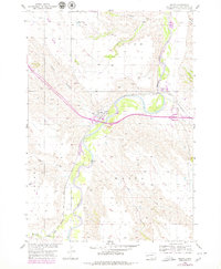
1954 Map of Wasta
USGS Topo · Published 1956About this map
The Cheyenne River carves a deep valley through this portion of Pennington County, defining the landscape where the Chicago and North Western railroad traverses the river bend. The small settlement of Wasta serves as a central hub for the surrounding ranching and transport activities, supported by the nearby Wasta Landing Field. The terrain is deeply dissected by numerous drainage systems, including Hawk Canyon to the west and Cedar Canyon to the northeast, illustrating the erosive power of the plains waterways. Mapping by the Geological Survey during the mid-1950s reveals a network of gravel pits and small water bodies like Shyne Lake, reflecting the local reliance on resource extraction and water management. To the south, the confluence of Boxelder Creek and several draws like Pats Draw into the river valley highlights the complex hydrology of the western South Dakota badlands margin.
Find a feature on this map
19 named features on this map. Tap any name to fly to it.
Don’t see what you’re looking for? This feature index may not catch every label — zoom into the map to look around manually.
Map Details
Editions of this 1954 Wasta Map
2 editions found
Other maps of this area

1953 · Rapid City
USGS Topo · 1:250,000

1954 · Wasta NE
USGS Topo · 1:24,000

1954 · Wasta SE
USGS Topo · 1:24,000

1954 · Owanka
USGS Topo · 1:24,000

1954 · Wasta NW
USGS Topo · 1:24,000

1954 · Brennan Flat
USGS Topo · 1:24,000

1954 · Quinn Table
USGS Topo · 1:24,000

1955 · Hot Springs
USGS Topo · 1:250,000

1957 · Rapid City
USGS Topo · 1:250,000
1957 · Owanka NE
USGS Topo · 1:24,000