
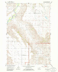
1954 Map of Quinn Table
USGS Topo · Published 1956About this map
The Quinn Table plateau dominates the western landscape of this mid-century survey, rising sharply from the drainages of the Cheyenne River and Sage Creek. This topographical study, produced as part of the Missouri River Basin development program, captures a rural landscape defined by sparse upland settlements and the erosion-carved terrain of the Badlands. Education in this isolated ranching country was anchored by small local schoolhouses, including the Lincoln Sch in the north and the Quinn Table Sch further south. The map documents the intricate water management of the era, from the Lakner Dam to a solitary Windmill marking a life-sustaining well. A portion of the Badlands National Monument is visible in the southeast, where landmarks like White Butte stand above the deeply incised channels of South Fork Sage Creek and Johnson Creek.
Find a feature on this map
21 named features on this map. Tap any name to fly to it.
Don’t see what you’re looking for? This feature index may not catch every label — zoom into the map to look around manually.
Map Details
Editions of this 1954 Quinn Table Map
2 editions found
Other maps of this area

1953 · Rapid City
USGS Topo · 1:250,000

1954 · Wasta SE
USGS Topo · 1:24,000

1954 · Scenic
USGS Topo · 1:24,000

1954 · Wasta
USGS Topo · 1:24,000

1954 · Owanka
USGS Topo · 1:24,000

1954 · Brennan Flat
USGS Topo · 1:24,000

1955 · Hot Springs
USGS Topo · 1:250,000

1957 · Rapid City
USGS Topo · 1:250,000

1960 · Quinn Table NE
USGS Topo · 1:24,000

1960 · Quinn Table SE
USGS Topo · 1:24,000