Old Maps of Sully County, South Dakota for Metal Detecting
Plan your next treasure hunt with 175 historic maps of Sully County. Find old homesites, ghost towns, trails, and gathering spots that may be lost to time — perfect for identifying promising metal detecting locations.
- Locate forgotten sites: Uncover places like long-lost settlements, abandoned rail lines, or gathering spots.
- Plan better hunts: Use map overlays combined with LiDAR or satellite views to narrow in on historically rich areas.
- Made for detectorists: Thousands of hobbyists use these maps to discover relics, coins, and hidden history.
Use these historic maps to boost your research and find new opportunities beneath the surface of Sully County.
Sully County, SD maps
(175)- 1953 Map of Huron, 1959 Print
 1953 Huron1959 Print · USGSCentral South Dakota comes alive in the mid-1950s as a thriving rail and agricultural corridor between the Missouri and James Rivers. Trace the legacy of family farms and prairie towns like Huron, Faulkton, and Wessington Springs along the historic Chicago and North Western rail lines.3 unique versions available
 - 1954 Map of Pierre, 1968 Print
 1954 Pierre1968 Print · USGSThe Missouri River and the newly formed Oahe Reservoir define central South Dakota in the 1950s. Genealogists and local historians can trace early settlements and rail stops like Eakin Siding, Mission Ridge, and Ottumwa.2 unique versions available
 - 1954 Map of Huron, 1977 Print
 1954 Huron1977 Print · USGSCentral South Dakota was a landscape of grain elevators and river bends during the mid-fifties. Genealogists and historians can trace the development of the James River valley through railroad towns like Redfield and the sprawling Crow Creek Indian Reservation.
 - 1958 Map of Pierre
 1958 Pierre1958 Print · USGSCentral South Dakota is documented during the mid-fifties, just as the Missouri River valley was being transformed by the massive Oahe Dam project. Researchers can trace the early Oahe Reservoir shoreline and find remote outposts like Milesville, Onida, and Giddings Flat.
 - 1965 Map of Artichoke Butte, 1966 Print
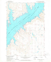
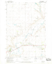
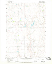
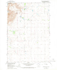 1965 Artichoke Butte1966 Print · USGSThe prairie landscape of Sully County is shown in the mid-1960s as the Missouri River Basin development transformed the region. Researchers can trace rural landmarks and early education sites such as Troy Sch, the namesake Artichoke Butte, and Troy Lake.
 - 1965 Map of Agar SW, 1966 Print
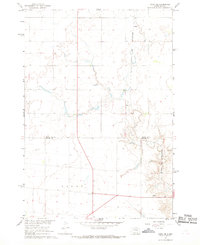
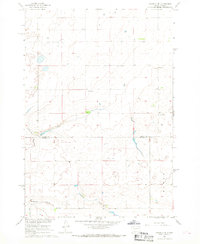
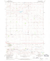
 1965 Agar SW1966 Print · USGSSully County, South Dakota, appears as a sprawling agricultural grid in the mid-1960s, mapped during the Missouri River Basin development program. Local historians can trace the locations of rural schoolhouses like Cass Sch and Hartford Sch or locate the Gravel Pits along Okobojo Creek.
 - 1965 Map of Okobojo NE, 1966 Print
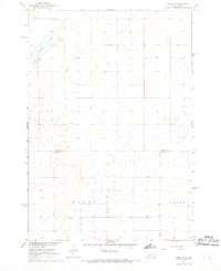
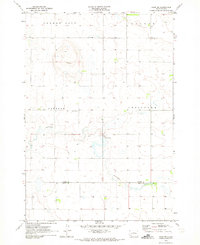
 1965 Okobojo NE1966 Print · USGSSully County was still a landscape of remote farmsteads and township boundaries in the mid-1960s. Genealogists and historians can locate community sites like the Okobojo Sch and Okobojo Cem near the banks of Okobojo Creek.
 - 1965 Map of Agar, 1966 Print
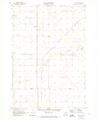
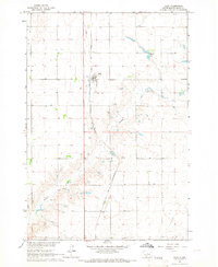 1965 Agar1966 Print · USGSAgar was a vital rail-side community in Sully County during the mid-sixties, centered on the Chicago and North Western line. Genealogists and local historians can trace the town grid, locate the Agar Cem, and find the rural Harrison Sch nestled near Okobojo Creek.
 - 1965 Map of Artichoke Butte SW, 1966 Print
 1965 Artichoke Butte SW1966 Print · USGSSully County sits along the rising waters of the Missouri River in the mid-sixties, capturing a landscape in transition. Researchers can trace rural landmarks like Blair Cem or locate the historic Pearl Sch and West Fairbank Sch.
 - 1965 Map of Okobojo, 1966 Print
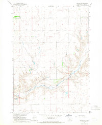
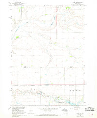
 1965 Okobojo1966 Print · USGSSully County, South Dakota, is captured here during the mid-sixties as the Missouri River Basin development reshaped the local landscape. Genealogists and researchers can trace the settlement of Okobojo and locate landmarks like Sully Buttes and the Flowing Well.
 - 1965 Map of Sully Lake, 1966 Print
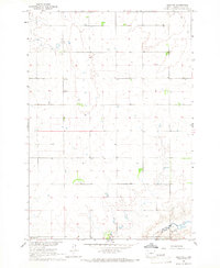
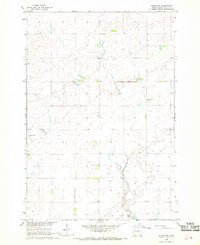
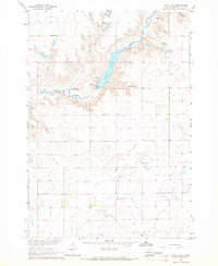 1965 Sully Lake1966 Print · USGSSully County, South Dakota, is captured here in the mid-1960s as a quiet prairie landscape shaped by the Missouri River Basin development. Genealogists and local historians can locate the Clifton Sch. and trace the drainage of Okobojo Creek into Sully Lake.
 - 1967 Map of Onida SE, 1968 Print
 1967 Onida SE1968 Print · USGSCentral South Dakota agriculture and rail transport come into focus in the late sixties along the Sully and Hughes county line. Genealogists and historians can trace the Chicago and North Western tracks past Eakin and locate the rural Felicia Sch.
 - 1967 Map of Onida SW, 1968 Print
 1967 Onida SW1968 Print · USGSThe central South Dakota prairie is captured here in the late sixties as the area straddled the Sully and Hughes county lines. Genealogists and local historians can locate rural landmarks like Goodwater Sch and trace the boundaries of Byron and Logan townships.
 - 1967 Map of Blunt, 1968 Print
 1967 Blunt1968 Print · USGSCentering on the railroad town of Blunt in the late 1960s, this survey shows a prairie landscape tied to the rails and creek beds. Genealogists and researchers can locate Lincoln Sch, trace the Chicago and North Western line, or find the Roadside Park.
 - 1967 Map of Okobojo SE, 1968 Print
 1967 Okobojo SE1968 Print · USGSThe border of Sully and Hughes Counties comes into focus in the late sixties, showing a landscape of upland prairie and localized industry. Researchers can trace the rural features of the era, from the small settlement of Gray Goose to the Landing Strip and various Gravel Pits dotting the plains.
 - 1967 Map of Blunt SE, 1968 Print
 1967 Blunt SE1968 Print · USGSThe high plains of Sully and Hughes counties come into focus during the late sixties as the Missouri River Basin development program reached its peak. Researchers can trace the rugged drainage of Medicine Creek and the distinctive elevations of Medicine Knoll.
 - 1967 Map of Blunt NW, 1968 Print
 1967 Blunt NW1968 Print · USGSSully County was characterized by its wide prairie reaches and township-based ranching in the late sixties. Genealogists and local historians can locate rural landmarks like Blaine Sch, a remote Landing Area, and the shores of Post Lake.
 - 1967 Map of Blunt NE, 1968 Print
 1967 Blunt NE1968 Print · USGSSully County, South Dakota, appears as a patchwork of prairie sections and vital water sources in the late sixties. Researchers can trace the rural infrastructure of the day, from the Buffalo Sch and Pleasant Cem to the course of Medicine Knoll Creek.
 - 1968 Map of Harrold NW, 1971 Print
 1968 Harrold NW1971 Print · USGSThe South Dakota prairie comes into focus in the late sixties, showing a landscape defined by agricultural fencing and the drainage of Medicine Creek. Genealogists and local historians can locate Pleasant Sch and trace the boundary line between Sully Co and Hyde Co.
 - 1968 Map of Harrold, 1971 Print
 1968 Harrold1971 Print · USGSThe rail-and-prairie town of Harrold is shown in the late sixties as the hub of a developing agricultural landscape. Researchers can trace the Chicago and North Western tracks, find family roots at St John Cem, or locate landmarks like the Harrold Municipal Airport.
 - 1969 Map of No Heart Creek SE, 1972 Print
 1969 No Heart Creek SE1972 Print · USGSThe Missouri River breaks of South Dakota are captured here during the expansion of the Oahe reservoir. Genealogists and historians can trace the Cheyenne River Indian Reservation Boundary and the inlets of Willow Creek Bay and Splits Creek.
 - 1969 Map of Artichoke Butte NW, 1972 Print
 1969 Artichoke Butte NW1972 Print · USGSThe Missouri River Basin undergoes a massive transition in the late sixties as the waters of Lake Oahe rise along the Cheyenne River Indian Reservation Boundary. You can trace the shorelines near Forest City and follow prairie drainages like Pascal Creek and Alberts Creek.
 - 1969 Map of No Heart Creek SW, 1972 Print
 1969 No Heart Creek SW1972 Print · USGSThe confluence of the Missouri and Cheyenne rivers in central South Dakota is captured here just as the landscape was transformed by the waters of Lake Oahe. Researchers can trace the Cheyenne River Indian Reservation Boundary and the many inlets formed by No Heart Creek and Tall Prairie Chicken Creek.
 - 1970 Map of Agar NW, 1973 Print
 1970 Agar NW1973 Print · USGSPotter and Sully Counties are captured in the early 1970s, showcasing the rural township structure of central South Dakota. Researchers can locate the East Cattron Sch and follow the path of Artichoke Creek to the Gorman Dam.
 - 1970 Map of Agar NE, 1973 Print
 1970 Agar NE1973 Print · USGSPotter and Sully counties are captured here in the early seventies, showing a landscape defined by organized townships and prairie agriculture. Researchers can locate the Schreiber Cem, the settlement of Gorman, and rural landmarks like Artichoke Sch.
Showing maps 1-25 of 175
Top cities of Sully County
Frequently asked questions
- What are the different types of historical maps available for Sully County?
- What is the oldest map of Sully County?
- Where can I purchase historical maps of Sully County for my home or office?
- Where can I download high-res historical maps of Sully County?
- Are there historical topographic maps available for Sully County?
- Is there historical aerial imagery available for Sully County?
- Where are historical maps of Sully County sourced from?