2020s Maps of Java, South Dakota
Explore 3 historic maps of Java from the 2020s. These maps offer a rare glimpse into what life looked like during the 2020s — showing old roads, neighborhoods, homes, and landmarks that have changed or disappeared over time.
Whether you're researching your family's past, planning a metal detecting trip, or studying how Java's landscape evolved across the 2020s, these high-resolution maps are a powerful tool for exploring the history of this region.
- Focus on a specific era: All maps on this page are from the 2020s, giving you a focused view of this time period.
- See what’s changed: Compare century-old streets, trails, and buildings to today's modern landscape using overlays and satellite layers.
- Research with precision: Use these maps for genealogy, historical research, land use analysis, or educational projects.
- View, download, or print: Maps are fully viewable online in high resolution, and can be downloaded or printed for your own records.
Start exploring Java's history through authentic maps from the 2020s. This is your window into the past.
Java, SD maps
(3)- 2021 Map of Lowry NW, 2021 Print
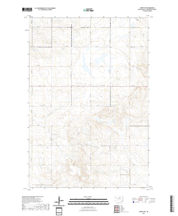 2021 Lowry NW2021 Print · USGSWalworth County at the start of the 2020s shows a landscape defined by its agricultural grid and intermittent prairie wetlands. Genealogists and land researchers can trace property lines and rural access along 312th Ave, 134th St, and the winding Rieger Cr.
 - 2021 Map of Java, 2021 Print
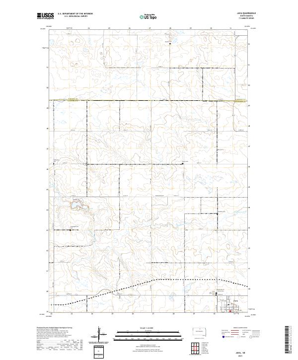 2021 Java2021 Print · USGSThe prairie landscape at the Walworth and Campbell County border is shown here during a period of established rural community. Genealogists can trace family connections through numerous sites like Bender Cem and Java or explore the terrain around Hiddenwood Lake.
 - 2021 Map of Java SE, 2021 Print
 2021 Java SE2021 Print · USGSThe rural landscape near the Campbell and Walworth County line is shown here in its modern agricultural context. Family historians can locate several historic burial sites such as Java East Cem and the Seventh - Day Adventist Cem.
End of results
Showing maps 1-3 of 3
Top cities near Java
Frequently asked questions
- What are the different types of historical maps available for Java?
- What is the oldest map of Java?
- Where can I purchase historical maps of Java for my home or office?
- Where can I download high-res historical maps of Java?
- Are there historical topographic maps available for Java?
- Is there historical aerial imagery available for Java?
- Where are historical maps of Java sourced from?