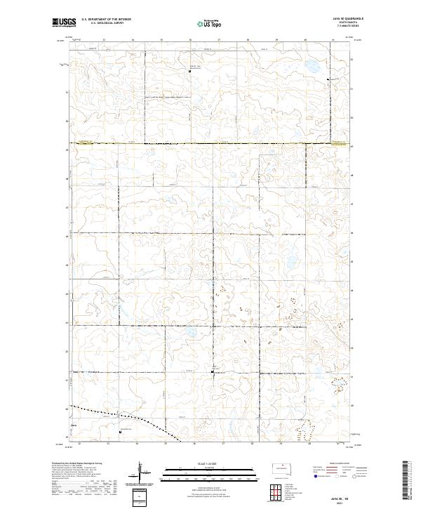
2021 Map of Java SE
USGS Topo · Published 2021About this map
Java anchors the southwestern corner of this South Dakota landscape, where the town limits transition into a grid of rural section roads and rolling prairie. The area is defined by its deep community roots, evidenced by several denominationally specific burial grounds scattered throughout the township. These sites, including Seventh - Day Adventist Cem, Baptist Cem, and Saint Paul Cem, offer critical spatial data for genealogists tracing the early settlement patterns of the region. The drainage of Hiddenwood Cr and Swan Lake Cr cuts through the topography, illustrating the natural watercourses that dictated early land use. This 2021 update preserves the exact layout of long-standing section lines like 122nd St and 315th Ave which have structured the Walworth and Campbell County border for generations.
Find a feature on this map
26 named features on this map. Tap any name to fly to it.
Don’t see what you’re looking for? This feature index may not catch every label — zoom into the map to look around manually.
Map Details
Editions of this 2021 Java SE Map
This is the sole edition of this map. No revisions or reprints were ever made.
Other maps of this area

1954 · Aberdeen
USGS Topo · 1:250,000

1956 · Aberdeen
USGS Topo · 1:250,000

1974 · Spring Lake
USGS Topo · 1:24,000
1974 · Lowry NW
USGS Topo · 1:24,000

1974 · Bowdle
USGS Topo · 1:24,000

1978 · Salt Lake
USGS Topo · 1:24,000

1978 · Bowdle-Hosmer Lake
USGS Topo · 1:24,000

1978 · Java SE
USGS Topo · 1:24,000
1978 · Java
USGS Topo · 1:24,000

1978 · Flat Lake
USGS Topo · 1:24,000