
1978 Map of Java SE
USGS Topo · Published 1979About this map
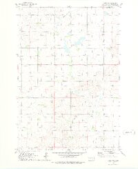
The rolling prairies of north-central South Dakota are defined here by a network of rural cemeteries and the traces of former transportation corridors. Java East Cem, Seventh-day Adventist Cem, Baptist Cem, and St Paul Cem are distributed across the landscape, serving as primary touchpoints for genealogical research in this part of Walworth and Campbell Counties. The southern edge of the map is marked by the Chicago Milwaukee St Paul and Pacific rail line, which runs parallel to an Old Railroad Grade, illustrating the evolution of transit through the region. Natural features like Hiddenwood Creek wind through the terrain, while the designated National Waterfowl Production Area indicates a focus on conservation amidst the agricultural surroundings and scattered Gravel Pit operations.
Find a feature on this map
11 named features on this map. Tap any name to fly to it.
Don’t see what you’re looking for? This feature index may not catch every label — zoom into the map to look around manually.
Map Details
Editions of this 1978 Java SE Map
This is the sole edition of this map. No revisions or reprints were ever made.
Other maps of this area

1954 · Aberdeen
USGS Topo · 1:250,000

1956 · Aberdeen
USGS Topo · 1:250,000

1974 · Spring Lake
USGS Topo · 1:24,000
1974 · Lowry NW
USGS Topo · 1:24,000

1974 · Bowdle
USGS Topo · 1:24,000

1978 · Salt Lake
USGS Topo · 1:24,000

1978 · Bowdle-Hosmer Lake
USGS Topo · 1:24,000
1978 · Java
USGS Topo · 1:24,000

1978 · Flat Lake
USGS Topo · 1:24,000

1978 · Feinstein Lake
USGS Topo · 1:24,000