
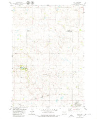
1978 Map of Salt Lake
USGS Topo · Published 1979About this map
High plains prairie and seasonal wetlands define this 1970s landscape in Campbell County, where conservation and agriculture meet. The topography is marked by several significant water bodies including Big Lake, Goehring Lake, and the large expanse of Salt Lake to the south. Much of the terrain is dedicated to habitat preservation, noted by the expansive National Waterfowl Production Area and the Salt Lake State Public Shooting Area.
Find a feature on this map
13 named features on this map. Tap any name to fly to it.
Don’t see what you’re looking for? This feature index may not catch every label — zoom into the map to look around manually.
Map Details
Editions of this 1978 Salt Lake Map
This is the sole edition of this map. No revisions or reprints were ever made.
Other maps of this area

1953 · McIntosh
USGS Topo · 1:250,000

1954 · Aberdeen
USGS Topo · 1:250,000

1956 · Aberdeen
USGS Topo · 1:250,000

1958 · McIntosh
USGS Topo · 1:250,000

1965 · Herreid
USGS Topo · 1:24,000

1967 · Mound City
USGS Topo · 1:24,000

1967 · Selby
USGS Topo · 1:24,000

1978 · Java SE
USGS Topo · 1:24,000
1978 · Java
USGS Topo · 1:24,000

1978 · Flat Lake
USGS Topo · 1:24,000