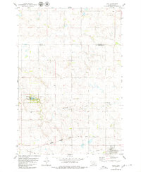
1978 Map of Java
USGS Topo · Published 1979About this map
Java serves as a focal point for this section of the Great Plains, positioned along the southern edge of the survey area. The local economy and transport history are etched into the terrain, most notably by the Chicago Milwaukee St Paul and Pacific railroad line that cuts through the southern townships. To the west, an Old Railroad Grade hints at earlier transit routes or decommissioned branches. The landscape is dotted with several family and community burial grounds, including the Bender Cem, Satziedler Cem, and Schnaible Cem, which provide significant data points for genealogical research.
Find a feature on this map
17 named features on this map. Tap any name to fly to it.
Don’t see what you’re looking for? This feature index may not catch every label — zoom into the map to look around manually.
Map Details
Editions of this 1978 Java Map
This is the sole edition of this map. No revisions or reprints were ever made.
Other maps of this area

1953 · McIntosh
USGS Topo · 1:250,000

1954 · Aberdeen
USGS Topo · 1:250,000

1956 · Aberdeen
USGS Topo · 1:250,000

1958 · McIntosh
USGS Topo · 1:250,000

1967 · Mound City
USGS Topo · 1:24,000

1967 · Selby
USGS Topo · 1:24,000

1968 · Akaska NE
USGS Topo · 1:24,000

1974 · Spring Lake
USGS Topo · 1:24,000
1974 · Lowry NW
USGS Topo · 1:24,000

1978 · Salt Lake
USGS Topo · 1:24,000