Old Maps of Jamesville, Jamesville Township for Genealogy
Trace your family roots with 9 historic maps of Jamesville. These high-res maps reveal old neighborhoods, homesites, landmarks, and streets — helping you uncover where your ancestors lived and how the area evolved over time.
- Explore historic neighborhoods: Identify where your relatives may have lived in the 1800s or 1900s.
- Compare maps over time: Trace the changes in streets, buildings, and landmarks for multi-generational research.
- Perfect for genealogy & ancestry research: Used by family historians and researchers to map out lineage and migration.
These maps are an incredible resource for exploring your personal connection to Jamesville's past.
Jamesville, Jamesville Township maps
(9)- 1898 Map of Parker
 1898 Parker1898 Print · USGSSoutheastern South Dakota in the late nineteenth century shows a landscape defined by the expansion of the Chicago and Northwestern railroad. Genealogists and local historians can trace early settlements and pioneer-era post offices like Idylwilde, Hurley, and the prominent rise of Turkey Ridge.4 unique versions available
 - 1955 Map of Sioux Falls, 1967 Print
 1955 Sioux Falls1967 Print · USGSThe eastern South Dakota and western Minnesota borderlands come alive in the mid-fifties, showing the vital rail-to-river connections of the era. Genealogists can trace family footprints across townships like Madison and Pipestone, while following the paths of the Big Sioux River and the Chicago and North Western line.3 unique versions available
 - 1957 Map of Jamesville, 1958 Print
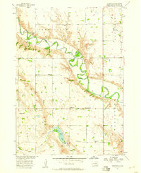 1957 Jamesville1958 Print · USGSYankton County's rural townships are captured here in the late fifties, showing a landscape defined by the winding James River and its protective levee. Genealogists can locate numerous country schools and churches, including Anderson Sch, Martinus Ch, and Vedin Corner.
 - 1958 Map of Sioux Falls
 1958 Sioux Falls1958 Print · USGSThe tri-state borderlands of South Dakota, Minnesota, and Iowa are captured here during the mid-century peak of the regional rail network. Genealogists and historians can trace local landmarks like Augustana Academy, the St Marys Cem, and the path of the Illinois Central through Rock Rapids.
 - 1985 Map of Freeman
 1985 Freeman1985 Print · USGSThe James River valley in the mid-1980s reveals a landscape of communal farming colonies and railroad-anchored prairie towns. Researchers can trace the layout of several Hutterite settlements like Maxwell Colony or locate local landmarks like Gagna Station and Turkey Ridge.2 unique versions available
 - 2012 Map of Jamesville, 2012 Print
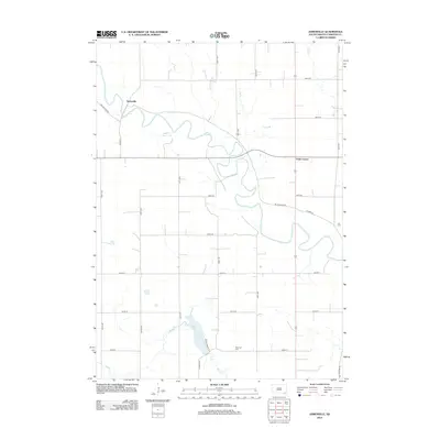 2012 Jamesville2012 Print · USGSCovers Jamesville, including Walshtown Township, Mayfield Township, and other nearby areas
 - 2015 Map of Jamesville, 2015 Print
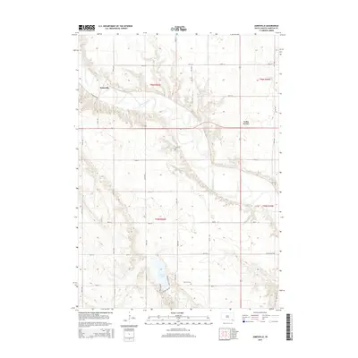 2015 Jamesville2015 Print · USGSCovers Jamesville, including Walshtown Township, Mayfield Township, and other nearby areas
 - 2017 Map of Jamesville, 2017 Print
 2017 Jamesville2017 Print · USGSCovers Jamesville, including Walshtown Township, Mayfield Township, and other nearby areas
 - 2021 Map of Jamesville, 2021 Print
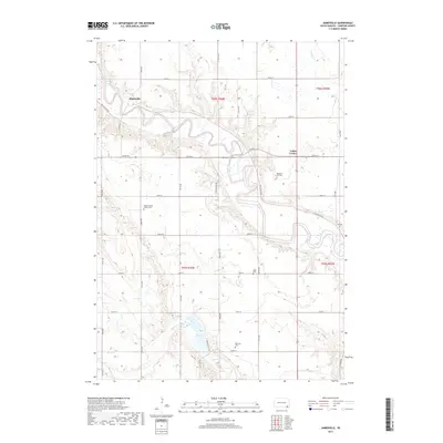
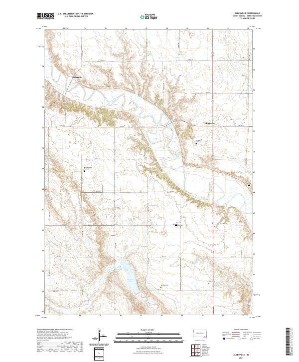 2021 Jamesville2021 Print · USGSYankton County's rural townships are documented here in the early 2020s, centered on the winding James River. Family historians can trace local roots at Pleasant Hill Cem, Martinus Cem, and the Braunsreuther Family Cem.
End of results
Showing maps 1-9 of 9
Top cities near Jamesville
- Yankton historical maps
- Menno historical maps
- Tabor historical maps
- Mayfield historical maps
- Spring Valley historical maps
- Mission Hill historical maps
See more
Frequently asked questions
- What are the different types of historical maps available for Jamesville?
- What is the oldest map of Jamesville?
- Where can I purchase historical maps of Jamesville for my home or office?
- Where can I download high-res historical maps of Jamesville?
- Are there historical topographic maps available for Jamesville?
- Is there historical aerial imagery available for Jamesville?
- Where are historical maps of Jamesville sourced from?