2020s Maps of District 2, South Dakota
Explore 20 historic maps of District 2 from the 2020s. These maps offer a rare glimpse into what life looked like during the 2020s — showing old roads, neighborhoods, homes, and landmarks that have changed or disappeared over time.
Whether you're researching your family's past, planning a metal detecting trip, or studying how District 2's landscape evolved across the 2020s, these high-resolution maps are a powerful tool for exploring the history of this region.
- Focus on a specific era: All maps on this page are from the 2020s, giving you a focused view of this time period.
- See what’s changed: Compare century-old streets, trails, and buildings to today's modern landscape using overlays and satellite layers.
- Research with precision: Use these maps for genealogy, historical research, land use analysis, or educational projects.
- View, download, or print: Maps are fully viewable online in high resolution, and can be downloaded or printed for your own records.
Start exploring District 2's history through authentic maps from the 2020s. This is your window into the past.
District 2, SD maps
(20)- 2021 Map of Bessie Butte, 2021 Print
 2021 Bessie Butte2021 Print · USGSZiebach County remains a landscape of high plains and creek drainages in this modern survey of western South Dakota. Researchers can locate distinctive landmarks like Bessie Butte and Mud Butte, or trace the winding path of Red Coat Cr through the prairies.
 - 2021 Map of Sears Dam, 2021 Print
 2021 Sears Dam2021 Print · USGSZiebach County in the early twenty-first century remains a landscape of sprawling prairie and strategic water management. Researchers can trace the path of Little Cottonwood Creek and locate ranching landmarks like Sears Dam and Campbell Dam.
 - 2021 Map of Bridger NE, 2021 Print
 2021 Bridger NE2021 Print · USGSZiebach County land patterns in the early twenty-first century are defined by isolated ranching infrastructure and winding creek beds. Researchers can locate the Saint Mark's Cem and trace rural routes like Red Scaffold Rd and BIA HWY 8 through the plains.
 - 2021 Map of Miller Dam, 2021 Print
 2021 Miller Dam2021 Print · USGSZiebach County ranching lands and the prairie breaks are captured here in the early twenty-first century. Researchers can trace local landmarks like Marple Butte and the settlement at Chase, along with the waters of Miller Dam and Cottonwood Cr.
 - 2021 Map of Rattlesnake Butte, 2021 Print
 2021 Rattlesnake Butte2021 Print · USGSZiebach County, South Dakota, is captured here in the early twenty-first century, showcasing a landscape of high plains drainage and isolated landmarks. Researchers can trace the winding paths of Rattlesnake Cr and locate high points like Rattlesnake Butte and Peaked Butte.
 - 2021 Map of Red Scaffold, 2021 Print
 2021 Red Scaffold2021 Print · USGSThe community of Red Scaffold and the surrounding plains are captured in this modern survey, showing a landscape defined by prairie creek systems. Researchers can locate the Sacred Heart Catholic Cem and trace the paths of Red Scaffold Creek and Cherry Creek near the Staple M Cliffs.
 - 2021 Map of Lemmon Creek, 2021 Print
 2021 Lemmon Creek2021 Print · USGSMeade County, South Dakota, is captured here in the early twenty-first century, showcasing a vast drainage basin defined by seasonal waterways. Researchers can trace the paths of Lemmon Cr and Johnny Cr or follow rural transit routes like Old Marcus Rd.
 - 2021 Map of Longbrake Ranch, 2021 Print
 2021 Longbrake Ranch2021 Print · USGSZiebach County ranching country is documented here in the early twenty-first century, showing a landscape defined by seasonal water and open range. Researchers can trace the layout of the Longbrake Ranch and locate remote water features like Herren Dam and Rattlesnake Cr.
 - 2021 Map of Dead Horse Draw, 2021 Print
 2021 Dead Horse Draw2021 Print · USGSZiebach County, South Dakota, is captured here in the early 2020s, showing a landscape defined by seasonal draws and rangeland. Researchers can trace local routes like BIA Hwy 13 and Tankini Rd alongside the waters of Dead Horse Draw and Bull Cr.
 - 2021 Map of Chasing Hawk Draw, 2021 Print
 2021 Chasing Hawk Draw2021 Print · USGSThe Cheyenne River Reservation landscape comes into focus in this contemporary survey of Ziebach County. Genealogists and local historians can pinpoint the Saint Pius Cem and Eaglestaff Cem near the banks of Cherry Cr.
 - 2021 Map of Avance SE, 2021 Print
 2021 Avance SE2021 Print · USGSMeade County ranchlands are documented here in the early twenty-first century, showing a landscape carved by the branches of Turtle Cr. Researchers can trace the rural road network including United School Rd and Red Sceffold Rd as they navigate the drainages of Brushy Cr and Little Turtle Cr.
 - 2021 Map of Durkee Lake, 2021 Print
 2021 Durkee Lake2021 Print · USGSMeade County, South Dakota, is captured here in the early 2020s, showing a landscape of open plains and winding creek beds. Researchers can trace the unique hydrology of Red Scaffold Cr and Spook Cr alongside local landmarks like Vichting Loop.
 - 2021 Map of Bedners Dam, 2021 Print
 2021 Bedners Dam2021 Print · USGSZiebach County is shown in the early 2020s as a landscape of wide-open rangeland and essential prairie water sources. Researchers can trace local land divisions and drainage patterns along Elm Cr or locate the man-made Bedners Dam near Thunder Butte Rd.
 - 2021 Map of Red Elm SW, 2021 Print
 2021 Red Elm SW2021 Print · USGSZiebach County is shown in the early 2020s as a landscape of open prairie and winding creek beds. Researchers can trace the hydrology of the S Fork Flint Rock Cr or locate remote rural routes such as 164th St and 162 St.
 - 2021 Map of Dupree, 2021 Print
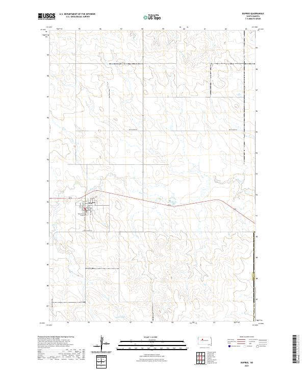 2021 Dupree2021 Print · USGSThe Ziebach County seat is captured here in the early 2020s, showing the intersection of prairie ranching life and civic organization. Genealogists and local historians can trace the town grid from Main St to the Ziebach County Courthouse and out toward Oliver Dam.
 - 2021 Map of Faith, 2021 Print
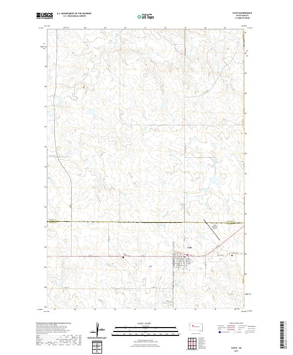 2021 Faith2021 Print · USGSThe northern Meade County plains and the town of Faith are captured here in the early twenty-first century. Researchers can trace the local landscape through landmarks like Saint Joseph Cem, the Faith Municipal Airport, and Rattlesnake Petes Pond.
 - 2021 Map of Red Elm, 2021 Print
 2021 Red Elm2021 Print · USGSZiebach County in the early 2020s remains a landscape of wide-open prairie and vital water crossings. Researchers can pinpoint family sites near Red Elm Cem or trace the drainage of Elm Cr and Knife Cr across the plains.
 - 2021 Map of Lantry, 2021 Print
 2021 Lantry2021 Print · USGSThe ranchlands of north-central South Dakota appear in detail in this recent survey of the Dewey and Ziebach county line. Genealogists and local historians can locate Lantry, trace the waters of Bear Creek, and identify burial sites at Saint James Cem.
 - 2021 Map of Rattlesnake Lake, 2021 Print
 2021 Rattlesnake Lake2021 Print · USGSZiebach County is mapped here in the early twenty-first century, showing the prairie landscape of north-central South Dakota. Genealogists and historians can trace family ties at Little Dog Cem and follow the seasonal waters of Cherry Cr and Ash Cr.
 - 2021 Map of Diermier Ranch, 2021 Print
 2021 Diermier Ranch2021 Print · USGSZiebach County ranch lands are documented here in the early twenty-first century, showing a remote landscape shaped by prairie drainage. Researchers can locate Diermier Ranch and the settlement of Chase along the winding banks of Cottonwood Cr.
End of results
Showing maps 1-20 of 20
Top cities near District 2
Top neighborhoods of District 2
Frequently asked questions
- What are the different types of historical maps available for District 2?
- What is the oldest map of District 2?
- Where can I purchase historical maps of District 2 for my home or office?
- Where can I download high-res historical maps of District 2?
- Are there historical topographic maps available for District 2?
- Is there historical aerial imagery available for District 2?
- Where are historical maps of District 2 sourced from?