Old Maps of District 2, South Dakota for Hiking & Exploration
Hike through history with 111 historic maps of District 2. Explore old trails, ghost towns, and forgotten backroads — perfect for outdoor adventurers and local explorers.
- Rediscover forgotten places: Map out old mining camps, roads, and footpaths that no longer exist on modern maps.
- Layer with modern tools: Combine with LiDAR or satellite views to plan hikes through historical terrain.
- Made for exploration: Popular among hikers, overlanders, and local history lovers.
Use these maps to find adventure and explore the hidden past of District 2.
District 2, SD maps
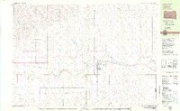
(111)- 1953 Map of Rapid City, 1964 Print
 1953 Rapid City1964 Print · USGSWestern South Dakota's transition from the Black Hills to the open prairie is captured here during the mid-fifties. Researchers can trace the development of Ellsworth Air Force Base alongside historic landmarks like Bear Butte and the Lower Alkali School.3 unique versions available
 - 1953 Map of McIntosh, 1965 Print
 1953 McIntosh1965 Print · USGSThe north-central Dakota prairie is captured here during the mid-fifties, showing the vast Standing Rock Indian Reservation and the newly formed Oah E Reservoir. Genealogists and historians can trace the Chicago Milwaukee St Paul and Pacific rail line through stops like McIntosh, Walker, and Eagle Butte.3 unique versions available
 - 1954 Map of Lemmon, 1964 Print
 1954 Lemmon1964 Print · USGSThe high plains of South Dakota and North Dakota are documented here during the mid-twentieth century. Family researchers can trace dozens of country school sites like Green Cabin School and Bierke School alongside landmarks like The Castles.2 unique versions available
 - 1954 Map of Pierre, 1968 Print
 1954 Pierre1968 Print · USGSThe Missouri River and the newly formed Oahe Reservoir define central South Dakota in the 1950s. Genealogists and local historians can trace early settlements and rail stops like Eakin Siding, Mission Ridge, and Ottumwa.2 unique versions available
 - 1955 Map of Rattlesnake Lake, 1956 Print
 1955 Rattlesnake Lake1956 Print · USGSZiebach County ranching life is documented here in the mid-1950s as part of the Missouri River Basin development. Genealogists can locate family landmarks like Knight Ranch or trace local history at Frazier Ch and Little Dog Cem.
 - 1957 Map of Lemmon
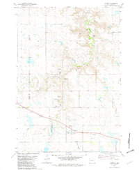
 1957 Lemmon1957 Print · USGSThe northwestern plains of South Dakota and North Dakota are captured here in the mid-fifties, centered on the rail hub of Lemmon. Genealogists and historians can trace dozens of rural schoolhouses and vanished sites like Imogene and the Shadehill Reservoir area.
 - 1957 Map of Rapid City
 1957 Rapid City1957 Print · USGSWestern South Dakota in the mid-fifties reveals a landscape of high-altitude forests and growing military installations. Researchers can trace the development of Ellsworth Air Force Base, locate the Theodore Roosevelt Monument, and find rural landmarks like Lower Alkali School.
 - 1958 Map of Pierre
 1958 Pierre1958 Print · USGSCentral South Dakota is documented during the mid-fifties, just as the Missouri River valley was being transformed by the massive Oahe Dam project. Researchers can trace the early Oahe Reservoir shoreline and find remote outposts like Milesville, Onida, and Giddings Flat.
 - 1958 Map of McIntosh
 1958 McIntosh1958 Print · USGSThe north-central Dakotas appear here in the mid-1950s as massive engineering projects and rail lines shaped the plains. Researchers can trace tribal lands within the Standing Rock Indian Reservation and locate local landmarks like the Keller Mine or the Virginia Siding.
 - 1979 Map of Dupree
 1979 Dupree1979 Print · USGSThe Ziebach County seat of Dupree is captured in the late seventies as a vital rail and aviation hub on the South Dakota plains. Researchers can trace the Milwaukee Road rail line and locate local landmarks like Bedners Dam and the Dupree Municipal Airport.
 - 1981 Map of Lantry, 1982 Print
 1981 Lantry1982 Print · USGSThe rural landscape of Dewey County is captured here in the early 1980s, centered on the settlement of Lantry. Researchers can trace the path of the Abandoned railroad or locate family roots at St James Cem and Lantry Cem near Bear Creek.
 - 1982 Map of Chasing Hawk Draw, 1983 Print
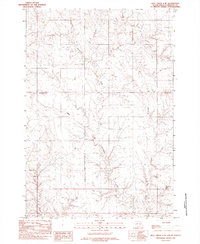
 1982 Chasing Hawk Draw1983 Print · USGSThe Cheyenne River Indian Reservation and the Ziebach-Meade county line meet in the early 1980s. Genealogists and historians can trace local landmarks like St Pius Cem, Eaglestaff Cem, and the path of Red Scaffold Creek through this remote prairie landscape.
 - 1982 Map of Dead Horse Draw, 1983 Print
 1982 Dead Horse Draw1983 Print · USGSZiebach County in the early 1980s is captured here as a landscape of remote draws and seasonal creeks within the Cheyenne River Indian Reservation. Local history researchers can trace the winding paths of Dead Horse Draw, Lake Buffalo, and Chasing Hawk Draw.
 - 1982 Map of Bull Creek 2 NE, 1983 Print
 1982 Bull Creek 2 NE1983 Print · USGSZiebach County ranching country is captured here in the early eighties as part of the Cheyenne River Indian Reservation. Researchers can trace the winding drainages of Rattlesnake Creek and Red Coal Creek or locate landmarks like Rattlesnake Butte.2 unique versions available
 - 1982 Map of Bridger NE, 1983 Print
 1982 Bridger NE1983 Print · USGSZiebach County is documented in the early eighties as a landscape of winding drainages and prairie benches within the Cheyenne River Indian Reservation. Researchers can locate remote landmarks like St Marks Cem and trace the paths of Cherry Creek and Felix Creek.
 - 1982 Map of Bessie Butte, 1983 Print
 1982 Bessie Butte1983 Print · USGSThe northern plains at the edge of the Cheyenne River Indian Reservation are documented here in the early eighties. Researchers can trace the courses of Red Scaffold Creek and Butcher Creek or locate landmarks like Bessie Butte.
 - 1982 Map of Red Scaffold, 1983 Print
 1982 Red Scaffold1983 Print · USGSThe rural landscape of Ziebach County is documented here in the mid-1970s, within the Cheyenne River Indian Reservation. Researchers can locate ranching landmarks like Red Coat Ranch, the site of White Swan Sch, and a solitary Grave near the creek.
 - 1982 Map of Miller Dam, 1983 Print
 1982 Miller Dam1983 Print · USGSZiebach County and the Cheyenne River Indian Reservation are captured in the early eighties when ranching trails dominated the plains. Researchers can trace the drainage of Cottonwood Creek, locate Miller Dam, and orient themselves by the elevation of Marple Butte.
 - 1982 Map of Longbrake Ranch, 1983 Print
 1982 Longbrake Ranch1983 Print · USGSZiebach County ranching life is documented here during the late twentieth century on the Cheyenne River Indian Reservation. Researchers can locate established family holdings such as Longbrake Ranch and Herren Ranch near the waters of Rattlesnake Creek.
 - 1982 Map of Diermier Ranch, 1983 Print
 1982 Diermier Ranch1983 Print · USGSThe Ziebach County rangeland in the early eighties is captured here, showing the remote ranching operations of central South Dakota. Researchers can locate family-named homesteads like Diermier Ranch, Johnson Ranch, and Fields Ranch along the winding West Branch Ash Creek.
 - 1982 Map of Red Elm, 1983 Print
 1982 Red Elm1983 Print · USGSZiebach County in the early eighties shows the quiet settlement of Red Elm as it appeared before modernization. Trace local history through family-named landmarks like Sandoz Dam, the isolated Red Elm Cem, and the path of an abandoned roadway.
 - 1982 Map of Sears Dam, 1983 Print
 1982 Sears Dam1983 Print · USGSThe South Dakota plains within the Cheyenne River Indian Reservation are captured here in the early eighties. Researchers can trace rural family life and land use through labels like Sunnybrook Ch, Mitchell Ranch, and Knight Ranch.
 - 1982 Map of Red Elm SW, 1983 Print
 1982 Red Elm SW1983 Print · USGSThe northern plains along the Cheyenne River Indian Res Bdy are captured here during the early eighties. Researchers can trace the complex drainage of Flint Rock Creek and locate a solitary Water Well amidst changing county lines.
 - 1983 Map of Faith, 1984 Print
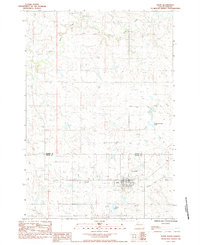 1983 Faith1984 Print · USGSThe town of Faith and its surrounding prairie are documented in the early 1980s, right at the border of Meade and Perkins counties. Researchers can trace the legacy of regional transport and community life via the Old Railroad Grade, St Joseph Cem, and Rattlesnake Petes Pond.
 - 1983 Map of Avance SE, 1984 Print
 1983 Avance SE1984 Print · USGSThe high plains of Meade County are captured in the early eighties, showing a landscape defined by seasonal creek systems and isolated settlements. Researchers can trace the drainage of Turtle Creek and its branches near the community of Zeal, or follow the course of Cherry Creek.
Showing maps 1-25 of 111
Top cities near District 2
Top neighborhoods of District 2
Frequently asked questions
- What are the different types of historical maps available for District 2?
- What is the oldest map of District 2?
- Where can I purchase historical maps of District 2 for my home or office?
- Where can I download high-res historical maps of District 2?
- Are there historical topographic maps available for District 2?
- Is there historical aerial imagery available for District 2?
- Where are historical maps of District 2 sourced from?