1980s Maps of District 3, South Dakota
Explore 7 historic maps of District 3 from the 1980s. These maps offer a rare glimpse into what life looked like during the 1980s — showing old roads, neighborhoods, homes, and landmarks that have changed or disappeared over time.
Whether you're researching your family's past, planning a metal detecting trip, or studying how District 3's landscape evolved across the 1980s, these high-resolution maps are a powerful tool for exploring the history of this region.
- Focus on a specific era: All maps on this page are from the 1980s, giving you a focused view of this time period.
- See what’s changed: Compare century-old streets, trails, and buildings to today's modern landscape using overlays and satellite layers.
- Research with precision: Use these maps for genealogy, historical research, land use analysis, or educational projects.
- View, download, or print: Maps are fully viewable online in high resolution, and can be downloaded or printed for your own records.
Start exploring District 3's history through authentic maps from the 1980s. This is your window into the past.
District 3, SD maps
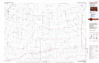
(7)- 1982 Map of Dead Horse Draw, 1983 Print
 1982 Dead Horse Draw1983 Print · USGSZiebach County in the early 1980s is captured here as a landscape of remote draws and seasonal creeks within the Cheyenne River Indian Reservation. Local history researchers can trace the winding paths of Dead Horse Draw, Lake Buffalo, and Chasing Hawk Draw.
 - 1982 Map of Bridger NE, 1983 Print
 1982 Bridger NE1983 Print · USGSZiebach County is documented in the early eighties as a landscape of winding drainages and prairie benches within the Cheyenne River Indian Reservation. Researchers can locate remote landmarks like St Marks Cem and trace the paths of Cherry Creek and Felix Creek.
 - 1982 Map of Longbrake Ranch, 1983 Print
 1982 Longbrake Ranch1983 Print · USGSZiebach County ranching life is documented here during the late twentieth century on the Cheyenne River Indian Reservation. Researchers can locate established family holdings such as Longbrake Ranch and Herren Ranch near the waters of Rattlesnake Creek.
 - 1982 Map of Sears Dam, 1983 Print
 1982 Sears Dam1983 Print · USGSThe South Dakota plains within the Cheyenne River Indian Reservation are captured here in the early eighties. Researchers can trace rural family life and land use through labels like Sunnybrook Ch, Mitchell Ranch, and Knight Ranch.
 - 1983 Map of Lemmon Creek, 1984 Print
 1983 Lemmon Creek1984 Print · USGSMeade and Ziebach counties are captured in the early 1980s, revealing a landscape defined by the Cheyenne River Indian Reservation Boundary. Researchers can trace the sprawling network of prairie draws and named watercourses such as Lemmon Creek, Johnny Creek, and Howes Grazing Lake.
 - 1984 Map of Camp Creek
 1984 Camp Creek1984 Print · USGSMeade County ranching country comes into focus in the mid-1980s, showcasing the remote settlements and airstrips of the South Dakota plains. Researchers can locate family landmarks like the Vig Ranch Landing Strip, the small community of Opal, and the high terrain of Fox Ridge.2 unique versions available
 - 1986 Map of Cherry Creek
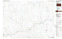 1986 Cherry Creek1986 Print · USGSWest-central South Dakota comes to life in the mid-1980s, centered on the Cheyenne River Indian Reservation and the river's winding path. Genealogists and historians can trace the remote settlements of Red Scaffold and Milesville or locate family landmarks like Staple M Cliffs and Robbs Flat.2 unique versions available
End of results
Showing maps 1-7 of 7
Top neighborhoods of District 3
Frequently asked questions
- What are the different types of historical maps available for District 3?
- What is the oldest map of District 3?
- Where can I purchase historical maps of District 3 for my home or office?
- Where can I download high-res historical maps of District 3?
- Are there historical topographic maps available for District 3?
- Is there historical aerial imagery available for District 3?
- Where are historical maps of District 3 sourced from?