Old Maps of District 3, South Dakota for Metal Detecting
Plan your next treasure hunt with 76 historic maps of District 3. Find old homesites, ghost towns, trails, and gathering spots that may be lost to time — perfect for identifying promising metal detecting locations.
- Locate forgotten sites: Uncover places like long-lost settlements, abandoned rail lines, or gathering spots.
- Plan better hunts: Use map overlays combined with LiDAR or satellite views to narrow in on historically rich areas.
- Made for detectorists: Thousands of hobbyists use these maps to discover relics, coins, and hidden history.
Use these historic maps to boost your research and find new opportunities beneath the surface of District 3.
District 3, SD maps
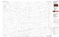
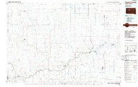
(76)- 1953 Map of Rapid City, 1964 Print
 1953 Rapid City1964 Print · USGSWestern South Dakota's transition from the Black Hills to the open prairie is captured here during the mid-fifties. Researchers can trace the development of Ellsworth Air Force Base alongside historic landmarks like Bear Butte and the Lower Alkali School.3 unique versions available
 - 1954 Map of Pierre, 1968 Print
 1954 Pierre1968 Print · USGSThe Missouri River and the newly formed Oahe Reservoir define central South Dakota in the 1950s. Genealogists and local historians can trace early settlements and rail stops like Eakin Siding, Mission Ridge, and Ottumwa.2 unique versions available
 - 1955 Map of Bridger, 1956 Print
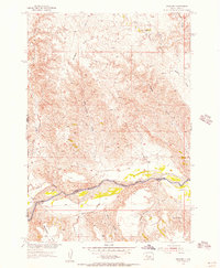 1955 Bridger1956 Print · USGSThe Cheyenne River Indian Reservation and the settlement of Bridger are documented during the mid-fifties. Genealogists and researchers can locate family-named landmarks like VJ Ranch, Hatchet Spring, and the expansive Barthold Flat.
 - 1955 Map of Rattlesnake Lake SE, 1956 Print
 1955 Rattlesnake Lake SE1956 Print · USGSThe Cheyenne River breaks and the plains of Haakon County are captured here in the mid-fifties. Researchers can trace rural school locations like Malone Sch, livestock landmarks such as White Thunder Ranch, and water sources like Beerwagon Spring.
 - 1955 Map of Rattlesnake Lake SW, 1956 Print
 1955 Rattlesnake Lake SW1956 Print · USGSThe Cheyenne River breaks of Haakon and Ziebach counties are captured here in the mid-1950s, showing a remote ranching landscape before modern consolidation. Genealogists and local historians can locate early rural landmarks like Harding Grove Sch and the Elshers Sch (Abandoned) along the edge of Milesville Flat.
 - 1955 Map of Rattlesnake Lake, 1956 Print
 1955 Rattlesnake Lake1956 Print · USGSZiebach County ranching life is documented here in the mid-1950s as part of the Missouri River Basin development. Genealogists can locate family landmarks like Knight Ranch or trace local history at Frazier Ch and Little Dog Cem.
 - 1955 Map of Rattlesnake Lake NE, 1956 Print
 1955 Rattlesnake Lake NE1956 Print · USGSZiebach County, South Dakota, is captured mid-century during a period of intensive Missouri River Basin development. Researchers can trace the rugged drainage patterns of Cherry Creek and follow the paths of Horn Draw and Straighthead Draw.
 - 1955 Map of Bridger SE, 1956 Print
 1955 Bridger SE1956 Print · USGSZiebach and Haakon counties meet along the high plains river breaks in the mid-1950s. Historians and researchers can trace the vital water sources and ranching landmarks of the era, including Bull Ranch, Black Bull Spring, and the Cheyenne River.2 unique versions available
 - 1955 Map of Howes, 1957 Print
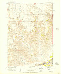 1955 Howes1957 Print · USGSThe Cheyenne River valley in the mid-1950s reveals a sparse ranching landscape shaped by deep creek breaks and isolated landmarks. Genealogists and local historians can trace the foundations of Howes, Plainview Ch, and the rural Negro Creek Sch.2 unique versions available
 - 1956 Map of Cherry Creek NW, 1957 Print
 1956 Cherry Creek NW1957 Print · USGSThe river valley along the Ziebach and Haakon county line is captured in the mid-1950s, showing the intersection of ranching and reservation land. Genealogists and historians can trace the legacy of local families at Red Fox Ranch, Motley Ranch, and White Cloud Ranch.2 unique versions available
 - 1956 Map of Cherry Creek, 1957 Print
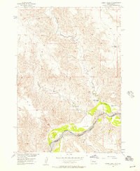
 1956 Cherry Creek1957 Print · USGSSettlement and ranching life along the Cheyenne River are documented here during the mid-1950s. Genealogists and historians can trace family landholdings and rural landmarks including Maupin Sch, Buchholtz Ranch, and Murphy Ranch.3 unique versions available
 - 1957 Map of Rapid City
 1957 Rapid City1957 Print · USGSWestern South Dakota in the mid-fifties reveals a landscape of high-altitude forests and growing military installations. Researchers can trace the development of Ellsworth Air Force Base, locate the Theodore Roosevelt Monument, and find rural landmarks like Lower Alkali School.
 - 1958 Map of Pierre
 1958 Pierre1958 Print · USGSCentral South Dakota is documented during the mid-fifties, just as the Missouri River valley was being transformed by the massive Oahe Dam project. Researchers can trace the early Oahe Reservoir shoreline and find remote outposts like Milesville, Onida, and Giddings Flat.
 - 1982 Map of Dead Horse Draw, 1983 Print
 1982 Dead Horse Draw1983 Print · USGSZiebach County in the early 1980s is captured here as a landscape of remote draws and seasonal creeks within the Cheyenne River Indian Reservation. Local history researchers can trace the winding paths of Dead Horse Draw, Lake Buffalo, and Chasing Hawk Draw.
 - 1982 Map of Bridger NE, 1983 Print
 1982 Bridger NE1983 Print · USGSZiebach County is documented in the early eighties as a landscape of winding drainages and prairie benches within the Cheyenne River Indian Reservation. Researchers can locate remote landmarks like St Marks Cem and trace the paths of Cherry Creek and Felix Creek.
 - 1982 Map of Longbrake Ranch, 1983 Print
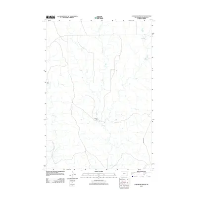
 1982 Longbrake Ranch1983 Print · USGSZiebach County ranching life is documented here during the late twentieth century on the Cheyenne River Indian Reservation. Researchers can locate established family holdings such as Longbrake Ranch and Herren Ranch near the waters of Rattlesnake Creek.
 - 1982 Map of Sears Dam, 1983 Print
 1982 Sears Dam1983 Print · USGSThe South Dakota plains within the Cheyenne River Indian Reservation are captured here in the early eighties. Researchers can trace rural family life and land use through labels like Sunnybrook Ch, Mitchell Ranch, and Knight Ranch.
 - 1983 Map of Lemmon Creek, 1984 Print
 1983 Lemmon Creek1984 Print · USGSMeade and Ziebach counties are captured in the early 1980s, revealing a landscape defined by the Cheyenne River Indian Reservation Boundary. Researchers can trace the sprawling network of prairie draws and named watercourses such as Lemmon Creek, Johnny Creek, and Howes Grazing Lake.
 - 1984 Map of Camp Creek
 1984 Camp Creek1984 Print · USGSMeade County ranching country comes into focus in the mid-1980s, showcasing the remote settlements and airstrips of the South Dakota plains. Researchers can locate family landmarks like the Vig Ranch Landing Strip, the small community of Opal, and the high terrain of Fox Ridge.2 unique versions available
 - 1986 Map of Cherry Creek
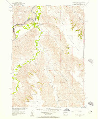
 1986 Cherry Creek1986 Print · USGSWest-central South Dakota comes to life in the mid-1980s, centered on the Cheyenne River Indian Reservation and the river's winding path. Genealogists and historians can trace the remote settlements of Red Scaffold and Milesville or locate family landmarks like Staple M Cliffs and Robbs Flat.2 unique versions available
 - 2012 Map of Rattlesnake Lake, 2012 Print
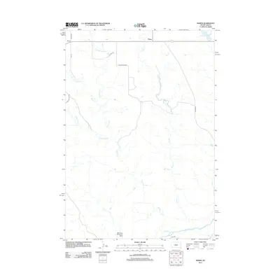
 2012 Rattlesnake Lake2012 Print · USGSCovers District 3, including District 2, Ziebach County, and other nearby areas
 - 2012 Map of Dead Horse Draw, 2012 Print
 2012 Dead Horse Draw2012 Print · USGSCovers District 3, including District 2, Ziebach County, and other nearby areas
 - 2012 Map of Howes, 2012 Print
 2012 Howes2012 Print · USGSCovers District 3, including Howes, Pennington County, and other nearby areas
 - 2012 Map of Bridger, 2012 Print
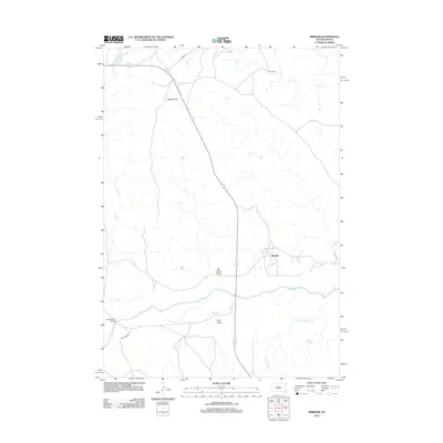 2012 Bridger2012 Print · USGSCovers District 3, including Bridger, Ziebach County, and other nearby areas
 - 2012 Map of Longbrake Ranch, 2012 Print
 2012 Longbrake Ranch2012 Print · USGSCovers District 3, including District 2, Ziebach County, and other nearby areas
Showing maps 1-25 of 76
Top neighborhoods of District 3
Frequently asked questions
- What are the different types of historical maps available for District 3?
- What is the oldest map of District 3?
- Where can I purchase historical maps of District 3 for my home or office?
- Where can I download high-res historical maps of District 3?
- Are there historical topographic maps available for District 3?
- Is there historical aerial imagery available for District 3?
- Where are historical maps of District 3 sourced from?