
1955 Map of Howes
USGS Topo · Published 1957About this map
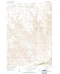
Cheyenne River waters define the southern reaches of this Meade County landscape, where the confluence with Ash Creek and Timber Creek shapes a complex network of draws and breaks. In the mid-1950s, the rural community of Howes serves as a small focal point in the northern section, supported by local landmarks like Plainview Ch. The terrain is deeply incised by the long course of Negro Creek, which winds southward toward the river basin.
Find a feature on this map
15 named features on this map. Tap any name to fly to it.
Don’t see what you’re looking for? This feature index may not catch every label — zoom into the map to look around manually.
Map Details
Editions of this 1955 Howes Map
2 editions found
Other maps of this area

1953 · Rapid City
USGS Topo · 1:250,000

1954 · Pierre
USGS Topo · 1:250,000

1955 · Bridger
USGS Topo · 1:24,000

1955 · Pedro
USGS Topo · 1:24,000

1955 · Pedro NW
USGS Topo · 1:24,000

1955 · Hilland NW
USGS Topo · 1:24,000

1957 · Rapid City
USGS Topo · 1:250,000

1958 · Pierre
USGS Topo · 1:250,000

1982 · Dead Horse Draw
USGS Topo · 1:24,000

1983 · Plainview
USGS Topo · 1:24,000