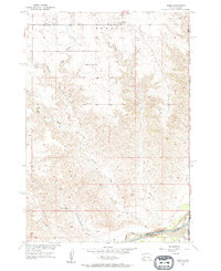
1955 Map of Howes
USGS Topo · Published 1957About this map
The settlement of Howes serves as the focal point for this 1950s study of the western South Dakota plains, situated just north of the Cheyenne River. The landscape is defined by an intricate network of drainage systems, most notably the several forks of Narcelle Creek and the curiously named Whimmer Whammer Draw. This map captures a moment in the mid-century ranching era when rural infrastructure remained centered on local landmarks like the Plainview Ch and the Negro Creek Sch.
Find a feature on this map
17 named features on this map. Tap any name to fly to it.
Don’t see what you’re looking for? This feature index may not catch every label — zoom into the map to look around manually.
Map Details
Editions of this 1955 Howes Map
2 editions found
Other maps of this area

1953 · Rapid City
USGS Topo · 1:250,000

1954 · Pierre
USGS Topo · 1:250,000

1955 · Bridger
USGS Topo · 1:24,000

1955 · Pedro
USGS Topo · 1:24,000

1955 · Pedro NW
USGS Topo · 1:24,000

1955 · Howes
USGS Topo · 1:24,000

1955 · Hilland NW
USGS Topo · 1:24,000

1957 · Rapid City
USGS Topo · 1:250,000

1958 · Pierre
USGS Topo · 1:250,000

1982 · Dead Horse Draw
USGS Topo · 1:24,000