
1956 Map of Cherry Creek
USGS Topo · Published 1957About this map
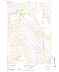
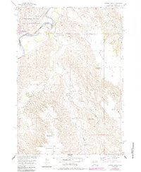
The Cheyenne River winds through the northwest corner of this 1950s survey, marking the Indian Reservation Boundary between Ziebach and Haakon counties. The settlement of Cherry Creek sits at this bend, serving as a hub for the surrounding ranchlands. The landscape transitions from the broad expanses of Maupin Flat and Hudson Flat to the intricate, eroded drainages of Plum Creek and its many tributaries, including East Fork Plum Creek. Evidence of local ranching and rural education is scattered throughout the territory, from the Maupin Sch near the river to isolated outposts like Buchholtz Ranch, Towne Ranch, and Quinn Ranch. Unique geological and hydrologic features, such as Stony Butte and several Flowing Wells, highlight the challenges and characteristics of life in this semi-arid South Dakota terrain.
Find a feature on this map
20 named features on this map. Tap any name to fly to it.
Don’t see what you’re looking for? This feature index may not catch every label — zoom into the map to look around manually.
Map Details
Editions of this 1956 Cherry Creek Map
3 editions found
Other maps of this area

1954 · Pierre
USGS Topo · 1:250,000

1955 · Rattlesnake Lake SE
USGS Topo · 1:24,000

1955 · Rattlesnake Lake NE
USGS Topo · 1:24,000

1956 · Kirley
USGS Topo · 1:24,000

1956 · Cherry Creek NW
USGS Topo · 1:24,000

1956 · Carlin Flat
USGS Topo · 1:24,000

1958 · Pierre
USGS Topo · 1:250,000

1983 · Philip
USGS Topo · 1:100,000

1983 · Moenville
USGS Topo · 1:24,000

1983 · Middle Draw
USGS Topo · 1:24,000