
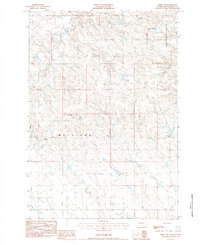
1983 Map of Middle Draw
USGS Topo · Published 1984About this map
Schofield Ranch and Ostilen Ranch anchor this West River landscape in Haakon County, illustrating the remote ranching operations of the early 1980s. A complex drainage network defines the topography, led by the winding paths of Crooked Creek, Plum Creek, and Deer Creek. The terrain is characterized by dissected breaks and the broad, open Flat to the north, which is navigated by isolated corridors such as Guinn Road and Singleton Road. The mapping reveals the practical requirements of rangeland infrastructure, from scattered Gravel Pits used for road maintenance to the seasonal flow of Long Branch Middle Draw Creek. This survey captures the region just before modern shifts in land use, showing a territory where water sources and family-named ranch sites remained the primary landmarks.
Find a feature on this map
10 named features on this map. Tap any name to fly to it.
Don’t see what you’re looking for? This feature index may not catch every label — zoom into the map to look around manually.
Map Details
Editions of this 1983 Middle Draw Map
This is the sole edition of this map. No revisions or reprints were ever made.
Other maps of this area

1954 · Pierre
USGS Topo · 1:250,000

1955 · Rattlesnake Lake SE
USGS Topo · 1:24,000

1956 · Kirley
USGS Topo · 1:24,000

1956 · Cherry Creek
USGS Topo · 1:24,000

1958 · Pierre
USGS Topo · 1:250,000

1983 · Mule Creek
USGS Topo · 1:24,000

1983 · Philip
USGS Topo · 1:100,000

1983 · Moenville
USGS Topo · 1:24,000

1983 · Tornado Ranch
USGS Topo · 1:24,000
1983 · Pheba 2SE
USGS Topo · 1:24,000