1960s Maps of Anderson County, Tennessee
Explore 10 historic maps of Anderson County from the 1960s. These maps offer a rare glimpse into what life looked like during the 1960s — showing old roads, neighborhoods, homes, and landmarks that have changed or disappeared over time.
Whether you're researching your family's past, planning a metal detecting trip, or studying how Anderson County's landscape evolved across the 1960s, these high-resolution maps are a powerful tool for exploring the history of this region.
- Focus on a specific era: All maps on this page are from the 1960s, giving you a focused view of this time period.
- See what’s changed: Compare century-old streets, trails, and buildings to today's modern landscape using overlays and satellite layers.
- Research with precision: Use these maps for genealogy, historical research, land use analysis, or educational projects.
- View, download, or print: Maps are fully viewable online in high resolution, and can be downloaded or printed for your own records.
Start exploring Anderson County's history through authentic maps from the 1960s. This is your window into the past.
Anderson County, TN maps
(10)- 1960 Map of Johnson City
 1960 Johnson City1960 Print · USGSUpper East Tennessee and the surrounding tri-state area are shown in the mid-fifties during the height of the TVA reservoir era. Trace the industrial rail lines of the Southern and Louisville and Nashville between Kingsport and Johnson City.
 - 1960 Map of Chattanooga
 1960 Chattanooga1960 Print · USGSSoutheast Tennessee and the southern Appalachians are shown here at the height of the river-management era. You can trace the valley rail lines and locate Lookout Mountain and the expansive waters of Chickamauga Reservoir.
 - 1963 Map of Johnson City
 1963 Johnson City1963 Print · USGSThe Tri-Cities and the surrounding Appalachian ridges are shown in detail during the early sixties, highlighting the era's vital rail and river networks. Genealogists and historians can trace the routes of the Clinchfield RR and locate settlements from Rogersville to Elizabethton.
 - 1964 Map of Chattanooga
 1964 Chattanooga1964 Print · USGSSoutheast Tennessee and the western Carolinas appear in the mid-sixties as a powerhouse of river-driven industry and mountain wilderness. Genealogists and historians can trace rail-town lineages along the Southern Ry or locate family landmarks near Watts Bar Lake and Tellico Plains.
 - 1966 Map of Bearden, 1968 Print
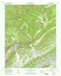
 1966 Bearden1968 Print · USGSWestern Knoxville and the Beaver Valley are captured in the mid-sixties during a transformative era of suburban growth. Genealogists and historians can trace the transition from rural landmarks like Beaver Ridge Cem to rising neighborhoods such as West Hills and Rocky Hill.
 - 1968 Map of Powell, 1971 Print
 1968 Powell1971 Print · USGSThe Tennessee Valley north of Knoxville comes into focus during the late sixties as suburban growth meets established rural ridges. Researchers can trace family-named burial sites like Mabry Cem, visit the Powell Airfield, or locate the Slave cem near Wolf Valley Creek.
 - 1968 Map of Clinton, 1972 Print
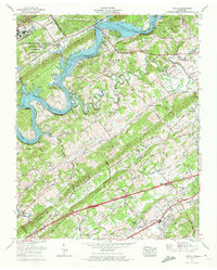
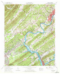 1968 Clinton1972 Print · USGSThe Clinch River Valley in the late sixties reveals the growing footprint of nuclear research and energy production near the industrial city of Clinton. Local historians can trace the development of Oak Ridge neighborhoods and find rural landmarks like Laurel Grove, Jarnigan Chapel, and the Bull Run Steam Plant.3 unique versions available
 - 1968 Map of Windrock, 1972 Print
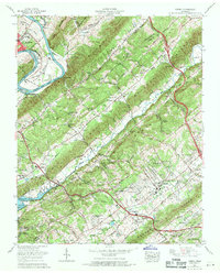
 1968 Windrock1972 Print · USGSAnderson County and the surrounding ridges are captured in the late sixties, showing the industrial pulse of the Cumberland Mountains. Genealogists and researchers can trace family names at Hoskins Cem and Smith Cem, or locate early sites in Oliver Springs and Tupper Town.5 unique versions available
 - 1968 Map of Bethel Valley, 1972 Print
 1968 Bethel Valley1972 Print · USGSOak Ridge and the Clinch River valley are shown during a period of intense atomic research and postwar expansion. Genealogists and historians can trace local landmarks like Bethel Chapel Cem, Bradbury, and the high-security Atomic Energy Commission grounds.
 - 1968 Map of Lovell, 1972 Print
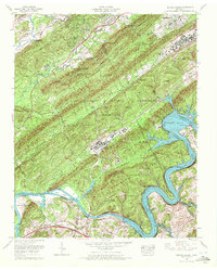
 1968 Lovell1972 Print · USGSKnox County is captured in a period of significant growth in the late sixties as the interstate system began to reshape the Tennessee valley. Researchers can trace family history at Hardin Valley Sch & Ch or explore the geography of Palace Caverns and Melton Hill Lake.4 unique versions available
End of results
Showing maps 1-10 of 10
Top cities of Anderson County
- Clinton historical maps
- Oliver Springs historical maps
- Rocky Top historical maps
- Norris historical maps
- Andersonville historical maps
- Briceville historical maps
Frequently asked questions
- What are the different types of historical maps available for Anderson County?
- What is the oldest map of Anderson County?
- Where can I purchase historical maps of Anderson County for my home or office?
- Where can I download high-res historical maps of Anderson County?
- Are there historical topographic maps available for Anderson County?
- Is there historical aerial imagery available for Anderson County?
- Where are historical maps of Anderson County sourced from?