1930s Maps of Anderson County, Tennessee
Explore 19 historic maps of Anderson County from the 1930s. These maps offer a rare glimpse into what life looked like during the 1930s — showing old roads, neighborhoods, homes, and landmarks that have changed or disappeared over time.
Whether you're researching your family's past, planning a metal detecting trip, or studying how Anderson County's landscape evolved across the 1930s, these high-resolution maps are a powerful tool for exploring the history of this region.
- Focus on a specific era: All maps on this page are from the 1930s, giving you a focused view of this time period.
- See what’s changed: Compare century-old streets, trails, and buildings to today's modern landscape using overlays and satellite layers.
- Research with precision: Use these maps for genealogy, historical research, land use analysis, or educational projects.
- View, download, or print: Maps are fully viewable online in high resolution, and can be downloaded or printed for your own records.
Start exploring Anderson County's history through authentic maps from the 1930s. This is your window into the past.
Anderson County, TN maps
(19)- 1935 Map of Bethel Valley
 1935 Bethel Valley1935 Print · USGSEastern Tennessee in the mid-1930s was a landscape of ridge-and-valley farms along the Clinch River. Genealogists and historians can trace the foundations of local life through the George Jones Memorial Ch, Wheat, and the White Wing Ferry.
 - 1935 Map of Bearden
 1935 Bearden1935 Print · USGSKnox County is captured in the mid-1930s just as the Tennessee Valley Authority began reshaping the regional landscape. Trace the old rail lines of the Southern railroad and find local landmarks like the County Prison Farm and Karns Sch.
 - 1935 Map of Lovell
 1935 Lovell1935 Print · USGSKnox County was a landscape of river crossings and ridge-top communities in the mid-1930s. Genealogists and local historians can trace family locations through rural landmarks like Gallaher Ferry, Grigsby Chapel, and Grand Caverns.
 - 1936 Map of Gorryton
 1936 Gorryton1936 Print · USGSNortheast of Knoxville in the mid-1930s, the landscape was being reshaped by the newly flooded Norris Reservoir. Genealogists and historians can trace numerous rural landmarks, including Welch Mill, Big Ridge Park Cemetery, and the Southern Railway corridor.
 - 1936 Map of Hogbell Gap
 1936 Hogbell Gap1936 Print · USGSThe Tennessee Cumberland Mountains are captured during the mid-1930s, revealing a landscape of high ridges and critical mountain passes. Researchers can trace the rugged topography of Bird Mountain and locate early landmarks such as Hogbell Gap and The Garden Spot.
 - 1936 Map of Duncan Flats
 1936 Duncan Flats1936 Print · USGSUpland Anderson County life is recorded here during the mid-1930s as federal agencies mapped the high ridges. Genealogists can locate the Duncan Flats Sch and trace the proximity of family homes to Duncan Flats and the Incline.
 - 1936 Map of White Hollow
 1936 White Hollow1936 Print · USGSUnion County enters a period of massive change in the mid-thirties as the Tennessee Valley Authority fills the new reservoir. Researchers can trace submerged landmarks and family sites like Wilson Mill, Lays Cem, and Mossy Spring Sch.
 - 1936 Map of Windrock
 1936 Windrock1936 Print · USGSAnderson County and its neighbors are captured here in the mid-1930s as industrial rail lines bridged the gap between mountain coal and valley towns. Genealogists can trace family names at Grave Hill Cemetery or locate the old Frost Bottom School.
 - 1936 Map of La Follette
 1936 La Follette1936 Print · USGSThe Powell Valley is shown during the early years of the Tennessee Valley Authority as the new shoreline of Norris Reservoir begins to take shape. Researchers can locate family landmarks like Bakers Forge Memorial Cem and coal infrastructure at Indian Creek Mines.
 - 1936 Map of Norris Dam
 1936 Norris Dam1936 Print · USGSIn the mid-thirties, the Clinch River valley underwent a total transformation as the new Norris Reservoir reshaped the land. Genealogists can trace family homesteads near Clinton, old burial sites like Leach Cem, and coal towns including Briceville.
 - 1936 Map of Friendship
 1936 Friendship1936 Print · USGSEast Tennessee in the mid-1930s is documented here at a turning point for the river and rail landscape of Knox and Blount counties. Genealogists can trace family names at Mt Zion Ch, Martel Sch, and the riverside settlement of Louisville before the valley landscape was transformed.
 - 1936 Map of Petros
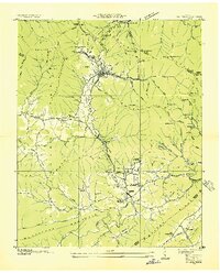 1936 Petros1936 Print · USGSMorgan County is shown at the height of its coal-mining era in the mid-1930s. Genealogists and historians can trace the foundations of Brushy Mountain State Prison and industrial camps like Coalfield Camp No 1 and Petros.
 - 1936 Map of Mc Lean Rock
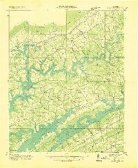 1936 Mc Lean Rock1936 Print · USGSUnion and Claiborne counties appear just as the Tennessee Valley Authority was reshaping the land in the mid-1930s. Researchers can locate family roots at Rose Hill Ch & Cem, trace the early operations of Lead Mine, or find the historic Speedwell Academy.
 - 1936 Map of Coal Creek
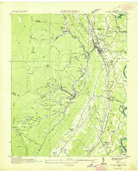 1936 Coal Creek1936 Print · USGSThe Tennessee coalfields are documented here in the mid-1930s, showing the industrial and social landscape of the Coal Creek valley. Family historians can trace local roots through landmarks like Miners Circle Cem, Briceville, and the Do Better Ch.2 unique versions available
 - 1936 Map of Demory
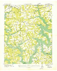 1936 Demory1936 Print · USGSAs the Tennessee Valley Authority reshaped the region in the mid-1930s, this survey documented the new shoreline of Norris Reservoir. Genealogists can trace community landmarks like Bakers Forge Memorial Cem, Demory Ch, and Alder Springs Sch.
 - 1936 Map of Clinton
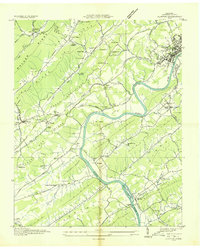 1936 Clinton1936 Print · USGSAnderson County settlements and ridge-and-valley farms are captured here in the mid-1930s as the river economy begins to shift. Genealogists can locate family landmarks like Worthington Cem, Spessard Mill, and old congregations at Sulphur Springs Ch.
 - 1936 Map of Norris
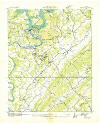 1936 Norris1936 Print · USGSAnderson County and the Clinch River valley are seen here in the mid-1930s during the transformative early years of the Tennessee Valley Authority. Researchers can locate vanished landmarks and Depression-era worksites like C C C Camp No 494, Loys Mill, and Glen Alpine Sch.
 - 1936 Map of Powell Station
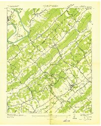 1936 Powell Station1936 Print · USGSThe Tennessee Valley during the mid-1930s shows a landscape of ridge-and-valley settlements and early federal infrastructure projects. Researchers can find many family landmarks and community hubs, including CCC Camp No 495, Bakers Mill, and Union Zion Ch.
 - 1936 Map of Big Ridge Park
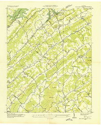 1936 Big Ridge Park1936 Print · USGSThe Tennessee Valley Authority era reshapes the landscape on this mid-1930s sheet as the newly formed Norris Reservoir reaches its pool level. Family historians can trace the transition of local communities through the New Loyston Cem, Webb Mill, and the many schools scattered along Hinds Creek Valley.
End of results
Showing maps 1-19 of 19
Top cities of Anderson County
- Clinton historical maps
- Oliver Springs historical maps
- Rocky Top historical maps
- Norris historical maps
- Andersonville historical maps
- Briceville historical maps
Frequently asked questions
- What are the different types of historical maps available for Anderson County?
- What is the oldest map of Anderson County?
- Where can I purchase historical maps of Anderson County for my home or office?
- Where can I download high-res historical maps of Anderson County?
- Are there historical topographic maps available for Anderson County?
- Is there historical aerial imagery available for Anderson County?
- Where are historical maps of Anderson County sourced from?