1900s (20th Century) Maps of Anchor Mill, Tennessee
Explore 5 historic maps of Anchor Mill from the 1900s (20th Century). These maps offer a rare glimpse into what life looked like during the 1900s — showing old roads, neighborhoods, homes, and landmarks that have changed or disappeared over time.
Whether you're researching your family's past, planning a metal detecting trip, or studying how Anchor Mill's landscape evolved across the 1900s, these high-resolution maps are a powerful tool for exploring the history of this region.
- Focus on a specific era: All maps on this page are from the 1900s, giving you a focused view of this time period.
- See what’s changed: Compare century-old streets, trails, and buildings to today's modern landscape using overlays and satellite layers.
- Research with precision: Use these maps for genealogy, historical research, land use analysis, or educational projects.
- View, download, or print: Maps are fully viewable online in high resolution, and can be downloaded or printed for your own records.
Start exploring Anchor Mill's history through authentic maps from the 1900s. This is your window into the past.
Anchor Mill, TN maps
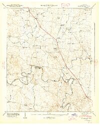
(5)- 1936 Map of Unionville
 1936 Unionville1936 Print · USGSBedford County's agricultural heartland is documented here in the mid-1930s, where river mills and country schoolhouses define the social geography. Researchers can locate family landmarks like Blackburns Mill, the curiosly named Three Cornered Garden, and the riverside Britton Ford.
 - 1944 Map of Shelbyville
 1944 Shelbyville1944 Print · USGSMid-century Middle Tennessee is captured here during the wartime mobilization of the 1940s. Genealogists and researchers can trace family lands near Bugscuffle, Shelbyville Mills, and the expansive Camp Forrest Military Res.
 - 1947 Map of Unionville, 1948 Print
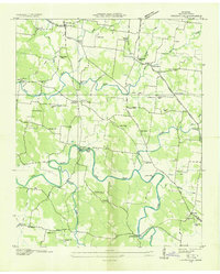
 1947 Unionville1948 Print · USGSBedford County's rural heartland is captured here in the late 1940s, centered on the historic crossroads of Unionville. Researchers can trace the mid-century river economy along the Duck River, finding local landmarks like Halls Mill, Anchor Mill, and Warner Bridge.5 unique versions available
 - 1956 Map of Columbia, 1960 Print
 1956 Columbia1960 Print · USGSMiddle Tennessee in the mid-fifties presents a landscape of established river towns and critical rail hubs before the arrival of the modern interstate system. Researchers can trace the routes of the Louisville and Nashville railroad or locate historic landmarks like Stones River National Military Park and the Tennessee National Wildlife Refuge.6 unique versions available
 - 1985 Map of Murfreesboro, 1986 Print
 1985 Murfreesboro1986 Print · USGSMiddle Tennessee in the mid-1980s shows a landscape of growing towns and deep-rooted rural outposts. Local researchers can trace old family lines near Bell Buckle, locate landmarks like Donnel Chapel, or explore the grounds of Henry Horton State Park and Hoovers Gap.
End of results
Showing maps 1-5 of 5
Top cities near Anchor Mill
- Murfreesboro historical maps
- Shelbyville historical maps
- Lewisburg historical maps
- Chapel Hill historical maps
- Eagleville historical maps
- Petersburg historical maps
See more
Frequently asked questions
- What are the different types of historical maps available for Anchor Mill?
- What is the oldest map of Anchor Mill?
- Where can I purchase historical maps of Anchor Mill for my home or office?
- Where can I download high-res historical maps of Anchor Mill?
- Are there historical topographic maps available for Anchor Mill?
- Is there historical aerial imagery available for Anchor Mill?
- Where are historical maps of Anchor Mill sourced from?