Old Maps of Normandy, Tennessee for Genealogy
Trace your family roots with 10 historic maps of Normandy. These high-res maps reveal old neighborhoods, homesites, landmarks, and streets — helping you uncover where your ancestors lived and how the area evolved over time.
- Explore historic neighborhoods: Identify where your relatives may have lived in the 1800s or 1900s.
- Compare maps over time: Trace the changes in streets, buildings, and landmarks for multi-generational research.
- Perfect for genealogy & ancestry research: Used by family historians and researchers to map out lineage and migration.
These maps are an incredible resource for exploring your personal connection to Normandy's past.
Normandy, TN maps
(10)- 1936 Map of Normandy
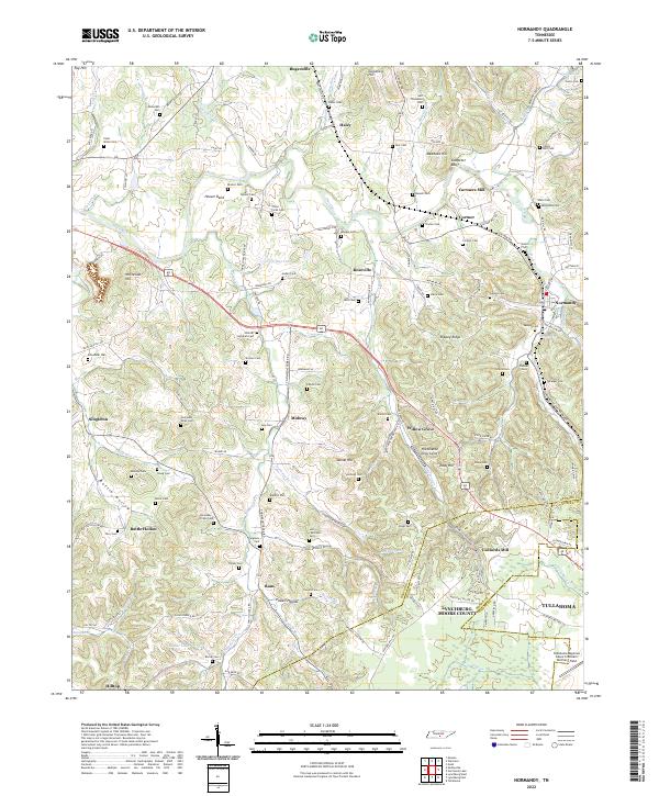
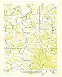 1936 Normandy1936 Print · USGSBedford and Moore counties come to life in the 1930s as the rail-and-river economy centers on the town of Normandy. Genealogists and historians can trace family locations at Bugscuffle, locate Jenkins Sch, or find industrial landmarks like Cortners Mill.
 - 1944 Map of Shelbyville
 1944 Shelbyville1944 Print · USGSMid-century Middle Tennessee is captured here during the wartime mobilization of the 1940s. Genealogists and researchers can trace family lands near Bugscuffle, Shelbyville Mills, and the expansive Camp Forrest Military Res.
 - 1947 Map of Normandy, 1948 Print
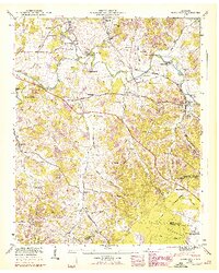 1947 Normandy1948 Print · USGSBedford and Moore Counties are captured here shortly after the war, when the Duck River still powered local industry. Genealogists can trace family names across Cortner Cem and Ledfords Mill or locate rural landmarks like Shoffner Ch.7 unique versions available
 - 1956 Map of Columbia, 1960 Print
 1956 Columbia1960 Print · USGSMiddle Tennessee in the mid-fifties presents a landscape of established river towns and critical rail hubs before the arrival of the modern interstate system. Researchers can trace the routes of the Louisville and Nashville railroad or locate historic landmarks like Stones River National Military Park and the Tennessee National Wildlife Refuge.6 unique versions available
 - 1981 Map of Tullahoma, 1982 Print
 1981 Tullahoma1982 Print · USGSSouthern Tennessee enters the 1980s with a mix of aerospace technology and deep rural roots. Researchers can trace the L & N RR through Shelbyville and Fayetteville or locate family sites like Old Salem Cem and Blanton Chapel near the Cumberland Plateau.
 - 2010 Map of Normandy, 2010 Print
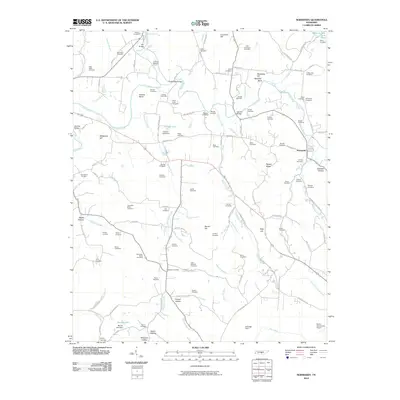 2010 Normandy2010 Print · USGSCovers Normandy, including Tullahoma, Bottle Hollow, and other nearby areas
 - 2013 Map of Normandy, 2013 Print
 2013 Normandy2013 Print · USGSCovers Normandy, including Tullahoma, Bottle Hollow, and other nearby areas
 - 2016 Map of Normandy, 2016 Print
 2016 Normandy2016 Print · USGSCovers Normandy, including Tullahoma, Bottle Hollow, and other nearby areas
 - 2019 Map of Normandy, 2019 Print
 2019 Normandy2019 Print · USGSCovers Normandy, including Tullahoma, Bottle Hollow, and other nearby areas
 - 2022 Map of Normandy, 2022 Print
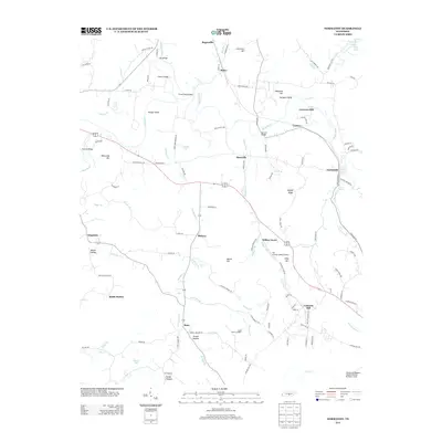
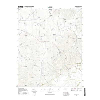
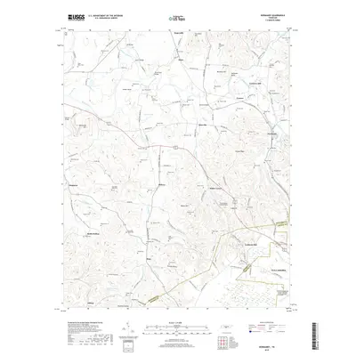
 2022 Normandy2022 Print · USGSBedford and Moore County heritage is preserved here in the valley of the Duck River. Genealogists and local historians can trace family roots through dozens of sites like the Shofner Lutheran Cem, Cortners Mill, and Ledfords Mill.
End of results
Showing maps 1-10 of 10
Top cities near Normandy
- Shelbyville historical maps
- Tullahoma historical maps
- Manchester historical maps
- Winchester historical maps
- Estill Springs historical maps
- Decherd historical maps
See more
Frequently asked questions
- What are the different types of historical maps available for Normandy?
- What is the oldest map of Normandy?
- Where can I purchase historical maps of Normandy for my home or office?
- Where can I download high-res historical maps of Normandy?
- Are there historical topographic maps available for Normandy?
- Is there historical aerial imagery available for Normandy?
- Where are historical maps of Normandy sourced from?