Old Maps of Benton County, Tennessee for Genealogy
Trace your family roots with 110 historic maps of Benton County. These high-res maps reveal old neighborhoods, homesites, landmarks, and streets — helping you uncover where your ancestors lived and how the area evolved over time.
- Explore historic neighborhoods: Identify where your relatives may have lived in the 1800s or 1900s.
- Compare maps over time: Trace the changes in streets, buildings, and landmarks for multi-generational research.
- Perfect for genealogy & ancestry research: Used by family historians and researchers to map out lineage and migration.
These maps are an incredible resource for exploring your personal connection to Benton County's past.
Benton County, TN maps
(110)- 1936 Map of Poplar Creek
 1936 Poplar Creek1936 Print · USGSBenton and Henry counties are shown in the mid-1930s as the Tennessee Valley Authority began shaping the region's river systems. Researchers can trace rural life through numerous country schools and landmarks like Sulphur Well, Murphy Landing, and Odem Sch.
 - 1936 Map of McKinnon
 1936 McKinnon1936 Print · USGSThe Tennessee River valley in the 1930s is revealed as a bustling hub of river landings and rail traffic before the landscape was transformed. Researchers can trace the river economy through the Danville Ferry, community ties at Griffin Ch, and the local rail stop at McKinnon.
 - 1936 Map of Camden
 1936 Camden1936 Print · USGSBenton County centers on the town of Camden during the mid-1930s, as the local economy transitioned through New Deal infrastructure projects. Genealogists can trace family roots through numerous rural landmarks like Missionary Grove Ch, Toll Chapel Sch, and the Bethlehem Cem near the river.
 - 1936 Map of Seventeen Creek
 1936 Seventeen Creek1936 Print · USGSBenton and Carroll counties appear here in the mid-1930s, showing a rural landscape defined by creek-side farming and small family settlements. Researchers can locate early schools and churches including Nole Sch, Palestine Ch, and the burial grounds at Pierce Cem.
 - 1936 Map of Big Sandy
 1936 Big Sandy1936 Print · USGSBig Sandy and its river valleys appear here in the mid-1930s just as the Tennessee Valley Authority was documenting the region's rural infrastructure. Genealogists and historians can locate dozens of country landmarks including McCarthy Chapel, Byer Sch, and Benton Cut along the rail line.
 - 1936 Map of Daniels Landing
 1936 Daniels Landing1936 Print · USGSLife along the Tennessee River in the mid-1930s was defined by its landings and creek-side communities before major dam projects altered the valley. Genealogists can trace family landmarks like Britt Chapel Cem, Daniels Landing, and the school at Oakview Sch.
 - 1936 Map of Johnsonville
 1936 Johnsonville1936 Print · USGSThe Tennessee River corridor in Humphreys County comes alive in the mid-1930s, showing the intersection of rail and river commerce. Genealogists and local historians can trace family sites like Crockett Cem or visit vanished points like Reynoldsburg Landing and Eva Station.
 - 1936 Map of Bruceton
 1936 Bruceton1936 Print · USGSBruceton was a bustling rail junction in the 1930s where the Tennessee Central met the St. Louis line. Genealogists can locate family landmarks like Sawyers Mill Zach PO, Cedar Grove Ch, and schools like Garfield Sch.
 - 1936 Map of Sugar Tree
 1936 Sugar Tree1936 Print · USGSDecatur and Benton counties are shown in the mid-thirties just as the TVA began its work along the river. Researchers can locate numerous family-named landmarks and community centers such as McIlwain, Hartley Cem, and Moore Chapel Sch.
 - 1936 Map of Harmon Creek
 1936 Harmon Creek1936 Print · USGSBenton and Humphreys counties are captured here in the mid-1930s, documenting the riverfront landings and valley farms along the Tennessee River. Genealogists can locate family-named landmarks like the Phifer Place, Carter Cem, and the Harmon Creek Sch.
 - 1936 Map of Cavvia
 1936 Cavvia1936 Print · USGSWest Tennessee rural life is captured in the mid-1930s where four counties converge among the forks of Birdsong and Cub Creeks. Researchers can trace ancestral locations at Shiloh Cem, identify vanished schoolhouse sites like Unity Sch, or locate old commercial hubs such as Tolleys Store.
 - 1936 Map of Rockport
 1936 Rockport1936 Print · USGSBenton County river life is captured here in the mid-1930s, showing a landscape defined by ferry crossings and upland farmsteads. Researchers can trace family sites at Trotters Ferry, Hardin Store, and schools like Tie Hill Sch.
 - 1936 Map of Manleyville
 1936 Manleyville1936 Print · USGSHenry County during the mid-1930s shows a landscape of small farming communities organized around local schools and rural churches. Researchers can locate family landmarks like Mc Davids Cem, Spring Creek Sch, and the community at Manleyville.
 - 1936 Map of Hustburg
 1936 Hustburg1936 Print · USGSHumphreys and Benton Counties are shown in the mid-1930s just as the Tennessee Valley Authority began its extensive survey work along the river. Genealogists can trace family connections through river landings like Dixie Landing and rural landmarks such as Oak Grove Ch or Pavatt Sch.
 - 1940 Map of Manleyville
 1940 Manleyville1940 Print · USGSThe West Tennessee river bottoms and hill country are shown just before the war, when the Big Sandy River valley was a patchwork of small farms and family cemeteries. Trace vanished local landmarks like Smith College, McDavid Sch, and the isolated Rushing Chapel among the network of drainage ditches.
 - 1941 Map of Manleyville
 1941 Manleyville1941 Print · USGSHenry and Benton County borderlands come into focus in the early 1940s, showing a rural landscape organized around the Big Sandy River. Researchers can locate several country schools and cemeteries, including Smith College, McDavid School, and Kemp Cemetery.
 - 1949 Map of Daniels Landing, 1953 Print
 1949 Daniels Landing1953 Print · USGSWest Tennessee river life is captured here in the late 1940s as the valley adapted to the creation of Kentucky Lake. Researchers can trace old family sites and river landings such as Daniels Landing, Blue Creek School, and Britta Chapel.3 unique versions available
 - 1949 Map of Harmon Creek, 1953 Print
 1949 Harmon Creek1953 Print · USGSThe Tennessee River valley at the junction of Benton and Humphreys counties is shown here shortly after the reservoir's formation. Researchers can locate numerous family burial sites and rural centers like Harmon Creek Church, St John School, and Melton Cem.3 unique versions available
 - 1949 Map of Hustburg, 1953 Print
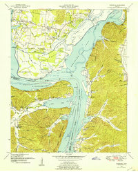 1949 Hustburg1953 Print · USGSHumphreys and Benton Counties are shown here during the transformative years following the filling of Kentucky Lake. Genealogists and local historians can locate dozens of family cemeteries and rural school sites like Tribble Sch and Byrd Sch.4 unique versions available
 - 1949 Map of Poplar Creek, 1953 Print
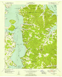 1949 Poplar Creek1953 Print · USGSBenton County river life and upland farming are documented here just after the war, as the reservoir system reshaped the shoreline. Researchers can locate dozens of family sites and landmarks, including Culpepper Cem, Antioch Boat Harbor, and the Louisville and Nashville rail stop at Faxon.3 unique versions available
 - 1949 Map of Sugar Tree, 1953 Print
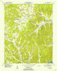 1949 Sugar Tree1953 Print · USGSBenton and Decatur Counties are captured in the late 1940s, showing a landscape of deep hollows and high ridges along the Tennessee River. Genealogists can trace family names at Manley Chapel Cemetery and locate vanished local landmarks like Spences Store or Mellwain.2 unique versions available
 - 1950 Map of Johnsonville, 1952 Print
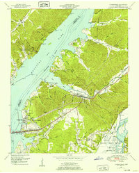 1950 Johnsonville1952 Print · USGSMid-century Tennessee geography is defined here by the creation of Kentucky Lake and the resulting relocation of river communities. Genealogists and historians can trace the transition from Old Johnsonville to New Johnsonville, alongside landmarks like Fairview Sch and Denver.4 unique versions available
 - 1950 Map of Rockport, 1953 Print
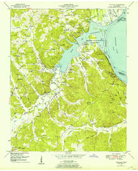 1950 Rockport1953 Print · USGSBenton and Humphreys counties are shown during the early years of the Kentucky Lake reservoir, where new shorelines met established rural communities. Researchers can locate family burial grounds like Hardin Cem or trace landmarks like Rockport Landing and Camp Mack Morris.4 unique versions available
 - 1950 Map of Big Sandy, 1953 Print
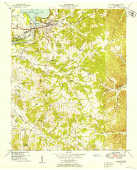 1950 Big Sandy1953 Print · USGSThe Tennessee riverfront near the Big Sandy settlement and the newly formed Kentucky Lake appears here in the early fifties. Genealogists and local historians can trace rural family life through landmarks like McRae Chapel, Morgan Claxton School, and Baker Chapel Cem.3 unique versions available
 - 1950 Map of Camden, 1953 Print
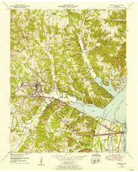 1950 Camden1953 Print · USGSMid-century Benton County shows the impact of the Tennessee Valley Authority's reservoir projects alongside the established hub of Camden. Genealogists can trace family names and rural life through landmarks like Toll Chapel School, Morris Chapel, and the Blanchard Cem.6 unique versions available
Showing maps 1-25 of 110
Top cities of Benton County
Frequently asked questions
- What are the different types of historical maps available for Benton County?
- What is the oldest map of Benton County?
- Where can I purchase historical maps of Benton County for my home or office?
- Where can I download high-res historical maps of Benton County?
- Are there historical topographic maps available for Benton County?
- Is there historical aerial imagery available for Benton County?
- Where are historical maps of Benton County sourced from?