1930s Maps of La Follette, Tennessee
Explore 5 historic maps of La Follette from the 1930s. These maps offer a rare glimpse into what life looked like during the 1930s — showing old roads, neighborhoods, homes, and landmarks that have changed or disappeared over time.
Whether you're researching your family's past, planning a metal detecting trip, or studying how La Follette's landscape evolved across the 1930s, these high-resolution maps are a powerful tool for exploring the history of this region.
- Focus on a specific era: All maps on this page are from the 1930s, giving you a focused view of this time period.
- See what’s changed: Compare century-old streets, trails, and buildings to today's modern landscape using overlays and satellite layers.
- Research with precision: Use these maps for genealogy, historical research, land use analysis, or educational projects.
- View, download, or print: Maps are fully viewable online in high resolution, and can be downloaded or printed for your own records.
Start exploring La Follette's history through authentic maps from the 1930s. This is your window into the past.
La Follette, TN maps
(5)- 1936 Map of Ivydell
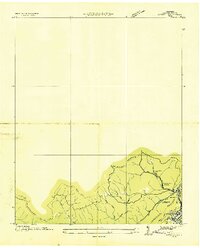 1936 Ivydell1936 Print · USGSCampbell County’s industrial landscape comes to life in the 1930s as mining operations and rail lines converge near the ridge. Researchers can trace the mechanical legacy of Indian Creek Mines and the specialized Incline and Tramway systems serving Ivydell.
 - 1936 Map of Jacksboro
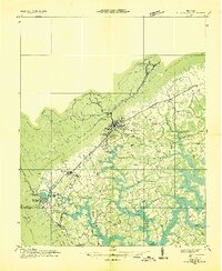
 1936 Jacksboro1936 Print · USGSCampbell County industry and agriculture meet during the mid-1930s as the Tennessee Valley Authority begins flooding the valley. Trace the legacy of mountain coal works like High Point Mine alongside rural landmarks such as Sharp Cem and Cumberland View Sch.
 - 1936 Map of La Follette
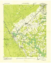
 1936 La Follette1936 Print · USGSThe Powell Valley is shown during the early years of the Tennessee Valley Authority as the new shoreline of Norris Reservoir begins to take shape. Researchers can locate family landmarks like Bakers Forge Memorial Cem and coal infrastructure at Indian Creek Mines.
 - 1936 Map of Demory
 1936 Demory1936 Print · USGSAs the Tennessee Valley Authority reshaped the region in the mid-1930s, this survey documented the new shoreline of Norris Reservoir. Genealogists can trace community landmarks like Bakers Forge Memorial Cem, Demory Ch, and Alder Springs Sch.
 - 1936 Map of La Follette
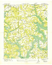
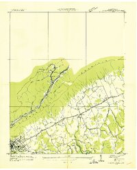 1936 La Follette1936 Print · USGSCampbell County's industrial and agricultural landscape is captured here during the mid-1930s, just as the Tennessee Valley Authority began shaping the region. Genealogists can locate family sites like Goins Cem, Glade Springs Ch, and old rural classrooms at Peabody Sch.
End of results
Showing maps 1-5 of 5
Top cities near La Follette
- Clinton historical maps
- LaFollette historical maps
- Jacksboro historical maps
- Caryville historical maps
- Jellico historical maps
- Rocky Top historical maps
See more
Top neighborhoods of La Follette
Frequently asked questions
- What are the different types of historical maps available for La Follette?
- What is the oldest map of La Follette?
- Where can I purchase historical maps of La Follette for my home or office?
- Where can I download high-res historical maps of La Follette?
- Are there historical topographic maps available for La Follette?
- Is there historical aerial imagery available for La Follette?
- Where are historical maps of La Follette sourced from?