Old Maps of Spanish Grove, Tennessee for Academic Research
Study the evolution of Spanish Grove with 10 high-resolution historic maps. Whether you're teaching, researching, or modeling changes in land use, these maps provide essential visual documentation of urban, environmental, and geographic change.
- Analyze long-term change: Track patterns in development, transportation, and natural features.
- Ideal for environmental or urban studies: Support academic projects with primary historical map data.
- Use in the classroom or lab: Educators and researchers rely on these maps to bring historical context to life.
These maps are a powerful tool for teaching, research, and visualizing how Spanish Grove has changed over the decades.
Spanish Grove, TN maps
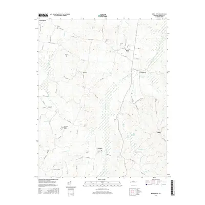
(10)- 1936 Map of Buena Vista
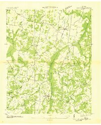 1936 Buena Vista1936 Print · USGSCarroll County communities thrived along the St Louis and Chattanooga Nashville Railroad in the mid-1930s. Researchers can locate numerous family burial sites and rural institutions like Spellings Cem, Mc Callie Cem, and Smyrna Sch.2 unique versions available
 - 1950 Map of Buena Vista, 1953 Print
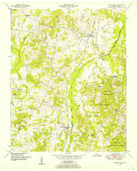 1950 Buena Vista1953 Print · USGSCarroll County was a landscape of small rail-stops and country parishes during the early fifties. Researchers can trace family ties through numerous rural landmarks like Williams Chapel, the Westport Sch, and Smyrna along the Nashville Chattanooga and St Louis line.3 unique versions available
 - 1956 Map of Blytheville, 1964 Print
 1956 Blytheville1964 Print · USGSWest Tennessee and the Arkansas Delta come alive in this mid-century survey of the river-and-rail corridor connecting Memphis to Jackson. Genealogists and historians can trace the rail lines of the Louisville and Nashville RR and locate landmarks like Western State Hospital or Fort Pillow State Prison Farm.2 unique versions available
 - 1959 Map of Blytheville
 1959 Blytheville1959 Print · USGSWest Tennessee and Northeast Arkansas meet along the river in the late fifties, during a period of steady industrial and agricultural growth. Genealogists can trace the rail corridors of the Illinois Central through Jackson or explore landmarks like Shiloh National Military Park and Fort Pillow State Prison.
 - 1986 Map of Milan
 1986 Milan1986 Print · USGSWest Tennessee in the mid-eighties shows a landscape defined by industrial military sites and expansive state forests. Trace the rail lines of the Seaboard System RR, locate the Milan Arsenal, or explore the protected lands of Natchez Trace State Forest.2 unique versions available
 - 2010 Map of Buena Vista, 2010 Print
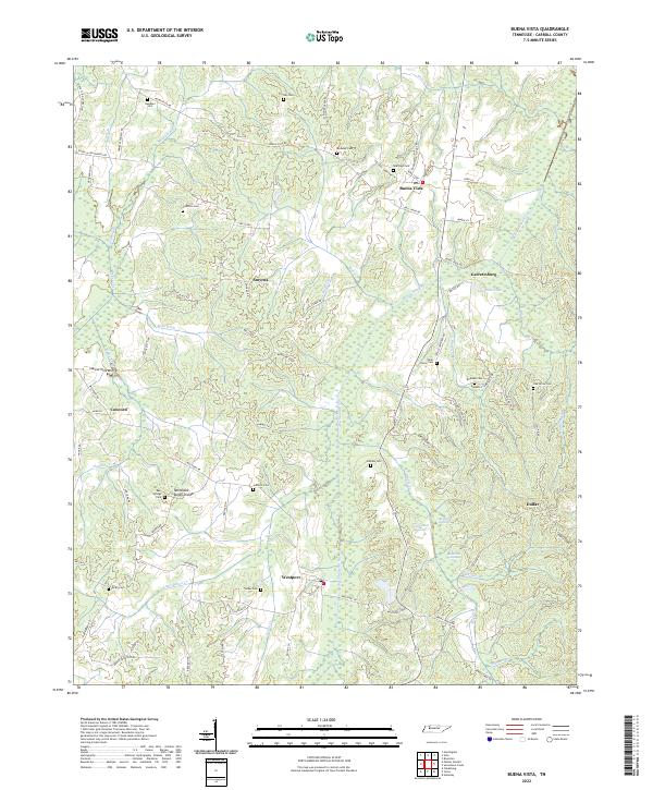
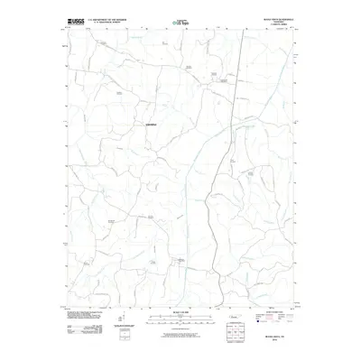 2010 Buena Vista2010 Print · USGSCovers Spanish Grove, including Huntingdon, Cross Roads, and other nearby areas
 - 2013 Map of Buena Vista, 2013 Print
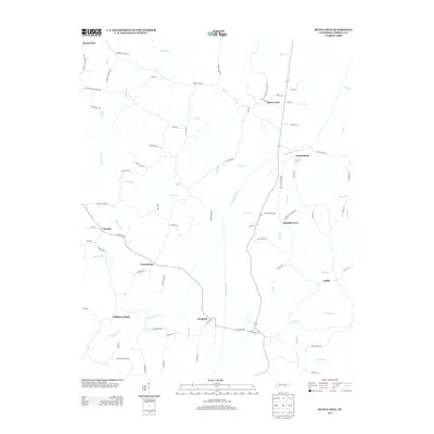 2013 Buena Vista2013 Print · USGSCovers Spanish Grove, including Huntingdon, Cross Roads, and other nearby areas
 - 2016 Map of Buena Vista, 2016 Print
 2016 Buena Vista2016 Print · USGSCovers Spanish Grove, including Huntingdon, Cross Roads, and other nearby areas
 - 2019 Map of Buena Vista, 2019 Print
 2019 Buena Vista2019 Print · USGSCovers Spanish Grove, including Huntingdon, Cross Roads, and other nearby areas
 - 2022 Map of Buena Vista, 2022 Print
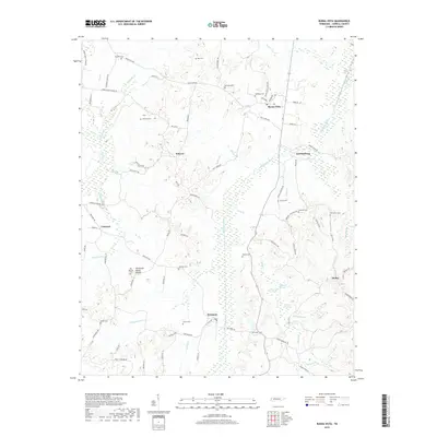
 2022 Buena Vista2022 Print · USGSCarroll County in the early twenty-first century remains a landscape of small river-valley settlements and rural cemeteries. Genealogists can trace family names at Ozier Taylor Cem and Cawthon Cem, or explore the old road networks around Westport and Smyrna.
End of results
Showing maps 1-10 of 10
Top cities near Spanish Grove
- Lexington historical maps
- McKenzie historical maps
- Huntingdon historical maps
- Camden historical maps
- Bruceton historical maps
- Hollow Rock historical maps
See more
Frequently asked questions
- What are the different types of historical maps available for Spanish Grove?
- What is the oldest map of Spanish Grove?
- Where can I purchase historical maps of Spanish Grove for my home or office?
- Where can I download high-res historical maps of Spanish Grove?
- Are there historical topographic maps available for Spanish Grove?
- Is there historical aerial imagery available for Spanish Grove?
- Where are historical maps of Spanish Grove sourced from?