
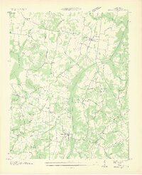
1936 Map of Buena Vista
USGS Topo · Published 1936About this map
Buena Vista and the rail-oriented hamlet of Westport anchor this mid-1930s survey of Carroll County, where the St Louis and Chattanooga Nashville Railroad cuts a straight line through the agricultural heartland. The landscape is defined by the Tennessee Divide, a prominent ridge line separating the local drainage basins including Big Sandy River and its numerous tributaries like Beaver Creek and Maple Creek.
Find a feature on this map
51 named features on this map. Tap any name to fly to it.
Don’t see what you’re looking for? This feature index may not catch every label — zoom into the map to look around manually.
Map Details
Editions of this 1936 Buena Vista Map
2 editions found
Other maps of this area

1936 · Clarksburg
USGS Topo · 1:24,000

1936 · Yuma
USGS Topo · 1:24,000

1936 · Seventeen Creek
USGS Topo · 1:24,000

1936 · Vale
USGS Topo · 1:24,000

1936 · Center Ridge
USGS Topo · 1:24,000

1936 · Bruceton
USGS Topo · 1:24,000

1936 · Cavvia
USGS Topo · 1:24,000

1950 · Yuma
USGS Topo · 1:24,000

1950 · Palmer Shelter
USGS Topo · 1:24,000
1950 · Bruceton
USGS Topo · 1:24,000