Old Maps of Elizabethton, Tennessee for Metal Detecting
Plan your next treasure hunt with 36 historic maps of Elizabethton. Find old homesites, ghost towns, trails, and gathering spots that may be lost to time — perfect for identifying promising metal detecting locations.
- Locate forgotten sites: Uncover places like long-lost settlements, abandoned rail lines, or gathering spots.
- Plan better hunts: Use map overlays combined with LiDAR or satellite views to narrow in on historically rich areas.
- Made for detectorists: Thousands of hobbyists use these maps to discover relics, coins, and hidden history.
Use these historic maps to boost your research and find new opportunities beneath the surface of Elizabethton.
Elizabethton, TN maps
(36)- 1891 Map of Roan Mountain
 1891 Roan Mountain1891 Print · USGSThe Tennessee-North Carolina border country comes alive in the 1890s, when narrow-gauge railroads and mountain ferries still moved the region's goods. Genealogists and historians can trace early crossings like Shipley's Ferry, industrial sites at Embreeville, and high-country settlements like Cloudland.
 - 1894 Map of Roan Mountain
 1894 Roan Mountain1894 Print · USGSNortheast Tennessee and Western North Carolina are mapped here in the late nineteenth century as the rail network expands through the Unaka Range. Trace early industrial footprints and family lands near Elizabethton, Terry Furnace, and the high summit at Cloudland.3 unique versions available
 - 1904 Map of Roan Mountain
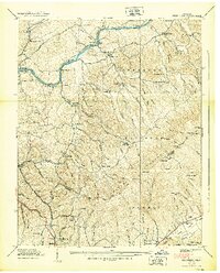
 1904 Roan Mountain1904 Print · USGSUpper East Tennessee and Western North Carolina are documented here at a time when river fords and narrow-gauge railroads still connected mountain hollows. Trace the paths to Hodge Ore Bank, find old Poplar Ridge Church, or locate river crossings like Yoakley Ferry.4 unique versions available
 - 1935 Map of Watauga Valley
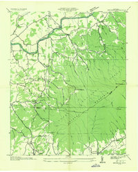
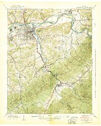
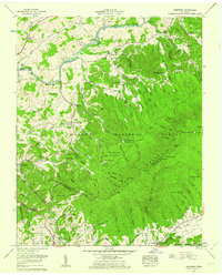
 1935 Watauga Valley1935 Print · USGSUpper East Tennessee's river valleys and mountain ridges are documented here during the mid-thirties, centered on the growing industrial hub of Elizabethton. Researchers can locate numerous vanished landmarks, from the Manganese Mine to rural schoolhouses like Caldwell Springs Sch.
 - 1935 Map of Elizabethton
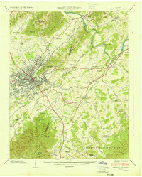
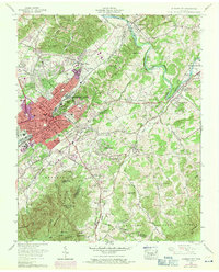
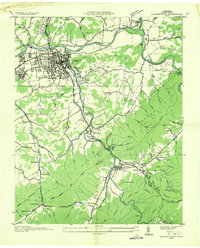 1935 Elizabethton1935 Print · USGSElizabethton and the surrounding mountain coves come into sharp focus in the mid-1930s as industrial growth meets traditional Appalachian life. Genealogists can locate family landmarks like Dungan Mill, the County Home, and numerous rural churches including Doe River Ch.
 - 1935 Map of Keenburg
 1935 Keenburg1935 Print · USGSSullivan and Carter counties come alive in the mid-1930s, showing a landscape where heavy industry and mountain trails meet. Genealogists and historians can trace family roots through sites like Harmony Chapel, Hickory Tree, and the Old Bauxite Mines.
 - 1935 Map of Johnson City
 1935 Johnson City1935 Print · USGSJohnson City and the Watauga River valley thrive as a railroad and collegiate center in the years before the second world war. Genealogists and researchers can trace family landmarks like Simmons Cem, old schoolhouses such as Range Sch, and the early St John Landing Field.
 - 1938 Map of Keenburg
 1938 Keenburg1938 Print · USGSSullivan and Carter Counties appear in the late thirties as a landscape of mountain hollows and riverside settlements. Genealogists and local historians can locate several rural schools and churches, including Keenburg Sch, Mt Holston Ch, and the riverside Island Park.2 unique versions available
 - 1938 Map of Elizabethton
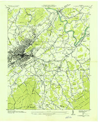
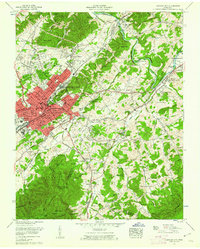
 1938 Elizabethton1938 Print · USGSElizabethton and the surrounding Carter County highlands are captured here during a period of industrial expansion and mountain farming. Local historians can trace the rail lines of the ET&WNC and locate vanished landmarks like Dugan Mill, Bemberg, and Lyons Cem.2 unique versions available
 - 1940 Map of Johnson City
 1940 Johnson City1940 Print · USGSJohnson City and its surrounding valleys are captured here at the start of the 1940s, showing a vital rail junction and industrial center. Genealogists can locate family landmarks like Taylor Chapel Cem, Milligan College, and the National Soldiers Home.2 unique versions available
 - 1955 Map of Johnson City
 1955 Johnson City1955 Print · USGSJohnson City and the surrounding hills of Washington and Carter Counties are shown in meticulous detail during the late fifties. Genealogists and historians can trace family ties at Monte Vista Cem, locate the campus of Milligan College, or follow the industrial lines of the Clinchfield Railroad and E T & W N C RR.
 - 1955 Map of Johnson City
 1955 Johnson City1955 Print · USGSEast Tennessee and the bordering highlands of Virginia and Kentucky appear here during the post-war industrial boom. You can trace the complex network of mountain ridges and new TVA lakes, from Johnson City to the coalfields near Middlesboro and Lynch.
 - 1957 Map of Johnson City, 1966 Print
 1957 Johnson City1966 Print · USGSUpper East Tennessee and Southwest Virginia are shown here during the mid-sixties transition of the Appalachians. Researchers can trace the industrial rail hubs of Kingsport, the sprawling waters of Cherokee Lake, and the historic Cumberland Gap.
 - 1959 Map of Elizabethton, 1962 Print
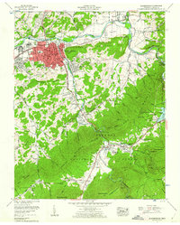 1959 Elizabethton1962 Print · USGSElizabethton and the surrounding Carter County highlands are shown in detail during the late fifties, as the ET&WNC Railroad still served the valley. Genealogists can locate dozens of family burial sites including Hazelwood Cem and Bowers Cem or trace the early path of the Appalachian Trail.4 unique versions available
 - 1959 Map of Johnson City, 1971 Print
 1959 Johnson City1971 Print · USGSJohnson City and Elizabethton appear here in the mid-century as urban growth begins to climb the surrounding ridges. Genealogists and local historians can trace the foundations of the area at Milligan College, the Sycamore Shoals Monument, and Oak Hill Cem.4 unique versions available
 - 1960 Map of Johnson City
 1960 Johnson City1960 Print · USGSUpper East Tennessee and the surrounding tri-state area are shown in the mid-fifties during the height of the TVA reservoir era. Trace the industrial rail lines of the Southern and Louisville and Nashville between Kingsport and Johnson City.
 - 1960 Map of Keenburg, 1962 Print
 1960 Keenburg1962 Print · USGSThe Tennessee Valley during the early sixties shows a landscape of river-fed settlements and rising ridges. Genealogists and historians can trace numerous family cemeteries such as Crockett Cem, the Tri-City Speedway, and Keenburg Church.3 unique versions available
 - 1963 Map of Johnson City
 1963 Johnson City1963 Print · USGSThe Tri-Cities and the surrounding Appalachian ridges are shown in detail during the early sixties, highlighting the era's vital rail and river networks. Genealogists and historians can trace the routes of the Clinchfield RR and locate settlements from Rogersville to Elizabethton.
 - 1980 Map of Johnson City, 1981 Print
 1980 Johnson City1981 Print · USGSEast Tennessee in the early eighties shows a landscape of mountain ridges and growing valley towns. Trace local history through Washington College and the Andrew Johnson National Cemetery, or find sites like David Crockett Birthplace State Park.
 - 2003 Map of Keenburg, 2004 Print
 2003 Keenburg2004 Print · USGSSullivan and Carter Counties at the turn of the 21st century reveal a landscape of mountain ridges and riverside communities. Genealogists can trace family roots through numerous sites like Crockett Cem, Chinquapin Grove Cem, and Mellon Memorial Ch.
 - 2003 Map of Johnson City, 2004 Print
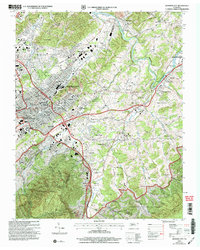 2003 Johnson City2004 Print · USGSJohnson City and Elizabethton appear here as they transitioned into the early twenty-first century, showing the established neighborhoods and mountain fringes. Genealogists can trace family sites at Monte Vista Cem and Oak Hill Cem, or locate the historic Milligan College and Mountain Home (PO).
 - 2011 Map of Keenburg, 2011 Print
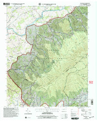
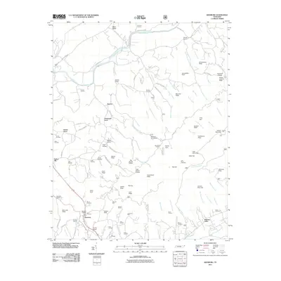 2011 Keenburg2011 Print · USGSCovers Elizabethton, including Silver Grove, Hickory Tree, and other nearby areas
 - 2011 Map of Johnson City, 2011 Print
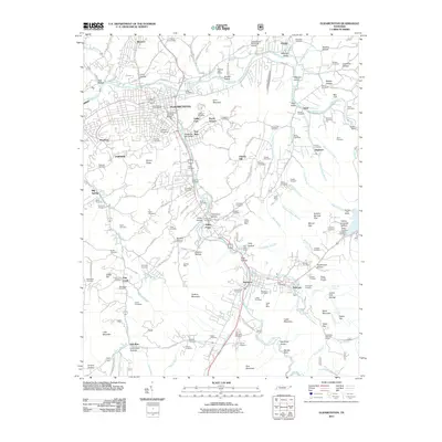
 2011 Johnson City2011 Print · USGSCovers Elizabethton, including Johnson City, Unicoi, and other nearby areas
 - 2011 Map of Elizabethton, 2011 Print
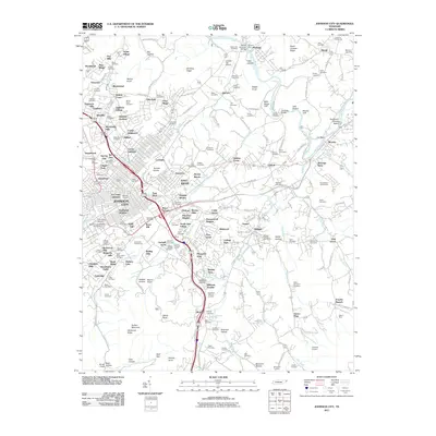
 2011 Elizabethton2011 Print · USGSCovers Elizabethton, including Bemberg, Gap Creek, and other nearby areas
 - 2013 Map of Johnson City, 2013 Print
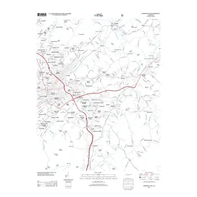 2013 Johnson City2013 Print · USGSCovers Elizabethton, including Johnson City, Unicoi, and other nearby areas
Showing maps 1-25 of 36
Top cities near Elizabethton
- Johnson City historical maps
- Kingsport historical maps
- Bristol historical maps
- Bloomingdale historical maps
- Erwin historical maps
- Jonesborough historical maps
See more
Top neighborhoods of Elizabethton
- Bemberg historical maps
- Valley Park historical maps
- Rayon Terrace historical maps
- Milligan historical maps
- Pine Crest historical maps
- Watauga Point historical maps
See more
Frequently asked questions
- What are the different types of historical maps available for Elizabethton?
- What is the oldest map of Elizabethton?
- Where can I purchase historical maps of Elizabethton for my home or office?
- Where can I download high-res historical maps of Elizabethton?
- Are there historical topographic maps available for Elizabethton?
- Is there historical aerial imagery available for Elizabethton?
- Where are historical maps of Elizabethton sourced from?