1940s Maps of New Tazewell, Tennessee
Explore 2 historic maps of New Tazewell from the 1940s. These maps offer a rare glimpse into what life looked like during the 1940s — showing old roads, neighborhoods, homes, and landmarks that have changed or disappeared over time.
Whether you're researching your family's past, planning a metal detecting trip, or studying how New Tazewell's landscape evolved across the 1940s, these high-resolution maps are a powerful tool for exploring the history of this region.
- Focus on a specific era: All maps on this page are from the 1940s, giving you a focused view of this time period.
- See what’s changed: Compare century-old streets, trails, and buildings to today's modern landscape using overlays and satellite layers.
- Research with precision: Use these maps for genealogy, historical research, land use analysis, or educational projects.
- View, download, or print: Maps are fully viewable online in high resolution, and can be downloaded or printed for your own records.
Start exploring New Tazewell's history through authentic maps from the 1940s. This is your window into the past.
New Tazewell, TN maps
(2)- 1942 Map of Clouds
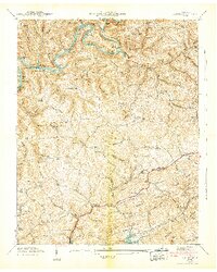 1942 Clouds1942 Print · USGSClaiborne and Union counties are shown in the early 1940s as the Norris Reservoir and Powell River shape the landscape. Researchers can trace family sites like Meyers Mill, Moody Chapel, and several local schools like Lily Grove Sch.3 unique versions available
 - 1943 Map of Tazewell, 1946 Print
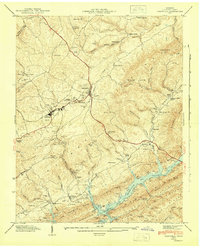 1943 Tazewell1946 Print · USGSTazewell and the surrounding Claiborne County hills are shown during the mid-forties as the newly formed Norris Reservoir reached into the valley. Researchers can trace family sites like Hoge Cem, rural landmarks such as Williams Mill, and local schools including the Rosenwald Sch.3 unique versions available
End of results
Showing maps 1-2 of 2
Top cities near New Tazewell
- Morristown historical maps
- Middlesboro historical maps
- Harrogate historical maps
- Maynardville historical maps
- Tazewell historical maps
- Rutledge historical maps
See more
Top neighborhoods of New Tazewell
Frequently asked questions
- What are the different types of historical maps available for New Tazewell?
- What is the oldest map of New Tazewell?
- Where can I purchase historical maps of New Tazewell for my home or office?
- Where can I download high-res historical maps of New Tazewell?
- Are there historical topographic maps available for New Tazewell?
- Is there historical aerial imagery available for New Tazewell?
- Where are historical maps of New Tazewell sourced from?