2000s (21st Century) Maps of Padgett Mill, Tennessee
Explore 6 historic maps of Padgett Mill from the 2000s (21st Century). These maps offer a rare glimpse into what life looked like during the 2000s — showing old roads, neighborhoods, homes, and landmarks that have changed or disappeared over time.
Whether you're researching your family's past, planning a metal detecting trip, or studying how Padgett Mill's landscape evolved across the 2000s, these high-resolution maps are a powerful tool for exploring the history of this region.
- Focus on a specific era: All maps on this page are from the 2000s, giving you a focused view of this time period.
- See what’s changed: Compare century-old streets, trails, and buildings to today's modern landscape using overlays and satellite layers.
- Research with precision: Use these maps for genealogy, historical research, land use analysis, or educational projects.
- View, download, or print: Maps are fully viewable online in high resolution, and can be downloaded or printed for your own records.
Start exploring Padgett Mill's history through authentic maps from the 2000s. This is your window into the past.
Padgett Mill, TN maps
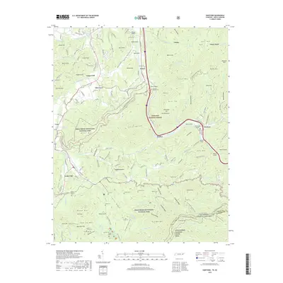
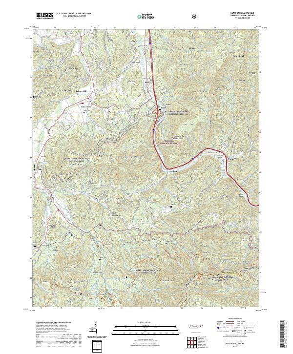
(6)- 2003 Map of Hartford, 2004 Print
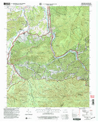 2003 Hartford2004 Print · USGSThe Tennessee and North Carolina borderlands come to life in this survey of the Pigeon River corridor as it appeared after the turn of the millennium. Researchers can trace family roots at Ogle Chapel, find historic mill sites like Jenkins Mill, and locate long-standing landmarks such as Catons Grove.
 - 2011 Map of Hartford, 2011 Print
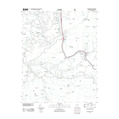 2011 Hartford2011 Print · USGSCovers Padgett Mill, including Catons Grove, Allen Grove, and other nearby areas
 - 2013 Map of Hartford, 2013 Print
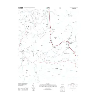 2013 Hartford2013 Print · USGSCovers Padgett Mill, including Catons Grove, Allen Grove, and other nearby areas
 - 2016 Map of Hartford, 2016 Print
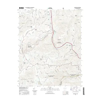 2016 Hartford2016 Print · USGSCovers Padgett Mill, including Catons Grove, Allen Grove, and other nearby areas
 - 2019 Map of Hartford, 2019 Print
 2019 Hartford2019 Print · USGSCovers Padgett Mill, including Catons Grove, Allen Grove, and other nearby areas
 - 2022 Map of Hartford, 2022 Print
 2022 Hartford2022 Print · USGSUpper Cocke County and the North Carolina state line are shown here as the twenty-first century began, dominated by the protected wilderness of the Smokies. Genealogists can trace family heritage through isolated sites like Shultz Cem and McMillan Cem along the Pigeon River.
End of results
Showing maps 1-6 of 6
Top cities near Padgett Mill
- Jefferson City historical maps
- Newport historical maps
- Gatlinburg historical maps
- Dandridge historical maps
- Pittman Center historical maps
- Baneberry historical maps
See more
Frequently asked questions
- What are the different types of historical maps available for Padgett Mill?
- What is the oldest map of Padgett Mill?
- Where can I purchase historical maps of Padgett Mill for my home or office?
- Where can I download high-res historical maps of Padgett Mill?
- Are there historical topographic maps available for Padgett Mill?
- Is there historical aerial imagery available for Padgett Mill?
- Where are historical maps of Padgett Mill sourced from?