1940s Maps of Manchester, Tennessee
Explore 3 historic maps of Manchester from the 1940s. These maps offer a rare glimpse into what life looked like during the 1940s — showing old roads, neighborhoods, homes, and landmarks that have changed or disappeared over time.
Whether you're researching your family's past, planning a metal detecting trip, or studying how Manchester's landscape evolved across the 1940s, these high-resolution maps are a powerful tool for exploring the history of this region.
- Focus on a specific era: All maps on this page are from the 1940s, giving you a focused view of this time period.
- See what’s changed: Compare century-old streets, trails, and buildings to today's modern landscape using overlays and satellite layers.
- Research with precision: Use these maps for genealogy, historical research, land use analysis, or educational projects.
- View, download, or print: Maps are fully viewable online in high resolution, and can be downloaded or printed for your own records.
Start exploring Manchester's history through authentic maps from the 1940s. This is your window into the past.
Manchester, TN maps
(3)- 1941 Map of Ovoca, 1943 Print
 1941 Ovoca1943 Print · USGSCoffee County in the early 1940s reflects a rural landscape undergoing rapid change as the military expanded its footprint. Genealogists can locate family-named crossings like Richardson Ford and local landmarks such as the Ovoca Orphans Home or Hickerson Station.2 unique versions available
 - 1941 Map of Manchester, 1943 Print
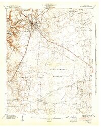 1941 Manchester1943 Print · USGSCoffee County is captured during a period of massive change as the military arrives in the early 1940s. Genealogists and historians can trace the rural landscape before the base expansion, locating family landmarks like Hickerson Cem, Old Stone Fort, and Seminary Hill Sch.3 unique versions available
 - 1943 Map of Mc Minnville, 1944 Print
 1943 Mc Minnville1944 Print · USGSMid-Tennessee is captured here during the mobilization of the early 1940s, showing the vast Camp Forrest Military Reservation and thriving rail towns. Trace the N C & ST L line through Mcminnville or locate smaller rural hubs like Morrison and Hickerson Station.
End of results
Showing maps 1-3 of 3
Top cities near Manchester
- Tullahoma historical maps
- Winchester historical maps
- Estill Springs historical maps
- Decherd historical maps
- Monteagle historical maps
- Morrison historical maps
See more
Top neighborhoods of Manchester
- Black Jack historical maps
- Glenview historical maps
- Melrose Park historical maps
- Royal Oaks historical maps
- Shady Acres historical maps
- West Meade historical maps
See more
Frequently asked questions
- What are the different types of historical maps available for Manchester?
- What is the oldest map of Manchester?
- Where can I purchase historical maps of Manchester for my home or office?
- Where can I download high-res historical maps of Manchester?
- Are there historical topographic maps available for Manchester?
- Is there historical aerial imagery available for Manchester?
- Where are historical maps of Manchester sourced from?