1930s Maps of Lake Tansi, Tennessee
Explore 2 historic maps of Lake Tansi from the 1930s. These maps offer a rare glimpse into what life looked like during the 1930s — showing old roads, neighborhoods, homes, and landmarks that have changed or disappeared over time.
Whether you're researching your family's past, planning a metal detecting trip, or studying how Lake Tansi's landscape evolved across the 1930s, these high-resolution maps are a powerful tool for exploring the history of this region.
- Focus on a specific era: All maps on this page are from the 1930s, giving you a focused view of this time period.
- See what’s changed: Compare century-old streets, trails, and buildings to today's modern landscape using overlays and satellite layers.
- Research with precision: Use these maps for genealogy, historical research, land use analysis, or educational projects.
- View, download, or print: Maps are fully viewable online in high resolution, and can be downloaded or printed for your own records.
Start exploring Lake Tansi's history through authentic maps from the 1930s. This is your window into the past.
Lake Tansi, TN maps
(2)- 1935 Map of Vandever
 1935 Vandever1935 Print · USGSCumberland County saw significant changes in the 1930s as federal projects and new highways reshaped the plateau. Local historians can trace the early layout of Cumberland Homesteads and find landmarks like Hale Chapel and New Era Sch.
 - 1936 Map of Crossville
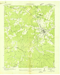 1936 Crossville1936 Print · USGSCumberland County during the mid-1930s reveals a landscape defined by New Deal initiatives and traditional crossroads life. Trace the planned layout of Cumberland Homesteads or locate family sites near Baker Crossroads and Roberts Chapel.
End of results
Showing maps 1-2 of 2
Top cities near Lake Tansi
- Crossville historical maps
- Fairfield Glade historical maps
- Spring City historical maps
- Crab Orchard historical maps
- Pleasant Hill historical maps
Top neighborhoods of Lake Tansi
- Oneida Subdivision historical maps
- Seminole Subdivision historical maps
- Winnebago Subdivision historical maps
- Comanche Subdivision historical maps
- Hiawatha Subdivision historical maps
- Kiowa Subdivision historical maps
See more
Frequently asked questions
- What are the different types of historical maps available for Lake Tansi?
- What is the oldest map of Lake Tansi?
- Where can I purchase historical maps of Lake Tansi for my home or office?
- Where can I download high-res historical maps of Lake Tansi?
- Are there historical topographic maps available for Lake Tansi?
- Is there historical aerial imagery available for Lake Tansi?
- Where are historical maps of Lake Tansi sourced from?