Old Maps of Lake Tansi, Tennessee for Academic Research
Study the evolution of Lake Tansi with 25 high-resolution historic maps. Whether you're teaching, researching, or modeling changes in land use, these maps provide essential visual documentation of urban, environmental, and geographic change.
- Analyze long-term change: Track patterns in development, transportation, and natural features.
- Ideal for environmental or urban studies: Support academic projects with primary historical map data.
- Use in the classroom or lab: Educators and researchers rely on these maps to bring historical context to life.
These maps are a powerful tool for teaching, research, and visualizing how Lake Tansi has changed over the decades.
Lake Tansi, TN maps
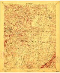
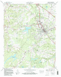
(25)- 1892 Map of Pikeville
 1892 Pikeville1892 Print · USGSThe Cumberland Plateau in the 1890s shows a rugged landscape of early river ferries and mountain gaps. Genealogists and historians can trace the paths between Sparta and Crossville, locating landmarks like Hodge Ferry and the Rock House tavern.
 - 1895 Map of Pikeville
 1895 Pikeville1895 Print · USGSThe Cumberland Plateau was a landscape of mountain settlements and critical gaps in the 1890s. Genealogists can trace family roots through upland communities like Pomona and Lantana, or locate old landmarks like Hale Chapel and Hodge Ferry along the river.7 unique versions available
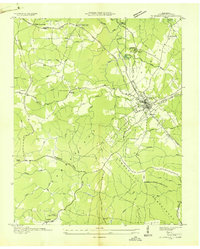
 - 1912 Map of Crossville
 1912 Crossville1912 Print · USGSCumberland County at the start of the twentieth century was a landscape of plateau settlements and developing rail lines. Genealogists and historians can trace early community hubs like Crossville, rural school sites such as Flynn School, and creek-side features like Hinch Mill.2 unique versions available
 - 1935 Map of Vandever
 1935 Vandever1935 Print · USGSCumberland County saw significant changes in the 1930s as federal projects and new highways reshaped the plateau. Local historians can trace the early layout of Cumberland Homesteads and find landmarks like Hale Chapel and New Era Sch.
 - 1936 Map of Crossville
 1936 Crossville1936 Print · USGSCumberland County during the mid-1930s reveals a landscape defined by New Deal initiatives and traditional crossroads life. Trace the planned layout of Cumberland Homesteads or locate family sites near Baker Crossroads and Roberts Chapel.
 - 1953 Map of Chattanooga
 1953 Chattanooga1953 Print · USGSSoutheast Tennessee in the early fifties shows a landscape reshaped by river management and rail power. Trace the rail lines of the Southern Ry through riverside towns or locate the preserved grounds of the Chickamauga and Chattanooga National Military Park.
 - 1956 Map of Vandever, 1958 Print
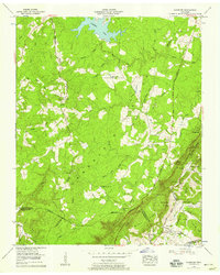 1956 Vandever1958 Print · USGSThe Tennessee mountains at the mid-fifties show a landscape of high plateaus and deep river heads as the William Howard Taft Highway was being built. Genealogists can trace family lines through Musick Cem, New Era Cem, and Parham Chapel.3 unique versions available
 - 1956 Map of Crossville, 1958 Print
 1956 Crossville1958 Print · USGSCumberland County centers on the plateau crossroads in the mid-1950s as the regional highway network begins to expand. Researchers can trace the Tennessee Central Ry corridor, locate old family burial sites like Swan Cem, and explore the early layout of Cumberland Mountain State Park.3 unique versions available
 - 1957 Map of Chattanooga, 1966 Print
 1957 Chattanooga1966 Print · USGSEast Tennessee in the mid-1960s shows a landscape of massive hydroelectric reservoirs and emerging industrial sites like the Atomic Energy Commission (Oak Ridge Area). Trace the rail networks of the Southern Ry through Chattanooga or locate family-named ridges across the Cumberland Plateau.3 unique versions available
 - 1959 Map of Chattanooga
 1959 Chattanooga1959 Print · USGSSoutheast Tennessee is shown here during a decade of industrial growth and hydroelectric development. Trace the regional rail networks of the Southern Ry and find landmark sites like Lookout Mountain, Fall Creek Falls State Park, and Chattanooga.
 - 1960 Map of Chattanooga
 1960 Chattanooga1960 Print · USGSSoutheast Tennessee and the southern Appalachians are shown here at the height of the river-management era. You can trace the valley rail lines and locate Lookout Mountain and the expansive waters of Chickamauga Reservoir.
 - 1964 Map of Chattanooga
 1964 Chattanooga1964 Print · USGSSoutheast Tennessee and the western Carolinas appear in the mid-sixties as a powerhouse of river-driven industry and mountain wilderness. Genealogists and historians can trace rail-town lineages along the Southern Ry or locate family landmarks near Watts Bar Lake and Tellico Plains.
 - 1981 Map of Mc Minnville
 1981 Mc Minnville1981 Print · USGSThe Cumberland Plateau and the Sequatchie Valley meet in this early 1980s look at Warren and White Counties. Researchers can locate vanished rural landmarks like Hutchins College, the old rail stops of the Tennessee Central, and Mount Zion Cem.
 - 1982 Map of Crossville, 1983 Print
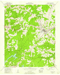
 1982 Crossville1983 Print · USGSCrossville and the surrounding Cumberland Plateau are shown during a period of significant growth in the early eighties. Researchers can trace family genealogy through numerous sites like Baisley Cem and Oaklawn Cem, or locate landmarks such as Cumberland Mountain State Park.2 unique versions available
 - 1983 Map of Vandever, 1989 Print
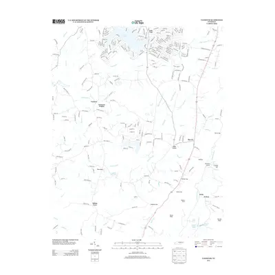
 1983 Vandever1989 Print · USGSCumberland County saw both suburban growth and preserved rural heritage in the 1980s. Genealogists and historians can trace family locations through Hale Chapel Cem, Musick Cem, and the historic Carding Machine Spring.
 - 2010 Map of Crossville, 2010 Print
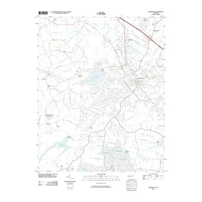 2010 Crossville2010 Print · USGSCovers Lake Tansi, including Crossville, Holiday Hills, and other nearby areas
 - 2010 Map of Vandever, 2010 Print
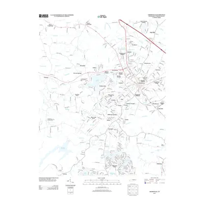
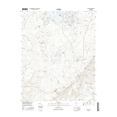
 2010 Vandever2010 Print · USGSCovers Lake Tansi, including Burke, Hilltop Acres, and other nearby areas
 - 2013 Map of Crossville, 2013 Print
 2013 Crossville2013 Print · USGSCovers Lake Tansi, including Crossville, Holiday Hills, and other nearby areas
 - 2013 Map of Vandever, 2013 Print
 2013 Vandever2013 Print · USGSCovers Lake Tansi, including Burke, Hilltop Acres, and other nearby areas
 - 2016 Map of Vandever, 2016 Print
 2016 Vandever2016 Print · USGSCovers Lake Tansi, including Burke, Hilltop Acres, and other nearby areas
 - 2016 Map of Crossville, 2016 Print
 2016 Crossville2016 Print · USGSCovers Lake Tansi, including Crossville, Holiday Hills, and other nearby areas
 - 2019 Map of Vandever, 2019 Print
 2019 Vandever2019 Print · USGSCovers Lake Tansi, including Burke, Hilltop Acres, and other nearby areas
 - 2019 Map of Crossville, 2019 Print
 2019 Crossville2019 Print · USGSCovers Lake Tansi, including Crossville, Holiday Hills, and other nearby areas
 - 2022 Map of Vandever, 2022 Print
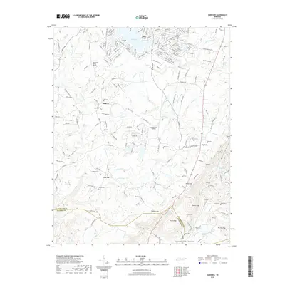
 2022 Vandever2022 Print · USGSThe high ridges of the Cumberland Plateau in the 2020s remain defined by family-named landmarks and the geologic Tennessee Valley Divide. Genealogists can trace deep roots through numerous burial sites like Musick Cem and New Era Cem or the rural settlements of Vandever and Big Lick.
 - 2023 Map of Crossville, 2023 Print
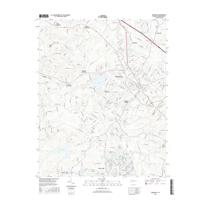
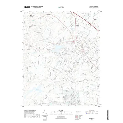
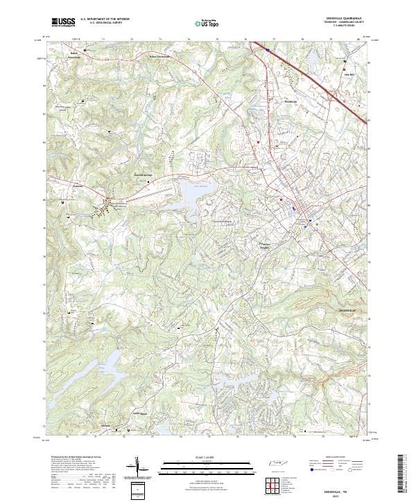 2023 Crossville2023 Print · USGSCumberland County’s high plateau country is documented here in recent years as the city of Crossville expands toward the Tennessee Valley Divide. Researchers can locate numerous family burial grounds like Lowery Stand Cem and Baisley Cem, or trace the waterfronts of Lake Tansi and Meadow Park Lake.
End of results
Showing maps 1-25 of 25
Top cities near Lake Tansi
- Crossville historical maps
- Fairfield Glade historical maps
- Spring City historical maps
- Crab Orchard historical maps
- Pleasant Hill historical maps
Top neighborhoods of Lake Tansi
- Oneida Subdivision historical maps
- Seminole Subdivision historical maps
- Winnebago Subdivision historical maps
- Comanche Subdivision historical maps
- Hiawatha Subdivision historical maps
- Kiowa Subdivision historical maps
See more
Frequently asked questions
- What are the different types of historical maps available for Lake Tansi?
- What is the oldest map of Lake Tansi?
- Where can I purchase historical maps of Lake Tansi for my home or office?
- Where can I download high-res historical maps of Lake Tansi?
- Are there historical topographic maps available for Lake Tansi?
- Is there historical aerial imagery available for Lake Tansi?
- Where are historical maps of Lake Tansi sourced from?