2020s Maps of DeKalb County, Tennessee
Explore 12 historic maps of DeKalb County from the 2020s. These maps offer a rare glimpse into what life looked like during the 2020s — showing old roads, neighborhoods, homes, and landmarks that have changed or disappeared over time.
Whether you're researching your family's past, planning a metal detecting trip, or studying how DeKalb County's landscape evolved across the 2020s, these high-resolution maps are a powerful tool for exploring the history of this region.
- Focus on a specific era: All maps on this page are from the 2020s, giving you a focused view of this time period.
- See what’s changed: Compare century-old streets, trails, and buildings to today's modern landscape using overlays and satellite layers.
- Research with precision: Use these maps for genealogy, historical research, land use analysis, or educational projects.
- View, download, or print: Maps are fully viewable online in high resolution, and can be downloaded or printed for your own records.
Start exploring DeKalb County's history through authentic maps from the 2020s. This is your window into the past.
DeKalb County, TN maps
(12)- 2022 Map of Short Mountain, 2022 Print
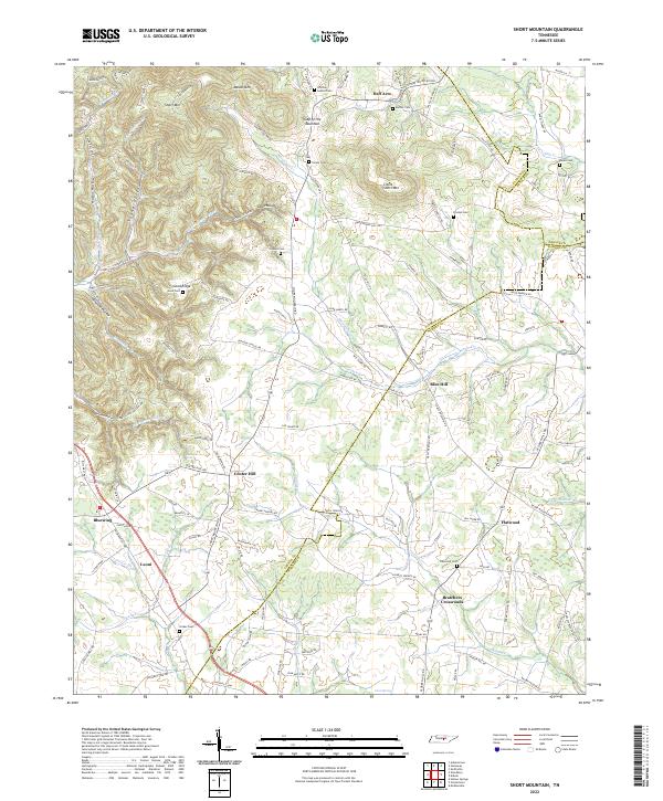 2022 Short Mountain2022 Print · USGSThe intersection of Cannon, DeKalb, and Warren counties is captured here in the twenty-first century, showcasing a landscape of high ridges and deep hollows. Genealogists can trace family heritage through sites like Bratchers Crossroads, Tucker Cemetery, and Center Hill.
 - 2022 Map of Alexandria, 2022 Print
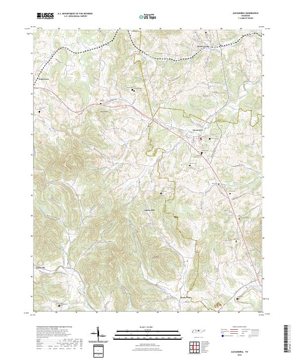 2022 Alexandria2022 Print · USGSMiddle Tennessee farming communities and crossroads appear here in the early twenty-first century as the landscape remains defined by its deep hollows and creek beds. Genealogists can trace family names through numerous burial sites like Grandstaff Cem, Hearn Hill Cem, and Vandatta Cem.
 - 2022 Map of Auburntown, 2022 Print
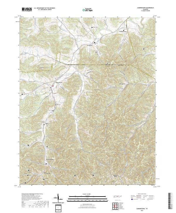 2022 Auburntown2022 Print · USGSCannon County’s deeply folded landscape is shown here in the 2020s, revealing a rural network of named hollows and historic family settlements. Genealogists can trace numerous burial sites like Milligan Alexander Cem and Odom Cem near Auburntown and Hardscrabble.
 - 2022 Map of Gassaway, 2022 Print
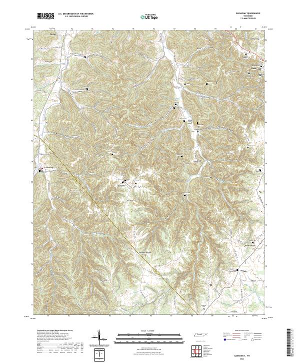 2022 Gassaway2022 Print · USGSDeKalb County’s rugged ridge-and-hollow country is documented here at the start of the 2020s. Researchers can trace family history through dozens of rural landmarks, including Gassaway School, Bluhmtown, and Snow Hill Baptist Church Cem.
 - 2022 Map of Campaign, 2022 Print
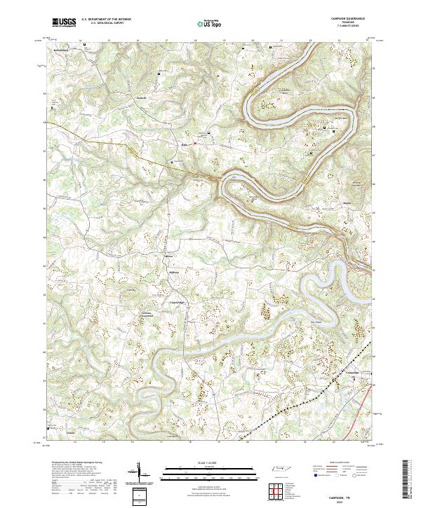 2022 Campaign2022 Print · USGSThe rural borderlands of DeKalb, Warren, and White counties are captured here in the early twenty-first century. Researchers can trace family history through numerous remote burial grounds like Javis Cantrell Cem and Salem Cem, or locate landmarks in Greens Crossroad and Campaign.
 - 2022 Map of Smithville, 2022 Print
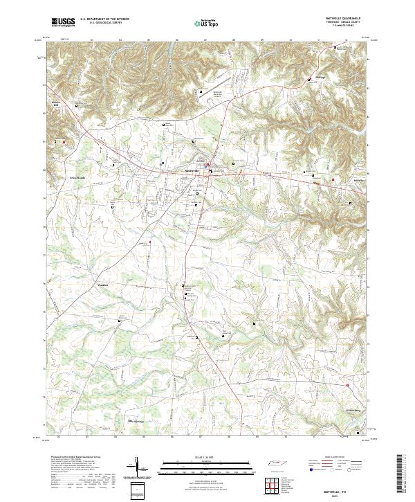 2022 Smithville2022 Print · USGSSmithville and the surrounding DeKalb County countryside are shown here in modern detail, from the courthouse square to the rural fringes. Genealogists can trace family names through dozens of burial sites like Jacobs Pillar Cem, Poor House Cem, and Old Bildad Cem.
 - 2022 Map of Sligo Bridge, 2022 Print
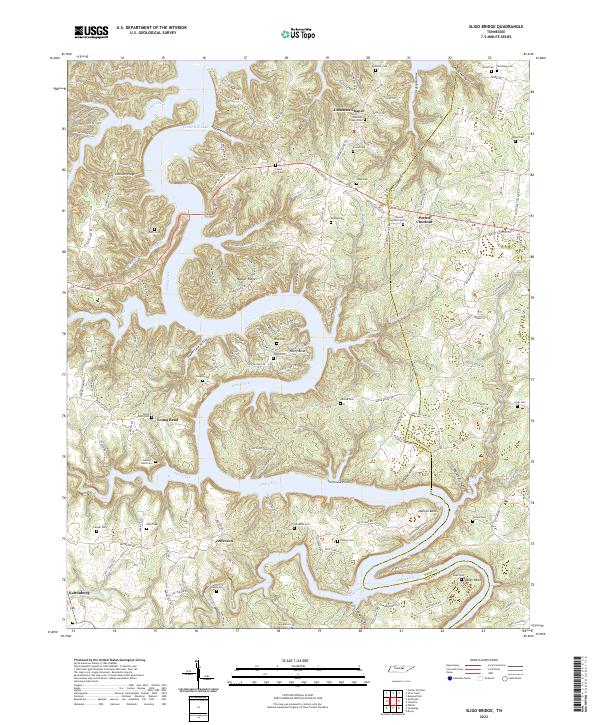 2022 Sligo Bridge2022 Print · USGSThe Caney Fork river valley in DeKalb County is shown here in the 2020s, highlighting the dramatic shoreline of Center Hill Lake. Family history researchers can locate numerous small burial grounds including George Estes Cem, Vaughn Cem, and Jones Cem.
 - 2022 Map of Liberty, 2022 Print
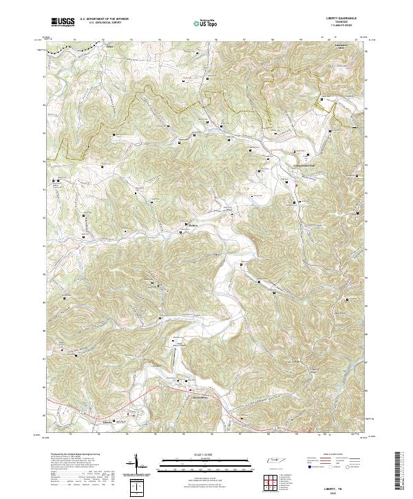 2022 Liberty2022 Print · USGSDeKalb County and the southern tip of Smith County are mapped here in the modern era as they follow the winding course of the Smith Fork Creek. Genealogists and historians can locate numerous family burial sites like Foutch Cem and Bates Cem, or trace early community centers in Liberty and Dowelltown.
 - 2022 Map of Dibrell, 2022 Print
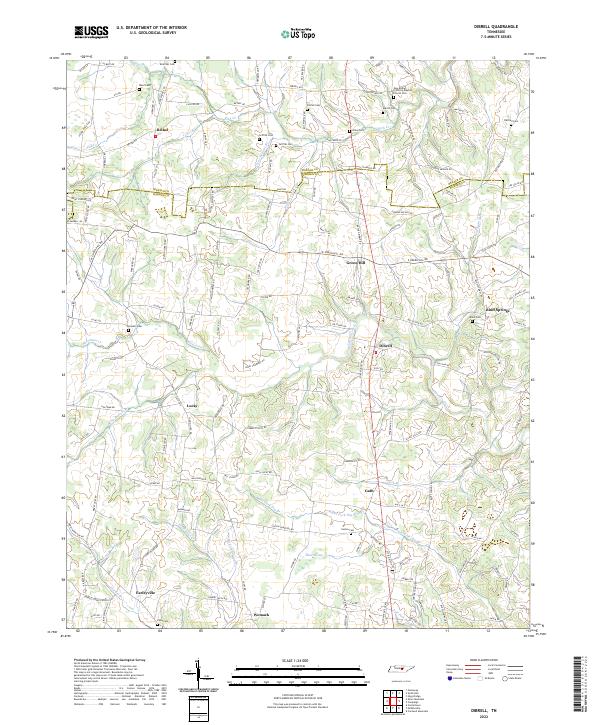 2022 Dibrell2022 Print · USGSTennessee's Highland Rim transitions into the rolling plateau of Warren and DeKalb counties in this modern-era study. Genealogists can trace family roots through historic burial sites like Griffith Cem and communities such as Earleyville and Bluff Springs.
 - 2022 Map of Buffalo Valley, 2022 Print
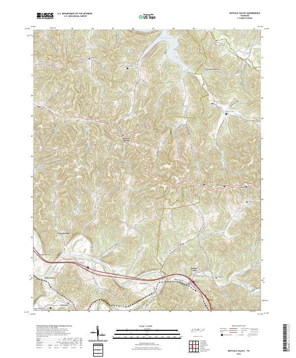 2022 Buffalo Valley2022 Print · USGSMiddle Tennessee's ridge-and-hollow landscape is captured here in the early twenty-first century as the Caney Fork winds through a network of rural settlements. Researchers can trace family history through numerous burial sites like Bockman Cem and Maddux Cem or locate old crossroads at Chestnut Mound and Lancaster.
 - 2022 Map of Center Hill Dam, 2022 Print
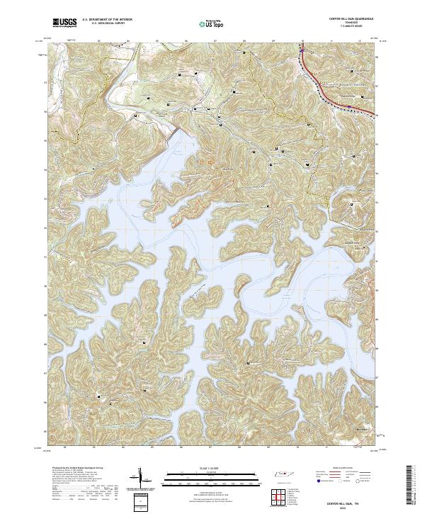 2022 Center Hill Dam2022 Print · USGSThis Tennessee highland region is shown here as a landscape of deep hollows and narrow ridges surrounding the waters of Center Hill Lake. Genealogists can trace family landmarks and burial sites like Mollie League Cem, Garr/Jones/Merritt Cem, and the settlement of Buckner.
 - 2022 Map of Silver Point, 2022 Print
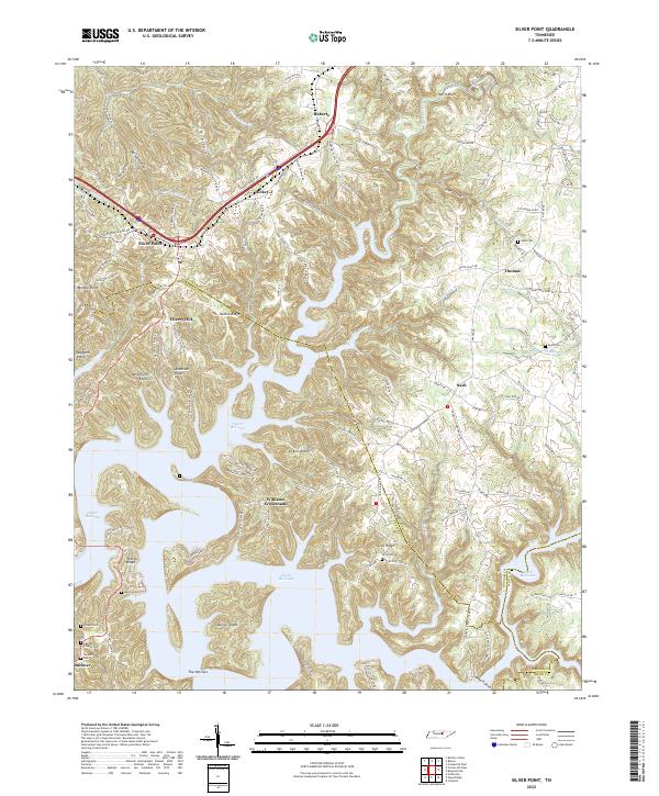 2022 Silver Point2022 Print · USGSThe Tennessee hills surrounding Center Hill Lake appear here in their modern form, showing a landscape defined by ridges and inundated valleys. Researchers can trace family-named landmarks and rural settlements like Williams Crossroads, Silver Point, and the Judd Cem.
End of results
Showing maps 1-12 of 12
Top cities of DeKalb County
- Smithville historical maps
- Alexandria historical maps
- Liberty historical maps
- Dowelltown historical maps
Frequently asked questions
- What are the different types of historical maps available for DeKalb County?
- What is the oldest map of DeKalb County?
- Where can I purchase historical maps of DeKalb County for my home or office?
- Where can I download high-res historical maps of DeKalb County?
- Are there historical topographic maps available for DeKalb County?
- Is there historical aerial imagery available for DeKalb County?
- Where are historical maps of DeKalb County sourced from?