1960s Maps of DeKalb County, Tennessee
Explore 12 historic maps of DeKalb County from the 1960s. These maps offer a rare glimpse into what life looked like during the 1960s — showing old roads, neighborhoods, homes, and landmarks that have changed or disappeared over time.
Whether you're researching your family's past, planning a metal detecting trip, or studying how DeKalb County's landscape evolved across the 1960s, these high-resolution maps are a powerful tool for exploring the history of this region.
- Focus on a specific era: All maps on this page are from the 1960s, giving you a focused view of this time period.
- See what’s changed: Compare century-old streets, trails, and buildings to today's modern landscape using overlays and satellite layers.
- Research with precision: Use these maps for genealogy, historical research, land use analysis, or educational projects.
- View, download, or print: Maps are fully viewable online in high resolution, and can be downloaded or printed for your own records.
Start exploring DeKalb County's history through authentic maps from the 1960s. This is your window into the past.
DeKalb County, TN maps
(12)- 1960 Map of Chattanooga
 1960 Chattanooga1960 Print · USGSSoutheast Tennessee and the southern Appalachians are shown here at the height of the river-management era. You can trace the valley rail lines and locate Lookout Mountain and the expansive waters of Chickamauga Reservoir.
 - 1960 Map of Short Mountain, 1961 Print
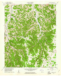
 1960 Short Mountain1961 Print · USGSThe rural uplands of Middle Tennessee come alive in this mid-century survey of the Cannon County highlands. Genealogists and local researchers can trace family landmarks like Grizzly Gunter Cem, Bratchers Crossroads, and the remote Osment Chapel.2 unique versions available
 - 1960 Map of Sligo Bridge, 1961 Print
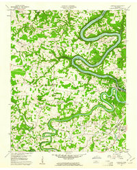
 1960 Sligo Bridge1961 Print · USGSThe rising waters of the Caney Fork valley define the rural landscape of DeKalb and White Counties at the dawn of the 1960s. Researchers can trace deep family roots through dozens of local landmarks like Johnsons Chapel, Peeled Chestnut, and the Taylor Providence Cem.4 unique versions available
 - 1960 Map of Dibrell, 1961 Print
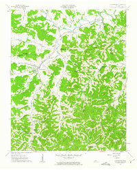
 1960 Dibrell1961 Print · USGSWarren and De Kalb counties are captured here in the early sixties, showing a rural landscape of family farms and creek-side settlements. Genealogists can locate legacy sites like Bildad Ch, Woods Cem, and the communities of Dibrell and Earleyville.3 unique versions available
 - 1960 Map of Smithville, 1961 Print
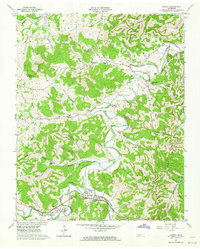
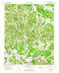
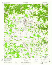 1960 Smithville1961 Print · USGSSmithville and the surrounding DeKalb County highlands are captured here in the early sixties as the regional landscape adjusted to the Center Hill Reservoir. Genealogists and local historians can locate numerous rural landmarks like Jacobs Pillar Ch, Martins Chapel, and the Evins Mill Pond.3 unique versions available
 - 1960 Map of Gassaway, 1961 Print
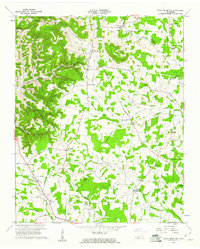
 1960 Gassaway1961 Print · USGSDeKalb and Cannon counties were defined by deep hollows and high ridges during the mid-century. Genealogists can trace family landmarks and rural centers like Gassaway, Mt Pisgah Ch, and Beech Hill Cem among the numerous caves and springs.3 unique versions available
 - 1960 Map of Campaign, 1961 Print
 1960 Campaign1961 Print · USGSThe rural crossing at the junction of the Caney Fork and Collins River is captured here in the early sixties as the reservoir system shaped the landscape. Genealogists can locate family landmarks like Friendship Cem and rural centers such as Campaign and Keltonburg.4 unique versions available
 - 1962 Map of Auburntown, 1963 Print
 1962 Auburntown1963 Print · USGSThe rural hills of Middle Tennessee in the early 1960s are defined by winding waterways and deep family-named hollows. Genealogists and historians can trace old homesteads and local institutions through landmarks like Auburntown, Cottage Home, and the Odom Cem.4 unique versions available
 - 1962 Map of Liberty, 1964 Print
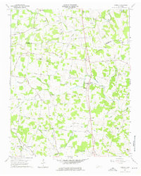
 1962 Liberty1964 Print · USGSThe rural communities of DeKalb County are captured in the early sixties as they navigated the transition between traditional valley farming and new reservoir management. Researchers can locate dozens of family burial grounds and churches like Cooper Chapel and Gwaltney Cem, or trace the winding course of the Smith Fork.3 unique versions available
 - 1962 Map of Buffalo Valley, 1964 Print
 1962 Buffalo Valley1964 Print · USGSUpper Middle Tennessee in the early sixties was a landscape of river-bend bottoms and tight ridge-top settlements. Genealogists and historians can trace family land across Caney Fork and Lancaster, or locate old landmarks like Harris Chapel and Maddux Cem.3 unique versions available
 - 1962 Map of Center Hill Dam, 1964 Print
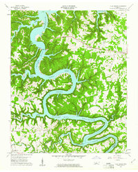
 1962 Center Hill Dam1964 Print · USGSDeKalb County and the surrounding ridges are shown in the early sixties as the Center Hill Reservoir redefined the landscape. Trace local family history through landmarks like Tucker Ridge Ch, Braswell Cem, and the Tennessee Central RR.4 unique versions available
 - 1964 Map of Chattanooga
 1964 Chattanooga1964 Print · USGSSoutheast Tennessee and the western Carolinas appear in the mid-sixties as a powerhouse of river-driven industry and mountain wilderness. Genealogists and historians can trace rail-town lineages along the Southern Ry or locate family landmarks near Watts Bar Lake and Tellico Plains.
End of results
Showing maps 1-12 of 12
Top cities of DeKalb County
- Smithville historical maps
- Alexandria historical maps
- Liberty historical maps
- Dowelltown historical maps
Frequently asked questions
- What are the different types of historical maps available for DeKalb County?
- What is the oldest map of DeKalb County?
- Where can I purchase historical maps of DeKalb County for my home or office?
- Where can I download high-res historical maps of DeKalb County?
- Are there historical topographic maps available for DeKalb County?
- Is there historical aerial imagery available for DeKalb County?
- Where are historical maps of DeKalb County sourced from?