2020s Maps of Dyer County, Tennessee
Explore 15 historic maps of Dyer County from the 2020s. These maps offer a rare glimpse into what life looked like during the 2020s — showing old roads, neighborhoods, homes, and landmarks that have changed or disappeared over time.
Whether you're researching your family's past, planning a metal detecting trip, or studying how Dyer County's landscape evolved across the 2020s, these high-resolution maps are a powerful tool for exploring the history of this region.
- Focus on a specific era: All maps on this page are from the 2020s, giving you a focused view of this time period.
- See what’s changed: Compare century-old streets, trails, and buildings to today's modern landscape using overlays and satellite layers.
- Research with precision: Use these maps for genealogy, historical research, land use analysis, or educational projects.
- View, download, or print: Maps are fully viewable online in high resolution, and can be downloaded or printed for your own records.
Start exploring Dyer County's history through authentic maps from the 2020s. This is your window into the past.
Dyer County, TN maps
(15)- 2021 Map of Caruthersville, 2021 Print
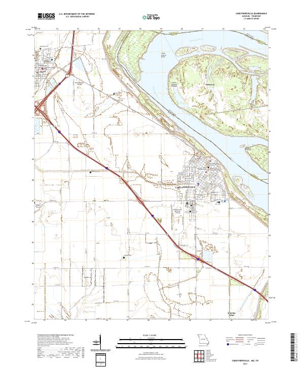 2021 Caruthersville2021 Print · USGSThe Missouri Bootheel thrives in this early 2020s view of Caruthersville and Hayti along the banks of the Mississippi River. Genealogists and local historians can trace family roots through numerous sites like Magnolia Cem, Woodlawn Cem, and Eastwood Memorial Methodist Church Cem.
 - 2021 Map of Cottonwood Point, 2021 Print
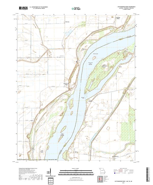 2021 Cottonwood Point2021 Print · USGSThe Missouri Bootheel and Tennessee borderlands meet here along the sweeping bends of the river. Researchers can trace family sites like Hickman Cem and the small settlements of Cottonwood Point and Heloise.
 - 2022 Map of Knob Creek, 2022 Print
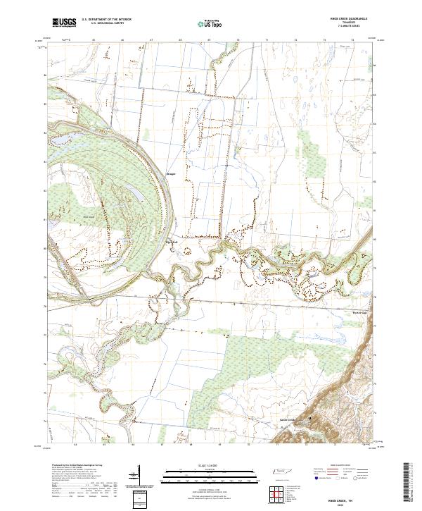 2022 Knob Creek2022 Print · USGSThe West Tennessee river bottoms come alive in this survey of the delta where the Obion and Forked Deer rivers meet. Researchers can trace the winding channels around Moss Island and locate local landmarks like Tiger Tail and the Henning Grove Missionary Baptist Church Cem.
 - 2022 Map of Bonicord, 2022 Print
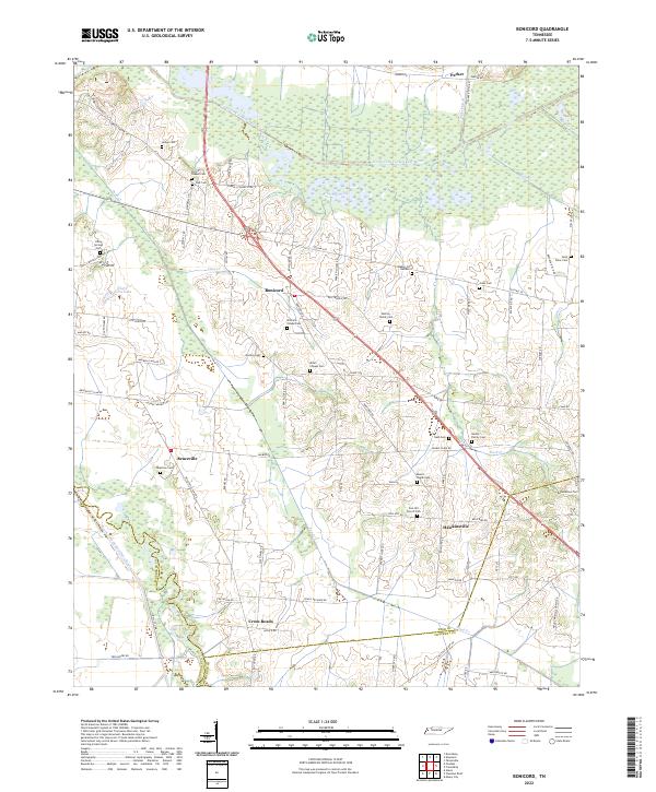 2022 Bonicord2022 Print · USGSThe Dyer County countryside near the Forked Deer River is captured here in the modern era. Genealogists can trace family landmarks like Murray Family Cem, Palestine Cem, and the small community of Hawkinsville.
 - 2022 Map of Chic, 2022 Print
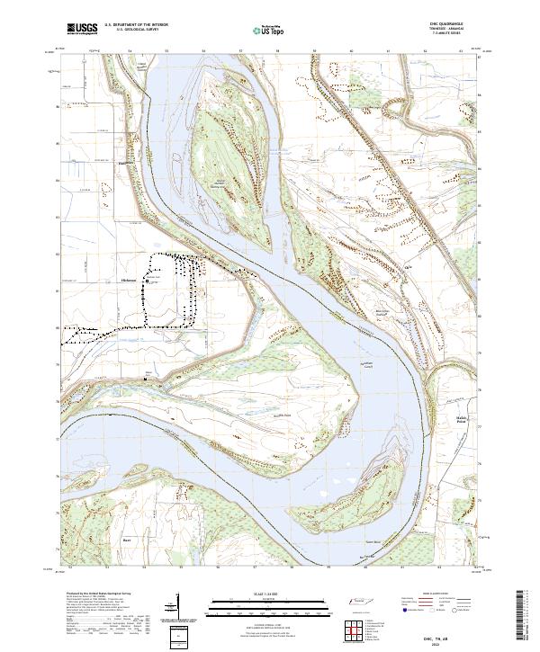 2022 Chic2022 Print · USGSDyer County and the Mississippi River bottoms are captured here in a time of modern river management and rural tradition. Genealogists can locate Buckner Cem or Walker Cem, while historians trace the river's path through Chic and the Needham Cutoff.
 - 2022 Map of Tennemo, 2022 Print
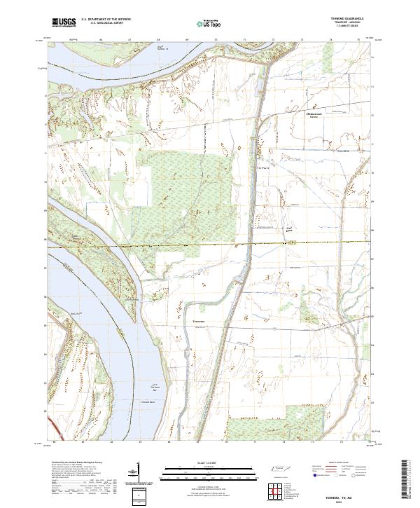 2022 Tennemo2022 Print · USGSThe Tennessee and Missouri state line winds through this riverine landscape during the early twenty-first century. Genealogists and local historians can trace family-named roads and remote settlements like Tennemo, Cottonwood Grove, and Owl Hoot.
 - 2022 Map of Newbern, 2022 Print
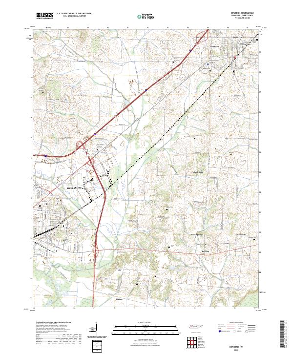 2022 Newbern2022 Print · USGSDyer County is documented here at a moment when established urban centers and rural hamlets like RoEllen and Viar remain connected by historic creek-side routes. Researchers can trace ancestral locations through a dense network of burial sites, including Poplar Grove Cem, Self Cem, and Memorial Park Cem.
 - 2022 Map of Miston, 2022 Print
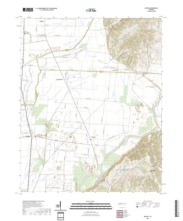 2022 Miston2022 Print · USGSNorthwestern Tennessee at the junction of Lake, Obion, and Dyer Counties reveals a landscape shaped by the Obion River and its floodplain. Trace family roots and local history through Miston, Bogota, and the Horn Ridge Cem.
 - 2022 Map of Tatumville, 2022 Print
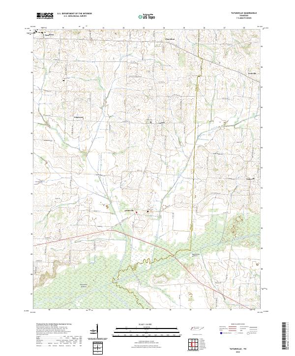 2022 Tatumville2022 Print · USGSWestern Tennessee’s agricultural heartland is captured here in the early twenty-first century, showing a landscape defined by river bottoms and rural crossroads. Local historians can trace family lines and old homesteads near Tatumville, Atkins Cem, and Macedonia Bottom.
 - 2022 Map of Lane, 2022 Print
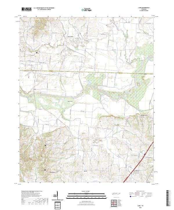 2022 Lane2022 Print · USGSThe Obion River valley and the rural uplands of West Tennessee come into focus in this recent survey. Local historians can trace family roots through several landmarks and burial sites, including Zion Cem, Locust Grove, and the community of Newbern.
 - 2022 Map of Trimble, 2022 Print
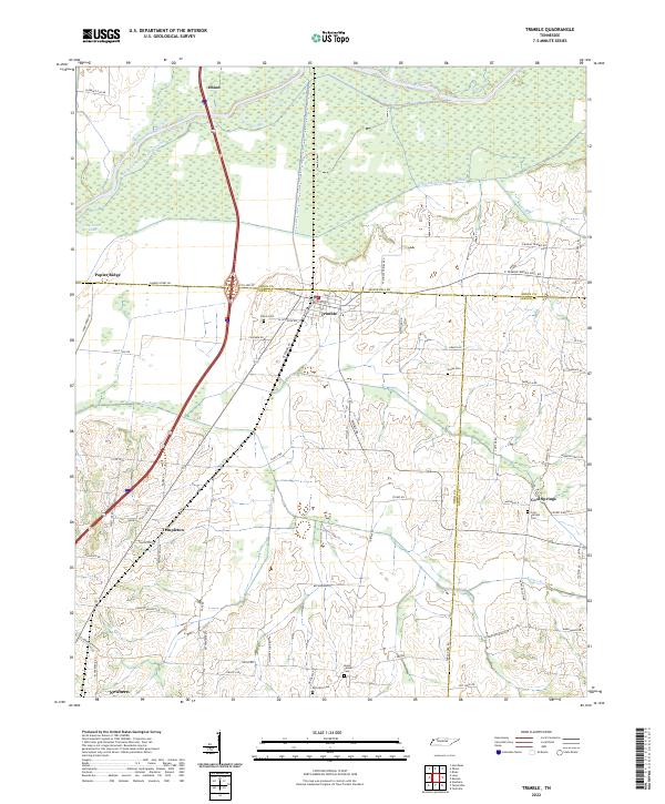 2022 Trimble2022 Print · USGSWest Tennessee’s river bottomlands and rural crossroads are meticulously documented in this recent survey. Genealogists and local historians can trace family-named landmarks and old burial grounds like Jones Cem and Cool Springs Cem near the Obion River.
 - 2022 Map of Friendship, 2022 Print
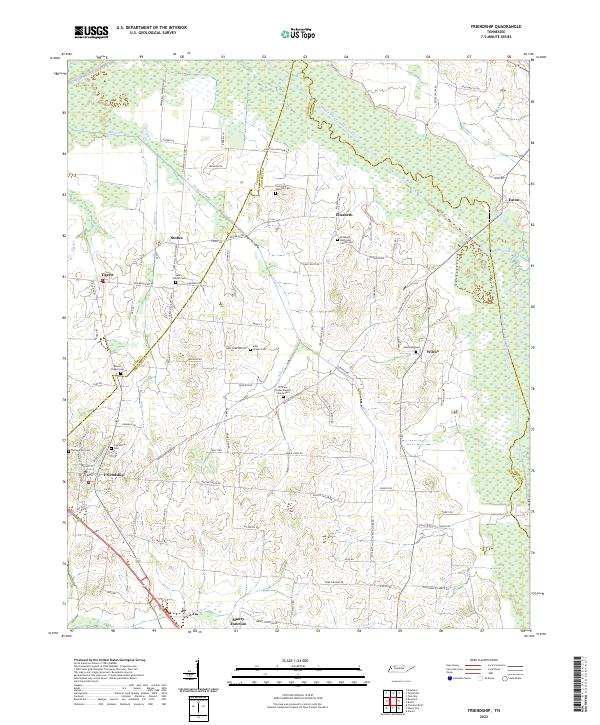 2022 Friendship2022 Print · USGSTennessee’s West Delta region is captured here as a landscape of river bottoms and scattered rural hamlets. Genealogists can trace family footprints at sites like Young and Williams Cem, Elizabeth, and Maury Junction.
 - 2022 Map of Fowlkes, 2022 Print
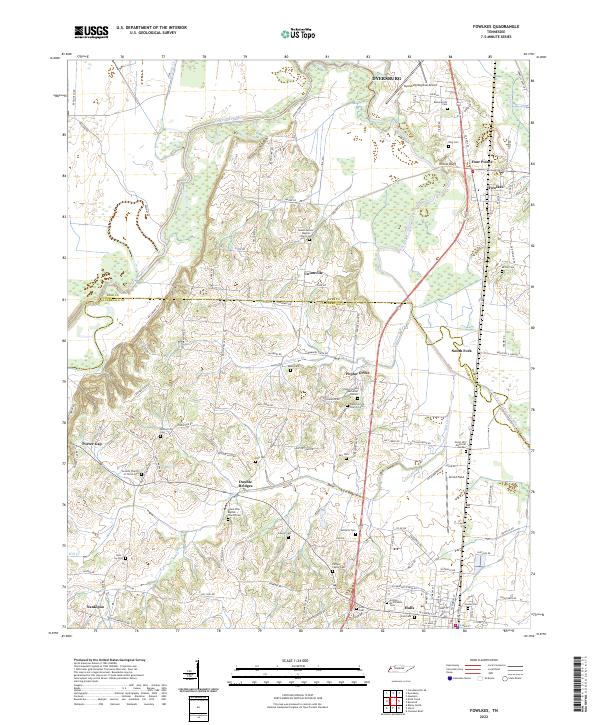 2022 Fowlkes2022 Print · USGSWestern Tennessee farm country comes into focus on the border of Dyer and Lauderdale counties. Researchers can trace family sites at the Carnell Family Cemetery or the crossroads at Double Bridges and Poplar Grove.
 - 2022 Map of Dyersburg, 2022 Print
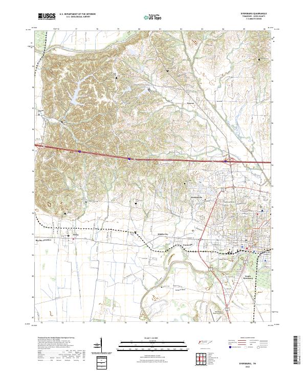 2022 Dyersburg2022 Print · USGSDyersburg and the surrounding Dyer County lowlands are captured here in the early twenty-first century, bounded by the Obion and Forked Deer rivers. Genealogists can locate numerous family burial sites like Light Family Cem and Carter Cem near settlements such as Finley and Lenox.
 - 2022 Map of Caruthersville SE, 2022 Print
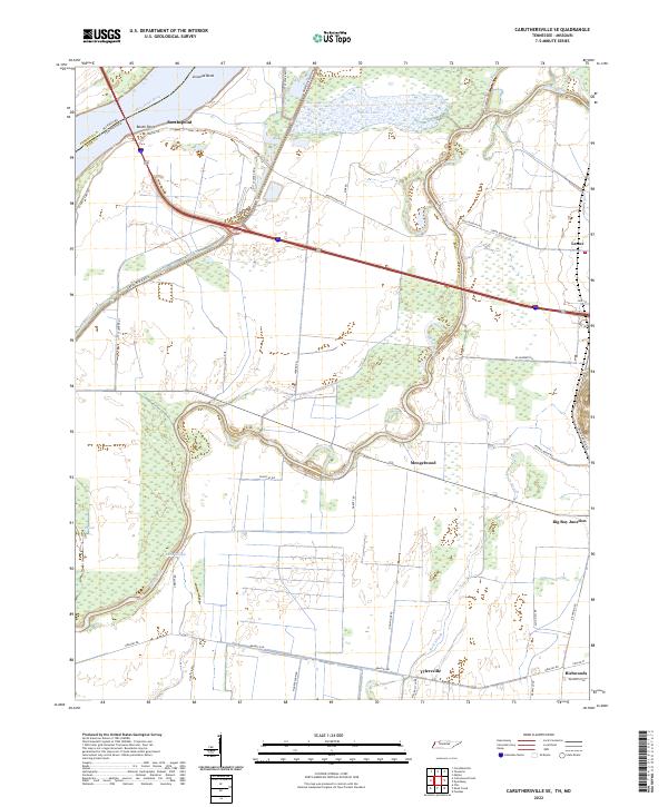 2022 Caruthersville SE2022 Print · USGSDyer County at the Missouri border is a landscape shaped by the Mississippi River and the winding Obion River in the early 2020s. Genealogists and researchers can trace local family landmarks and rural hubs such as Mengelwood, Tylersville, and Big Boy Junction.
End of results
Showing maps 1-15 of 15
Top cities of Dyer County
Frequently asked questions
- What are the different types of historical maps available for Dyer County?
- What is the oldest map of Dyer County?
- Where can I purchase historical maps of Dyer County for my home or office?
- Where can I download high-res historical maps of Dyer County?
- Are there historical topographic maps available for Dyer County?
- Is there historical aerial imagery available for Dyer County?
- Where are historical maps of Dyer County sourced from?